Near Devine in Medina County, Texas — The American South (West South Central)
Moore Family Cemetery
Historical Area
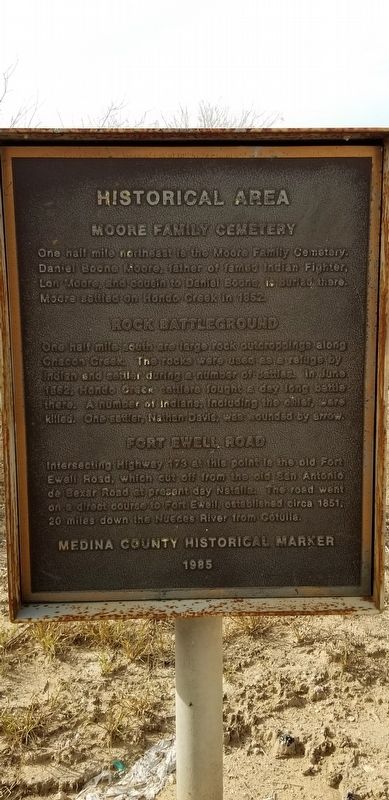
Moore Family Cemetery
One half mile northeast is the Moore family cemetery. Daniel Boone Moore, father of famed Indian fighter, Lon Moore, and cousin to Daniel Boone, is buried there. Moore settled on Hondo Creek in 1852.
Rock Battleground
One half mile south are the large rock outcroppings along Chacon Creek. The rocks were used as a refuge by Indian and settler during a number of battles. In June 1862, Hondo Creek settlers fought a day long battle there. A number of Indians, including the chief, were killed. One settler, Nathan Davis, was wounded by arrow.
Fort Ewell Road
Intersecting Highway 173 at this point is the old Fort Ewell Road, which cut off from the old San Antonio de Bexar Road at present day Natalia. The road went on a direct course to Fort Ewell, established circa 1851, 20 miles down the Neches River from Cotulla.
Medina County Historical Marker 1985
Erected 1985 by Medina County Historical Commission.
Topics. This historical marker is listed in these topic lists: Cemeteries & Burial Sites • Forts and Castles • Wars, US Indian. A significant historical month for this entry is June 1862.
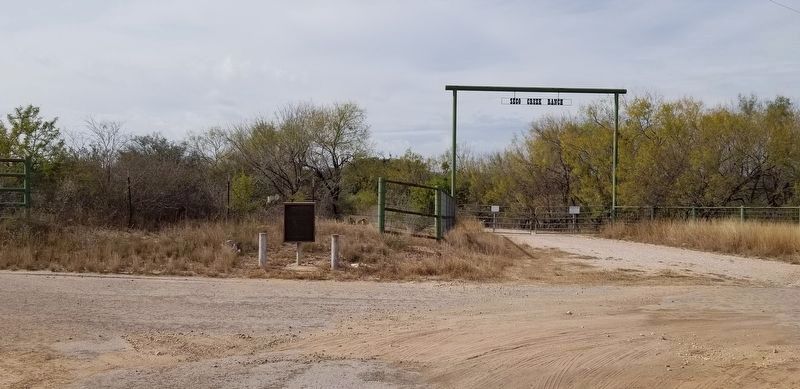
Location. 29° 6.556′ N, 98° 52.72′ W. Marker is near Devine, Texas , in Medina County. Marker is at the intersection of County Highway 773 and State Highway 173, on the right when traveling south on County Highway 773. Touch for map. Marker is in this post office area: Devine TX 78016, United States of America. Touch for directions.
Other nearby markers. At least 8 other markers are within 4 miles of this marker, measured as the crow flies. Stroud's Blacksmith Shop (approx. 2.6 miles away); Judge Thomas J. Devine (approx. 2.7 miles away); Last Person Killed by Indians in Medina County (approx. 2.7 miles away); American Legion Memorial (approx. 2.7 miles away); First Baptist Church of Devine (approx. 2.9 miles away); Devine Lodge, No. 590 (approx. 3.2 miles away); Devine Evergreen Cemetery (approx. 3.3 miles away); William Carvin Winters (approx. 3.3 miles away). Touch for a list and map of all markers in Devine.
Also see . . . Fort Ewell. Fort Ewell was located on the south bank of the Nueces River at the crossing of the San Antonio-Laredo Road in what is now La Salle County. Source: The Handbook of Texas (Submitted on December 16, 2020, by James Hulse of Medina, Texas.)
Credits. This page was last revised on December 17, 2020. It was originally submitted on December 16, 2020, by James Hulse of Medina, Texas. This page has been viewed 314 times since then and 34 times this year. Photos: 1, 2. submitted on December 16, 2020, by James Hulse of Medina, Texas. • J. Makali Bruton was the editor who published this page.

