Downtown Los Angeles in Los Angeles County, California — The American West (Pacific Coastal)
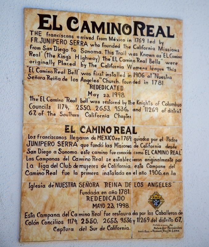
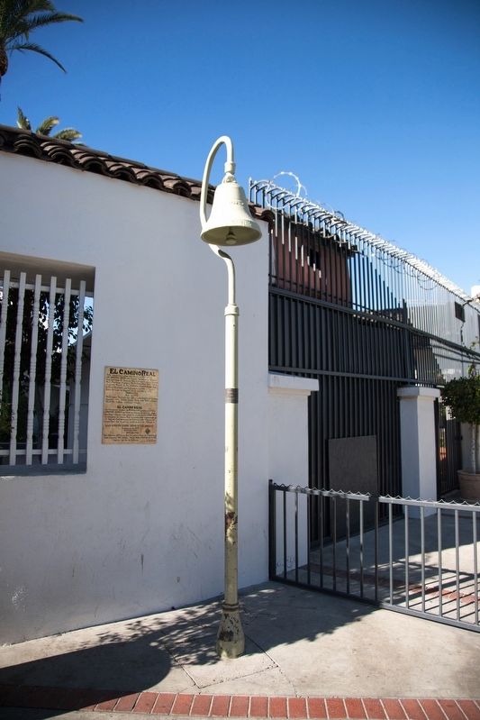
El Camino Real
Rededicated May 23, 1998. The “El Camino Real Bell” was restored by the Knights of Columbus Councils 1174, 2550, 2653, 9536 and 11269 of district 67, the Southern California Chapter.
Redidicado Mayo 23, 1998. Esta campana del “Camino Real” fue restaurada por los Caballeros de Colón Concilios 1174, 2550, 2653, 9536 y 11269 del distrito 67, Captura del Sur de California.
Pintado a mano por Salvador Hernández. Redactado → Ramon (Roy) V. Luna
Topics and series. This historical marker is listed in these topic lists: Colonial Era • Hispanic Americans • Roads & Vehicles. In addition, it is included in the El Camino Real, “The King's Highway” (California) series list. A significant historical date for this entry is May 23, 1998.
Location. 34° 3.422′ N, 118° 14.352′ W. Marker is in Los Angeles, California, in Los Angeles County. It is in Downtown Los Angeles. Marker is at the intersection of North Main Street and Paseo Luis Olivares, on the left when traveling north on North Main Street. It is to the right of the entrance to the church courtyard. Touch for map. Marker is in this post office area: Los Angeles CA 90012, United States of America. Touch for directions.
Other nearby markers. At least 8 other markers are within walking distance of this marker. The Annunciation Mosaic (a few steps from this marker); Nuestra Señora la Reina de Los Angeles (a few steps from this marker); La Iglesia de Nuestra Señora la Reina de los Angeles (a few steps from this marker); Historic Los Angeles Cemetery (within shouting distance of this marker); Spanish Expeditions Into Southern California (within shouting distance of this marker); Yangna (within shouting distance of this marker); The Original Pueblo of Los Angeles (within shouting distance of this marker); Felipe de Neve, 1728–84 (within shouting distance of this marker). Touch for a list and map of all markers in Los Angeles.
Also see . . . Wikipedia entry for El Camino Real (California). Excerpt:
Once Mexico won its independence from Spain, no road in Mexico, including California, was a camino real. The name was rarely used after that and was only revived in the American period in connection with the boosterism associated with the Mission Revival movement of the early 20th century.(Submitted on December 20, 2020.)
The original route begins in Baja California Sur, Mexico, at the site of Misión de Nuestra Señora de Loreto Conchó, present day Loreto, (the first mission successfully established in Las Californias). Today, many streets throughout California that either follow or run parallel to this historic route still bear the "El Camino Real" name. Some of the original route has also been continually upgraded until it is now part of the modern California freeway system. The route is roughly traced by a series of commemorative bell markers.
Credits. This page was last revised on January 30, 2023. It was originally submitted on December 20, 2020, by J. J. Prats of Powell, Ohio. This page has been viewed 203 times since then and 32 times this year. Photos: 1, 2. submitted on December 20, 2020, by J. J. Prats of Powell, Ohio.

