St. Charles in St. Charles County, Missouri — The American Midwest (Upper Plains)
The Lewis and Clark Expedition Across Missouri
Inscription.
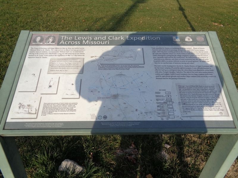
The Corps of Discovery left Camp Dubois on May 14, 1804, and headed up the Missouri River to St. Charles. The corps arrived on May 16 and was greeted by a number of local residents. Co-commander William Clark was in command for this leg of the journey since Meriwether Lewis was still wrapping up last minute business in St. Louis. Lewis rejoined the expedition on May 20, a day before the departure from St. Charles.
Clark described St. Charles as containing about 450 residents, mainly of French-Canadian and mixed-blood parentage, living in 100 small frame houses lining a single, mile-long street running parallel to the river at the foot of the hills for which the town was originally named (Les Petite Cotes or Little Hills). Lewis expanded on Clark's description, noting that the village contained a chapel and that the houses were "generally small and but illy constructed." He characterized the residents as "miserably pour, illiterate, and when at home excessively lazy, tho' they are polite hospitable and by no means deficient in point of natural genious." He added that "they live in a perfect state of harmony among each other."
The town was the headquarters for the St. Charles District of Upper Louisiana, and the last major jumping off point for upriver journeys. It was officially founded in 1787, but had been a settlement since the 1760s when Louis Blanchette settled there with other French-Canadian Catholics. The men of the town were mainly hunters, traders and engages (hired French boatmen), but two large common fields were used for agricultural pursuits and another large common field served as a source of firewood and for the grazing of livestock.
(side quote:)
"…we arrived at St. Charles at 12 o'clock…a number Spectators french & Indians flocked to the bank to See the party. This Village is about one mile in length. Situated on the North Side of the Missourie at the foot of a hill from which it takes its name Petiete Coete (petite cote) or the Little hill.."
William Clark, May 16, 1804
(aside:)
While in St. Charles, William Clark dined on several occasions with Francois Duquette (a local merchant) and his "charming wife" (so described by Clark), Mary Louisa Bauvis Duquette. They lived in a house surrounded by orchards and a garden near the corner of present Second and Decatur Streets (the original stone church of St. Charles Borromeo was later erected in 1827 on this property after Madame Duquette sold the lot to the Catholic diocese). Francois Duquette was born in Quebec, Canada, in 1774 and came to this country as a young man, landing first at Ste. Genevieve, where he met and married his wife in 1794. The Duquettes then came
to St. Charles around 1797, where Francois established himself as a fur trader and dealer in other goods. He also invested heavily in lands and became a staunch supporter of the Catholic faith in St. Charles. He died in 1816, and his wife survived for another 25 years, becoming a highly respected citizen of the town.
(photo caption:)
These watercolor portraits of French Creoles were painted by Anna Maria von Phul in 1818 and depict the range of Creole classes from the "miserably poor, illiterate" common folk described by Meriwether Lewis to members of the genteel class, like Francois Duquette and his wife, Mary Louisa, who were described by William Clark as "an agreeable man [and] more agreeable lady, this Gentleman has a Delightfull Situation & garden"
Erected by National Park Service, Missouri Dept. of Natural Resources, and Missouri Lewis and Clark Bicentennial Commission.
Topics and series. This historical marker is listed in these topic lists: Exploration • Native Americans • Settlements & Settlers • Waterways & Vessels. In addition, it is included in the Lewis & Clark Expedition series list. A significant historical date for this entry is May 14, 1804.
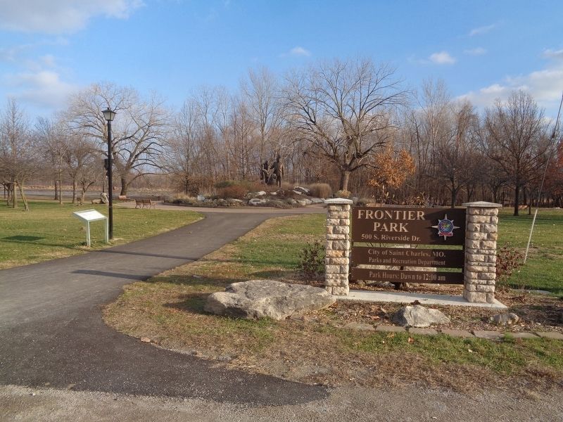
Location. 38° 46.566′ N, 90° 28.961′ W. Marker is in St. Charles, Missouri, in St. Charles County. Marker is on South Riverside Drive, on the right when traveling north. Marker is located at Frontier Park, in front of the Lewis & Clark Monument. It is also off the Katy Trail, which is parallel to Riverside Drive. Touch for map. Marker is at or near this postal address: 700 S Riverside Dr, Saint Charles MO 63301, United States of America. Touch for directions.
Other nearby markers. At least 8 other markers are within walking distance of this marker. Lewis & Clark Monument (a few steps from this marker); St. Louis, St. Charles and Spain During the American Revolution (about 300 feet away, measured in a direct line); Farmer's Home (about 300 feet away); Collier Cottage (about 400 feet away); First Methodist Church (about 400 feet away); Glenday / Zeisler Home (about 400 feet away); The Lewis and Clark Expedition Rendezvous Site (about 400 feet away); The Trail to Fort Osage (about 400 feet away). Touch for a list and map of all markers in St. Charles.
Credits. This page was last revised on December 25, 2020. It was originally submitted on December 25, 2020, by Jason Voigt of Glen Carbon, Illinois. This page has been viewed 300 times since then and 35 times this year. Photos: 1, 2. submitted on December 25, 2020, by Jason Voigt of Glen Carbon, Illinois.

