Trail Ridge Road at Rock Cut
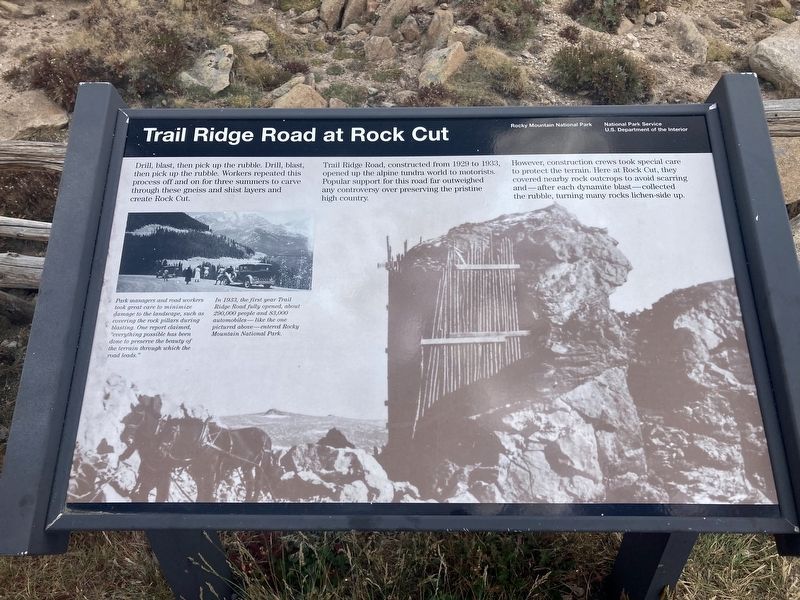
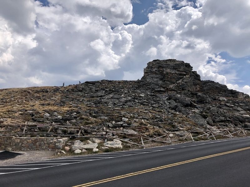
Drill, blast, then pick up the rubble. Drill, blast, then pick up the rubble. Workers repeated this process off and on for three summers to carve through these gneiss and shist layers and create Rock Cut. Trail Ridge Road, constructed from 1929 to 1933, opened up the alpine tundra world to motorists. Popular support for this road far outweighed any controversy over preserving the pristine high country.
However, construction crews took special care to protect the terrain. Here at Rock Cut, they covered nearby rock outcrops to avoid scarring and-after each dynamite blast-collected the rubble, turning many rocks lichen-side up.
In 1933, the first year Trail Ridge Road fully opened, about 290,000 people and 83,000 automobiles- like the one Park managers and road workers took great care to minimize damage to the landscape, such as covering the rock pillars during blasting. One report claimed, "everything possible has been done to preserve the beauty of the terrain through which the road leads."
In 1933, the first year Trail Ridge Road fully opened, about 290,000 people and 83,000 automobiles-like the one pictured above-entered Rocky Mountain National Park.
Erected by National
this page online
Topics. This historical marker is listed in these topic lists: Parks & Recreational Areas • Roads & Vehicles. A significant historical year for this entry is 1929.
Location. 40° 24.725′ N, 105° 43.97′ W. Marker is in Estes Park, Colorado, in Larimer County. It is on Trail Ridge Road, on the right when traveling north. Touch for map. Marker is in this post office area: Estes Park CO 80517, United States of America. Touch for directions.

Regionally, this marker is in the Front Range. It is also in the American Mountain West. Globally, it is in North America, the Rocky Mountains, the Western Hemisphere, the Western World, and the Anglosphere. Historically, it finds itself in what was once the Louisiana Purchase.
Other nearby markers. At least 8 other markers are within 5 miles of this marker, measured as the crow flies: Roger Wolcott Toll (approx. half a mile away); Old Fall River Road (approx. 2.3 miles away); Glacial Cirque (approx. 2.3 miles away); Gore Range (approx. 2.4 miles away); Horseshoe Park (approx. 3.7 miles away); Changing Times Bring Changing Uses (approx. 4.1 miles away); Beaver Trade (approx.
Credits. This page was last revised on January 6, 2021. It was originally submitted on December 27, 2020, by Connor Olson of Menomonee Falls, Wisconsin. This page has been viewed 618 times since then and 50 times this year. Photos: 1, 2. submitted on December 27, 2020, by Connor Olson of Menomonee Falls, Wisconsin. • J. Makali Bruton was the editor who published this page.
