San José del Torreón in Ocampo, Guanajuato, Mexico — The Central Highlands (North America)
A City Under Cactus
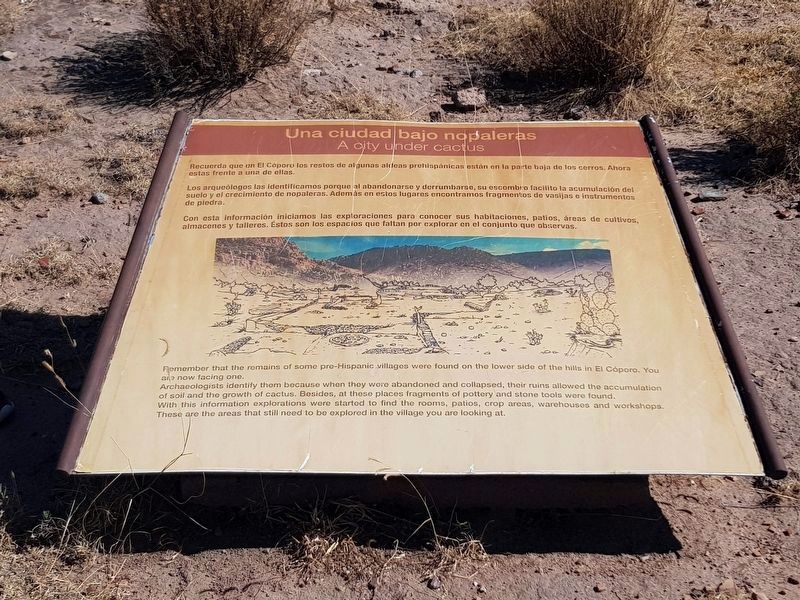
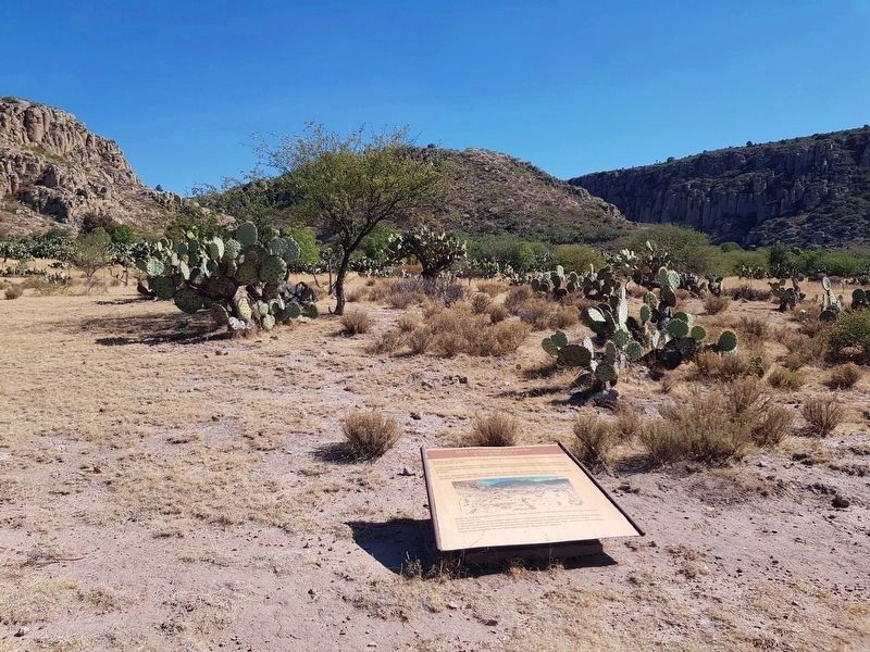
Recuerda que en El Cóporo los restos de algunas aldeas prehispánicas están en la parte baja de los cerros. Ahora estas frente a una de ellas.
Los arqueólogos las identificamos porque al abandonarse y derrumbarse, su escombro facilita la acumulación del suelo y el crecimiento de nopaleras. Además en estos lugares encontramos fragmentos de vasijas e instrumentos de piedra.
Con esta información iniciamos las exploraciones para conocer sus habitaciones, patios, áreas de cultivos, almacenes y talleres. Estos son los espacios que faltan por explorar en el conjunto que observas.
A city under cactus
Remember that the remains of some pre-Hispanic villages were found on the lower side of the hills in El Cóporo. You are now facing one.
Archaeologists identify them because when they were abandoned and collapsed, their ruins allowed the accumulation of soil and the growth of cactus. Besides, at these places fragments of pottery and stone tools were found.
With this information explorations were started to find the rooms, patios, crop areas, warehouses and workshops. These are the areas that still need to be explored in the village you are looking at.
Erected by Instituto Nacional de Antropología e Historia (INAH).
Topics. This historical marker is listed in these topic lists: Anthropology & Archaeology • Native Americans • Parks & Recreational Areas.
Location. 21° 28.703′ N, 101° 27.657′ W. Marker is in San José del Torreón, Guanajuato, in Ocampo. Marker can be reached from Camino a El Cóporo, on the left when traveling east. Touch for map. Marker is in this post office area: San José del Torreón GTO 37640, Mexico. Touch for directions.
Other nearby markers. At least 8 other markers are within 19 kilometers of this marker, measured as the crow flies. The Pre-Hispanic House (about 120 meters away, measured in a direct line); The Kitchen (about 120 meters away); El Cóporo (200 to 900 AD) (about 150 meters away); Sunset Square (about 180 meters away); The Transformation of the Landscape by Man (about 180 meters away); The Sunset Room (about 210 meters away); Father Hidalgo (approx. 19 kilometers away); Parish of San Juan Bautista (approx. 19 kilometers away). Touch for a list and map of all markers in San José del Torreón.
More about this marker. The El Cóporo Archaeological Site markers are accessible as part of a tour of the site. Access is during the site's normal hours of operation and a small fee is paid ($2 in 2020). The staff provides transportation to the site from the visitors center near San José del Torreón.
Credits. This page was last revised on December 30, 2020. It was originally submitted on December 28, 2020, by J. Makali Bruton of Accra, Ghana. This page has been viewed 54 times since then and 4 times this year. Photos: 1, 2. submitted on December 28, 2020, by J. Makali Bruton of Accra, Ghana.

