Near Winchester in Frederick County, Virginia — The American South (Mid-Atlantic)
The Third Battle of Winchester
Camp Averell
Photographed by Craig Swain, August 26, 2007
1. The Third Battle of Winchester Marker
A Virtual Tour of the Third Winchester Battlefield by HMDb markers:
Click for more information.
Click for more information.
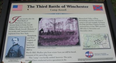
In the months after the Third Battle of Winchester, this area became home to Camp Averell, named after Union cavalry gen. William Woods Averell. Elements of six cavalry and "mounted infantry" regiments from New York, Pennsylvania, and West Virginia all camped here from September 1864 to March 1865. Shallow pits from winter huts can still be found, remnants of the sprawling camp.
This "camp" was hardly settled, however. The units stationed here conducted active operations in the Shenandoah Valley, raiding, skirmishing, and then returning to camp to rest and resupply. Company H of the 2nd West Virginia Cavalry, stationed here in late 1864, marched 400 miles in November and December alone.
Erected by Civil War Preservation Trust.
Topics. This historical marker is listed in this topic list: War, US Civil. A significant historical month for this entry is March 1865.
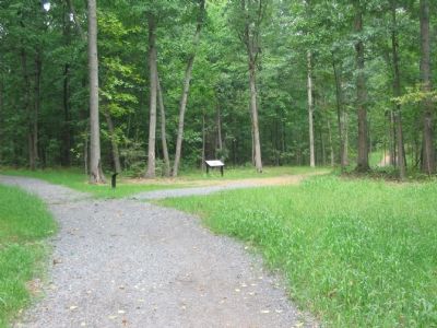
Location. Marker has been reported permanently removed. It was located near 39° 11.677′ N, 78° 6.958′ W. Marker was near Winchester, Virginia, in Frederick County. It could be reached from Redbud Road, on the right when traveling east. Located at the Camp Averell Wayside,
this page online
We have been informed that this marker is no longer there and will not be replaced. This page is an archival view of what was.
Regionally, this marker was in the Shenandoah Valley. It was also in the American South, specifically in the Upper South, and in the Mid-Atlantic. Globally, it was in North America, the Western Hemisphere, the Western World, and the Anglosphere. Historically, it found itself in what was once the territory of the Mississippian Culture, one of the original Thirteen Colonies, one of the Confederate States of America, and the Antebellum South.

Other nearby markers. At least 8 other markers are within walking distance of this location: Sheridan Moves To Battle (within shouting distance of this marker); The Union Attacks (about 400 feet away, measured in a direct line); a different marker also named Third Battle of Winchester

2. Help Preserve 3rd Winchester
Details of CWPT efforts to save this battlefield.
Click for more information.
Click for more information.
Other markers no longer nearby. The Third Battle of Winchester (was within shouting distance of this marker but has been permanently removed); a different marker also named The Third Battle of Winchester (was about 500 feet away but has been permanently removed).
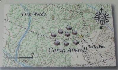
More about this marker. On the lower left side, the marker displays a portrait of Union General William Woods Averell. In the center is a wartime photograph of "A typical Civil War cavalry camp. There is no known, existing image of Camp Averell." On the lower right is a topographical map displaying the location of Camp Averell.
Also see . . . Third Battle of Winchester. American Battlefield Trust website entry (Submitted on October 27, 2007, by Craig Swain of Leesburg, Virginia.)
Photographed by Craig Swain, August 26, 2007
3. Camp Averell Topographical Map
Photographed by Craig Swain, August 26, 2007
4. Camp Averell Wayside
Credits. This page was last revised on July 23, 2022. It was originally submitted on October 27, 2007, by Craig Swain of Leesburg, Virginia. This page has been viewed 2,009 times since then and 20 times this year. Last updated on January 2, 2021, by Bradley Owen of Morgantown, West Virginia. Photos: 1. submitted on October 27, 2007, by Craig Swain of Leesburg, Virginia. 2. submitted on March 13, 2009, by Craig Swain of Leesburg, Virginia. 3, 4. submitted on October 27, 2007, by Craig Swain of Leesburg, Virginia. • J. Makali Bruton was the editor who published this page.
