
Turning Point for Spain in Texas
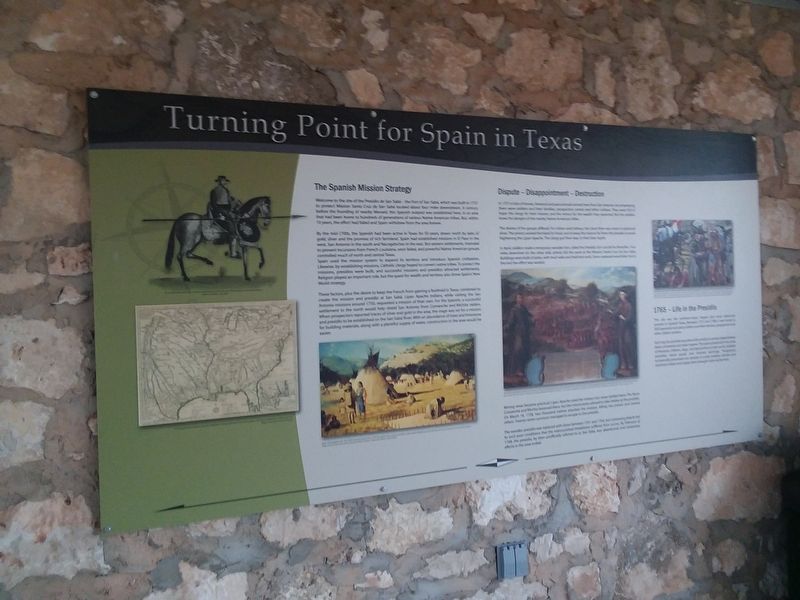
The Spanish Mission Strategy
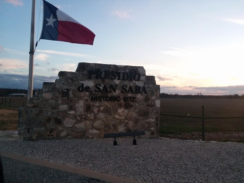
Welcome to the site of the Presidio de San Sabá - the Fort of San Sabá, which was built in 1757 to protect Mission Santa Cruz de San Sabá located about four miles downstream. A century before the founding of nearby Menard, this Spanish outpost was established here, in an area that had been home to hundreds of generations of various Native American tribes. But, within 10 years, the effort had failed and Spain withdrew from the area forever.
By the mid-1700s, the Spanish had been active in Texas for 50 years, drawn north by tales of gold, silver and the promise of rich farmland. Spain had established missions in El Paso in the west, San Antonio in the south and Nacogdoches in the east. But eastern settlements intended to prevent incursions from French Louisiana, soon failed, and powerful Native American groups controlled much of north and central Texas. Spain used the mission system to expand its territory and introduce Spanish civilization. Likewise, by establishing missions, Catholic clergy hoped to convert native tribes. To protect the missions, presidios were built, and
this page online
These factors, plus the desire to keep the French from gaining a foothold in Texas, combined to create the mission and presidio at San Sabá. Lipan Apache Indians, while visiting the San Antonio missions around 1750, requested a mission of their own. For the Spanish, a successful settlement to the north would help shield San Antonio from Comanche and Wichita raiders. When prospectors reported traces of silver and gold in the area, the stage was set for a mission and presidio to be established on the San Sabá River. With an abundance of trees and limestone for building materials, along with a plentiful supply of water, construction in the area would be easier.
Dispute - Disappointment – Destruction
In 1757 a train of horses, livestock and pack animals arrived here from San Antonio. Accompanying
them were soldiers and their families, prospectors, priests and other civilians. They were full of
hope: the clergy for their mission, and the miners
The desires of the groups differed. For miners and military, the Llano River was closer to gold and silver. The priests wanted farmland for food, and to keep the mission far from the presidio to avoid frightening the Lipan Apache. The clergy got their way, to their later regret.
In April, soldiers made a temporary wooden fort, called the Presidio San Luis de las Amarillas. Four miles downriver on the other side, priests did the same at the Mission Santa Cruz de San Sabá. Buildings were built of poles, with mud walls and thatched roofs. Stone replaced wood later, but in the end the effort was wasted.
Mining never became practical; Lipan Apache used the mission but never settled there. The fierce Comanche and Wichita harassed them, but the missionaries refused to take shelter at the presidio. On March 16, 1758, two thousand natives attacked the mission, killing two priests and several others. Twenty-seven survivors managed to escape to the presidio.
The wooden presidio was replaced with stone between 1761 and 1764,
but continuing attacks led to such poor conditions that the malnourished inhabitants suffered from scurvy. By February of 1768, the presidio, by then unofficially referred to as San Saba, was abandoned, and missionary efforts in the area ended.
1765 - Life in the Presidio
This site was the northern most, largest and most advanced
presidio in Spanish Texas Between 175/ and 17e8, it was home to
300 Spaniards including soldiers and their families prospectors and
other civilian workers.
Each day the presidio was alive with activity as women baked bread,
beans simmered and meat roasted The yard echoed with the noise
of livestock, children, dogs, and blacksmiths at their anvils Soldiers
patrolled, stood guard, and shouted warnings Prospectors
Occasionally processed ore samples in crude smelters, farmers and
stockman toiled, and supply trains brought noisy excitement.
Topics. This historical marker is listed in these topic lists: Colonial Era • Forts and Castles • Hispanic Americans • Settlements & Settlers. A significant historical month for this entry is February 1768.
Location. 30° 55.367′ N, 99° 48.167′ W. Marker is near Menard, Texas, in Menard County. It is on Presidio Road 0.2 miles south of U.S. 190, on the left when traveling south. On the grounds of the Presidio de San Saba County Park. Touch for map. Marker is in this post office area: Menard TX 76859, United States of America. Touch for directions.
Regionally, this marker is in Big Country. Globally, it is in North America, a Gulf of Mexico state, the Western Hemisphere, the Western World, and the Anglosphere. Historically, it finds itself in what was once New Spain, the Republic of Texas, and one of the Confederate States of America.
Other nearby markers. At least 8 other markers are within walking distance of this marker: Welcome To Menard (here, next to this marker); Presidio de San Sabá (within shouting distance of this marker); NW Bastion (within shouting distance of this marker); VIP Quarters (about 300 feet away, measured in a direct line); Livestock Corral (about 300 feet away); Restoration and Reconstruction (about 400 feet away); Real Presidio de San Saba (about 400 feet away); Plaza (about 500 feet away). Touch for a list and map of all markers in Menard.
Credits. This page was last revised on January 3, 2021. It was originally submitted on January 3, 2021, by Craig Doda of Napoleon, Ohio. This page has been viewed 514 times since then and 20 times this year. Photos: 1, 2. submitted on January 3, 2021, by Craig Doda of Napoleon, Ohio. • Devry Becker Jones was the editor who published this page.
