Fleet in Norfolk, Virginia — The American South (Mid-Atlantic)
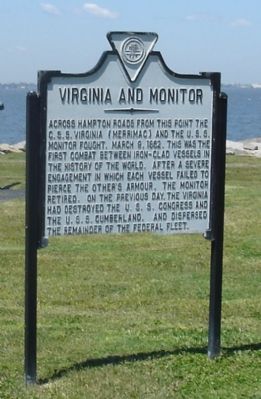
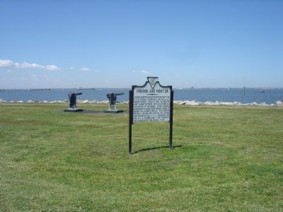
Virginia and Monitor
Erected 1931 by the City of Norfolk.
Topics and series. This historical marker is listed in these topic lists: War, US Civil • Waterways & Vessels. In addition, it is included in the Battlefield Trails - Civil War series list. A significant historical date for this entry is March 9, 1862.
Location. 36° 57.321′ N, 76° 18.747′ W. Marker is in Norfolk, Virginia. It is in Fleet. Marker is on Massey Hughes Drive, 0.4 miles Maryland Avenue, on the left when traveling east. Marker is on the U.S. Naval Station, on Iowa Point. Hampton Boulevard (State Route 337) ends at Gate 2, where Maryland Avenue inside the naval base begins. Touch for map. Marker is in this post office area: Norfolk VA 23511, United States of America. Touch for directions.
Other nearby markers. At least 8 other markers are within 2 miles of this marker, measured as the crow flies. We remember turret two ... (within shouting distance of this marker); USS Cole (DDG 67) Memorial (about 400 feet away, measured in a direct line); USS Cole DDG 67 (about 600 feet away); Birthplace of Naval Aviation (approx. ¼ mile away); Naval Air Station Norfolk (approx. 0.4 miles away); Navy Mess Attendant School (approx. 0.7 miles away); Naval Aviation Depot, Norfolk (approx. 1.1 miles away); a different marker also named Birthplace of Naval Aviation (approx. 1.4 miles away). Touch for a list and map of all markers in Norfolk.
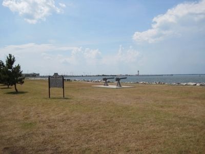
More about this marker. This marker was originally erected in 1931 at the Newport News Ferry wharf in Norfolk at Sewell’s Point. The ferry that carried traffic between Norfolk and Newport News is no longer running. Sewell’s Point is now in the Norfolk Naval Station and off-limits to the casual visitor.
In the 1980s the marker was on Willoughby Beach on West Ocean View Avenue between Thirteenth View and Fourteenth View streets. Today the marker is closer to its original location.
Related markers. Click here for a list of markers that are related to this marker. Battle of Hampton Roads by Markers.
Also see . . . Action between USS Monitor and CSS Virginia, 9 March 1862. (Submitted on May 3, 2007.)
Additional keywords. Virginia and Monitor
Credits. This page was last revised on February 1, 2023. It was originally submitted on May 3, 2007, by J. J. Prats of Powell, Ohio. This page has been viewed 2,346 times since then and 32 times this year. Last updated on February 24, 2009, by Richard E. Miller of Oxon Hill, Maryland. Photos: 1, 2. submitted on May 3, 2007, by J. J. Prats of Powell, Ohio. 3. submitted on July 18, 2010, by Kevin W. of Stafford, Virginia. 4. submitted on July 27, 2010, by Kevin W. of Stafford, Virginia. • Kevin W. was the editor who published this page.


