
Chester in Chesterfield County, Virginia — The American South (Mid-Atlantic)
The Bermuda Hundred Campaign
Photographed by Bernard Fisher, August 29, 2015
1. The Bermuda Hundred Campaign Marker
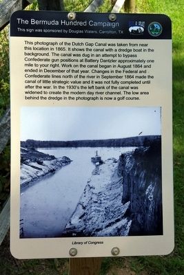
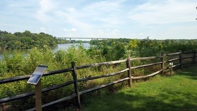
This photograph of the Dutch Gap Canal was taken from near this location in 1865. It shows the canal with a dredge boat in the background. The canal was dug in an attempt to bypass Confederate gun positions at Battery Dantzler approximately one mile to your right. Work on the canal began in August 1864 and ended in December of that year. Changes in the Federal and Confederate lines north of the river in September 1864 made the canal of little strategic value and it was not fully completed until after the war. In the 1930's the left bank of the canal was widened to create the modern day river channel. The low area behind the dredge in the photograph is now a golf course.
This sign was sponsored by Douglas Waters, Carrollton, TX
Erected 2015 by The Chesterfield Historical Society of Virginia. (Marker Number 3.)
Topics. This historical marker is listed in these topic lists: War, US Civil • Waterways & Vessels. A significant historical month for this entry is August 1864.
Location. 37° 22.595′ N, 77° 21.616′ W. Marker is in Chester, Virginia, in Chesterfield County. It can be reached from Henricus Park Road 1.3 miles east of Coxendale Road. Located in Henricus Historical Park 300 yards north of the parking lot. Touch for map. Marker is at or near this postal address: 251 Henricus Park Road, Chester VA 23836, United States of America. Touch for directions.

Regionally, this marker is in Virginia’s Piedmont, in Central Virginia, and in the Richmond Metropolitan Area. It is also in the American South, specifically in the Upper South, and on the Eastern Seaboard. Globally, it is in the North Atlantic Region, North America, the Western Hemisphere, the Western World, and the Anglosphere. Historically, it finds itself in what was once the territory of the Mississippian Culture, one of the original
this page online
Other nearby markers. At least 8 other markers are within walking distance of this marker: USCTs At Dutch Gap (here, next to this marker); Dutch Gap Canal (here, next to this marker); Mortar Pit (a few steps from this marker); The Lightkeeper’s House (within shouting distance of this marker); The Church of Henricopolis (within shouting distance of this marker); Henricopolis (within shouting distance of this marker); Henricus Historical Park (within shouting distance of this marker); John Smith Explores the Chesapeake (within shouting distance of this marker). Touch for a list and map of all markers in Chester.
Other markers no longer nearby. The James River...Floating Through The Centuries (was a few steps from this marker but has been permanently removed); Dutch Gap (was a few steps from this marker but has been permanently removed); The Tides (was within shouting distance of this marker but has been permanently removed); Mount Malady (was within shouting distance of this marker but has been permanently removed).
Also see . . .
1. Henricus Historical Park.
Photographed by Bernard Fisher, August 29, 2015
2. The Bermuda Hundred Campaign Marker
2. The Bermuda Hundred Campaign. Essential Civil War Curriculum website entry (Submitted on January 4, 2024, by Larry Gertner of New York, New York.)
Credits. This page was last revised on January 4, 2024. It was originally submitted on August 29, 2015, by Bernard Fisher of Richmond, Virginia. This page has been viewed 644 times since then and 28 times this year. Last updated on January 9, 2021, by Bradley Owen of Morgantown, West Virginia. Photos: 1, 2. submitted on August 29, 2015, by Bernard Fisher of Richmond, Virginia.
