Mandans and the Practice of Farming
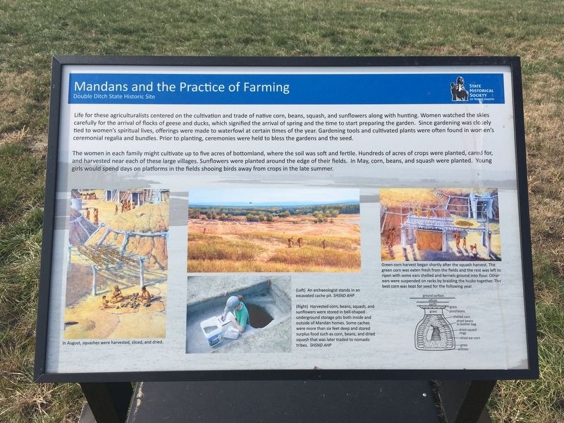
The women in each family might cultivate up to five acres of bottomland, where the soil was soft and fertile. Hundreds of acres of crops were planted, cared for, and harvested near each of these large villages. Sunflowers were planted around the edge of their fields. In May, corn, beans, and squash were planted. Young girls would spend days on platforms in the fields shooing birds away from crops in the late summer.
Captions:
In August, squashes were harvested, sliced, and dried.
An archaeologist stands in an
excavated cache pit.
Harvested corn, beans, squash, and
sunflowers were stored in bell-shaped
underground storage pits both inside and
outside of Mandan homes. Some caches
grass
puncheons
grass
shelled corn
dried beans
in leather bag
were more than six feet deep and stored
surplus food such as corn, beans, and dried
squash that was later traded to nomadic
tribes.
Green corn harvest began shortly after the squash harvest. The
green corn was eaten fresh from the fields and the rest was left to
ripen with some ears shelled and kernels ground into flour. Other
ears were suspended on racks by braiding the husks together. The
best corn was kept for seed for the following year.
Erected by State
this page online
Topics. This historical marker is listed in these topic lists: Agriculture • Indigenous Peoples and Communities.
Location. 46° 56.268′ N, 100° 54.129′ W. Marker is near Bismarck, North Dakota, in Burleigh County. It can be reached from Double Ditch Loop. Marker is on skids so location may vary slightly. Touch for map. Marker is in this post office area: Bismarck ND 58503, United States of America. Touch for directions.

Regionally, this marker is on the Missouri Plateau. It is also in the American Lewis & Clark Corridor, on the prairies, and on the Northern Plains. Globally, it is in North America, the Western Hemisphere, the Western World, and the Anglosphere. Historically, it finds itself in what was once Rupert’s Land and also the Louisiana Purchase.
Other nearby markers. At least 8 other markers are within walking distance of this marker: Mandan Origin Stories (within shouting distance of this marker); Hunting and Gathering (about 300 feet away, measured in a direct line); Bullboats (about 500 feet away); Double Ditch State Historic Site (about 600 feet away); Stone Shelter (about 600 feet away); a different marker also named Stone Shelter (about 600 feet away); Square Buttes (about 700 feet away); Potande and the Mandan Fishery (about 800 feet away). Touch for a list and map of all markers in Bismarck.
Also see . . . Double Ditch State Hist. Site. (Submitted on January 10, 2021, by Connor Olson of Menomonee Falls, Wisconsin.)
Credits. This page was last revised on January 15, 2021. It was originally submitted on January 10, 2021, by Connor Olson of Menomonee Falls, Wisconsin. This page has been viewed 227 times since then and 18 times this year. Photo 1. submitted on January 10, 2021, by Connor Olson of Menomonee Falls, Wisconsin. • Bill Pfingsten was the editor who published this page.
