Archaeological Excavations of Houses
| — | Huff Indian Village State Historic Site | — |
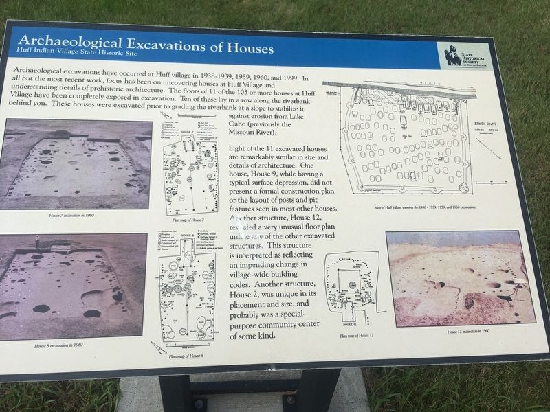
Eight of the 11 excavated houses are remarkably similar in size and details of architecture. One house, House 9, while having a typical surface depression, did not present a formal construction plan or the layout of posts and pit features seen in most other houses. Another structure, House 12, revealed a very unusual floor plan unlike any of the other excavated structures. This structure is interpreted as reflecting an impending change in village-wide building codes. Another structure, House 2, was unique in its placement and size, and probably was a special-purpose community center
this page online
Captions:
House 7 excavated in 1960
Plan Map of House 7
House 8 excavated in 1960
Plan map of House 8
Map of Huff Village showing the 1938-1939, 1959, and 1960 excavations
Plan map of House 12
House 12 excavation in 1960
Erected by State Historical Society of North Dakota.
Topics. This historical marker is listed in these topic lists: Anthropology & Archaeology • Indigenous Peoples and Communities. A significant historical year for this entry is 1938.
Location. 46° 37.121′ N, 100° 38.494′ W. Marker is in Huff, North Dakota, in Morton County. It can be reached from North Dakota Route 1806 0.6 miles north of County Road 136, on the right when traveling north. Located near Roughrider Trail. Touch for map. Marker is in this post office area: Mandan ND 58554, United States of America. Touch for directions.
Regionally, this marker is on the Missouri Plateau and in Greater Bismarck Area. It is also in the American Lewis & Clark Corridor, on the prairies, and on the Northern Plains. Globally, it is in North America, the Western Hemisphere, the Western World, and the Anglosphere. Historically,
Other nearby markers. At least 8 other markers are within walking distance of this marker: A different marker also named Archaeological Excavations of Houses (here, next to this marker); Houses and Architecture (within shouting distance of this marker); Non-Destructive Ways to See Underground (within shouting distance of this marker); Plaza and Ceremonial Lodge (within shouting distance of this marker); The Cache Pit and Village Subsistence (about 300 feet away, measured in a direct line); Animal Remains Found in Cache Pits (about 300 feet away); Remote Sensing (about 300 feet away); Village Fortifications and Human Conflict (about 600 feet away). Touch for a list and map of all markers in Huff.
Also see . . . State Historical Society of North Dakota about the Huff Village State Historic Site. (Submitted on January 10, 2021, by Connor Olson of Menomonee Falls, Wisconsin.)
Credits. This page was last revised on January 11, 2021. It was originally submitted on January 10, 2021, by Connor Olson of Menomonee Falls, Wisconsin. This page has been viewed 307 times since then and 24 times this year. Photos: 1, 2. submitted on January 10, 2021, by Connor Olson of Menomonee Falls, Wisconsin. • Mark Hilton was the editor who published this page.
