Potomac in Montgomery County, Maryland — The American Northeast (Mid-Atlantic)
A Geologic Barrier

Photographed by Tom Bosse, July 4, 2020
1. A Geologic Barrier Marker
At Widewater the canal builders used a river channel abandoned thousands of years ago by the Potomac when it cut its present gorge. At this bend, just above Widewater, the engineers found a steep cliff where the old channel ended, and had to build an immense buttressed wall to cradle the canal and towpath about 70 feet above the present river level.
Erected by National Park Service, U.S. Department of the Interior.
Topics and series. This historical marker is listed in these topic lists: Parks & Recreational Areas
this page online
Location. 38° 59.902′ N, 77° 14.917′ W. Marker is in Potomac, Maryland, in Montgomery County. It is on Chesapeake and Ohio Canal Towpath, on the left when traveling north. Marker is located within the Chesapeake and Ohio Canal National Historical Park. Touch for map. Marker is in this post office area: Potomac MD 20854, United States of America. Touch for directions.

Regionally, this marker is in the Washington Metropolitan Area. It is also in the American Mid-Atlantic. Globally, it is in North America, the Western Hemisphere, the Western World, and the Anglosphere. Historically, it finds itself in what was once one of the original Thirteen Colonies and also the Antebellum South.
Other nearby markers. At least 8 other markers are within walking distance of this marker: Fighting Floods (a few steps from this marker); Creating a National Park (within shouting distance of this marker); Great Falls Tavern (about 700 feet away); a different marker also named Great Falls Tavern

Photographed by Tom Bosse, July 4, 2020
2. A Geologic Barrier Marker
Other markers no longer nearby. Boats Passing By (was about 600 feet away, measured in a direct line but has been confirmed missing); A Lift Lock (was about 700 feet away but has been confirmed missing).
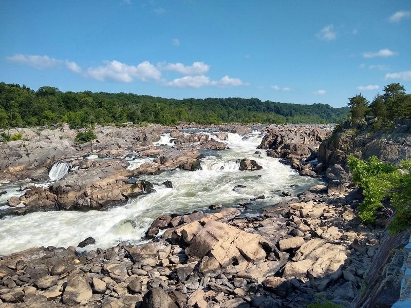
Photographed by Tom Bosse, July 4, 2020
3. The Potomac River
Credits. This page was last revised on March 20, 2026. It was originally submitted on January 11, 2021, by Tom Bosse of Jefferson City, Tennessee. This page has been viewed 350 times since then and 38 times this year. Photos: 1, 2, 3. submitted on January 11, 2021, by Tom Bosse of Jefferson City, Tennessee. • Bill Pfingsten was the editor who published this page.
