Hilton Head Island in Beaufort County, South Carolina — The American South (South Atlantic)
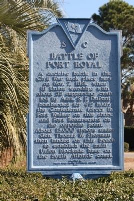
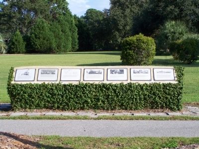
Battle of Port Royal
Erected 1961 by Hilton Head Island Historical Society. (Marker Number 7-7.)
Topics. This historical marker is listed in this topic list: War, US Civil. A significant historical month for this entry is October 1900.
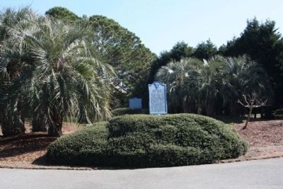
Location. 32° 14.103′ N, 80° 40.696′ W. Marker is on Hilton Head Island, South Carolina, in Beaufort County. Marker is at the intersection of Fort Walker Drive and Circle at Catesby Lane, in the median on Fort Walker Drive. Located in Port Royal Plantation - a Secure Gated Community,Restricted Access. Touch for map. Marker is in this post office area: Hilton Head Island SC 29928, United States of America. Touch for directions.
Other nearby markers. At least 8 other markers are within walking distance of this marker. Hilton Head (a few steps from this marker); Two Gallant Gentlemen from South Carolina (within shouting distance of this marker); Steam Gun (about 300 feet away, measured in a direct line); Fort Walker (approx. 0.2 miles away); "Robbers Row" (approx. 0.2 miles away); The Dawn of Freedom: Mitchelville (approx. half a mile away); The Battle of Port Royal / William Fitzhugh and Black Sailors in the Union Navy (approx. half a mile away); Black Troops on Hilton Head (approx. half a mile away). Touch for a list and map of all markers in Hilton Head Island.
Also see . . .
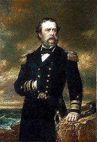
1. Samuel Francis Du Pont. made significant contributions to the modernization of the U.S. Navy. (Submitted on February 27, 2009, by Mike Stroud of Bluffton, South Carolina.)
2. The Battle of Port Royal. was one of the earliest amphibious operations of the American Civil War (Submitted on February 27, 2009, by Mike Stroud of Bluffton, South Carolina.)
Photographed By Mike Stroud, 2009
5. Interpretive marker at Ft.Walker Dr.
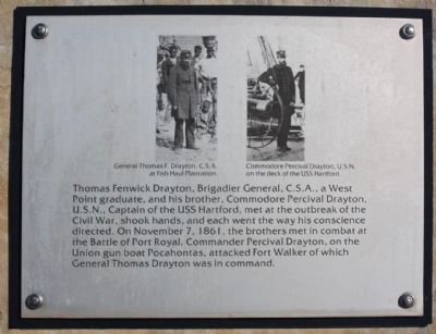
Left- General Thomas F. Drayton,C.S.A .
at Fish Hall Plantation
Right- Commodore Percival Drayton, U.S.N. on the deck of the USS Hartford.
Thomas Fenwick Drayton, Brigadier General, C.S.A., a West Point graduate, and his brother, Commodore Percival Drayton, U.S.N., Captain of the USS Hartford, met at the outbreak of the Cival War, shook hands, and each went the way his conscience directed. On November 7, 1861, the brothers met in combat at the Battle of Port Royal. Commander Percival Drayton, on the Union gun boat Pocahontas, attacked Fort Walker of which General Thomas Drayton was in command.
Photographed By Mike Stroud
6. "The Hilton Head Island Historical Society , Port Royal Interpretive Markers"
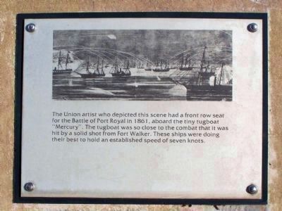
The Union artist who depicted this scene had a front row seat for the Battle of Port Royal in 1861, abourd the tiny tugboat "Mercury". The tugboat was so close to the combat that it was hit by solid shot from Fort Walker. These ships were doing their best to hold an established speed of seven knots.
The Hilton Head Island Historical Society , Port Royal Interpretive Markers
7. Battle of Port Royal Marker
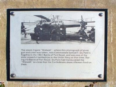
The steam frigate "Wabash", where this photograph of pivot gun and crew was taken, was Commodore Samuel F. Du Pont's flagship in the 1861 Battle of Port Royal, and was one of the most powerful battleships in the Union Navy at the time. During the battle of Port Royal, Du Pont had maneuvered the "Wabash" so close that the Confederate shore riflemen fired on them.
The Hilton Head Island Historical Society , Port Royal Interpretive Markers
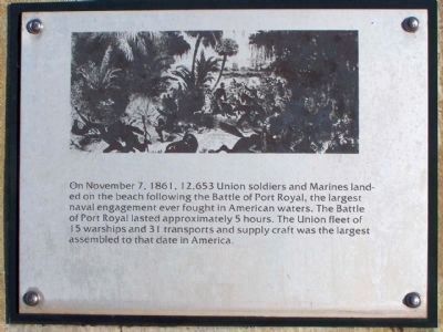
8. Battle of Port Royal Marker
On November 7, 1861, 12,653 Union soldiers and Marines landed on the beach following the battle of Port Royal, the
largest naval engagement ever fought in American waters. The battle of Port Royal lasted approximately 5 hours. The
Union fleet of 15 war ships and 31 transports and supply craft was the largest assembled to that date in America.
Credits. This page was last revised on June 16, 2016. It was originally submitted on February 27, 2009, by Mike Stroud of Bluffton, South Carolina. This page has been viewed 4,933 times since then and 88 times this year. Photos: 1, 2, 3, 4, 5. submitted on February 27, 2009, by Mike Stroud of Bluffton, South Carolina. 6, 7, 8, 9. submitted on August 30, 2009, by Mike Stroud of Bluffton, South Carolina. • Craig Swain was the editor who published this page.
