Austin in Travis County, Texas — The American South (West South Central)
John Williams and Howell Haggett
Photographed by Richard Denney, June 29, 2020
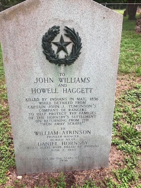
1. John Williams and Howell Haggett Marker
To John Williams and Howell Haggett
Killed by Indians in May, 1836 while detailed from Captain John J. Tumlinson’s company of Rangers to help protect the families of the Hornsby’s settlement on returning from the “Run Away Scrape”
To William Atkinson
Pioneer Ranger buried near Daniel Hornsby when both were killed by Indians June 7, 1845
Erected 1936 by State of Texas. (Marker Number 15027.)
Topics and series. This historical marker is listed in these topic lists: Cemeteries & Burial Sites • Indigenous Peoples and Communities • Settlements & Settlers. In addition, it is included in the Texas 1936 Centennial Markers and Monuments series list. A significant historical month for this entry is May 1836.
Location. 30° 15.348′ N, 97° 37.34′ W. Marker is in Austin, Texas, in Travis County. It can be reached from Unnamed Road south of Local Route 969 when traveling south. The marker is located in the Hornsby Cemetery, south of 969. Touch for map. Marker is in this post office area: Austin TX 78725, United States of America. Touch for directions.

Regionally, this marker is in Central Texas. It is also in the
this page online
Other nearby markers. At least 8 other markers are within 4 miles of this marker, measured as the crow flies: Josephus Hornsby (here, next to this marker); Site of Home of Reuben Hornsby (about 600 feet away, measured in a direct line); Reuben Hornsby (approx. 0.8 miles away); Decker United Methodist Church and Community (approx. 3.7 miles away); The Texas Centennial Historic Marker & Fort Colorado (approx. 3.8 miles away); Site of Fort Colorado (approx. 3.8 miles away); Del Valle Army Air Base (approx. 3.9 miles away); First Colored Baptist Church (approx. 4 miles away). Touch for a list and map of all markers in Austin.
Photographed by Keith Peterson, July 29, 2007
2. John Williams and Howell Haggett Marker
Photographed by Richard Denney, April 11, 2015
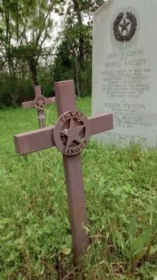
3. John Williams and Howell Haggett Marker
In Hornsby Cemetery graves of Texas Rangers are marked (in addition to the grave marker) with a metal cross stating "Texas Ranger".
Photographed by Richard Denney, April 11, 2015
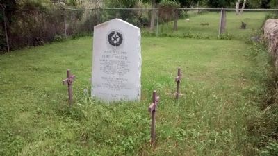
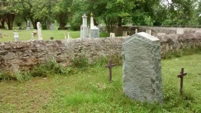
4. John Williams and Howell Haggett Marker
Photographed by Richard Denney, April 11, 2015
5. John Williams and Howell Haggett Marker
This view shows the marker's reverse and its proximity to the Josephus Hornsby marker (across the rock wall).
Credits. This page was last revised on February 1, 2023. It was originally submitted on December 23, 2009, by Keith Peterson of Cedar Park, Texas. This page has been viewed 2,020 times since then and 47 times this year. Last updated on January 24, 2021, by Richard Denney of Austin, Texas. Photos: 1. submitted on June 30, 2020, by Richard Denney of Austin, Texas. 2. submitted on December 23, 2009, by Keith Peterson of Cedar Park, Texas. 3, 4, 5. submitted on April 11, 2015, by Richard Denney of Austin, Texas. • J. Makali Bruton was the editor who published this page.
