Grand Lake Saint Marys
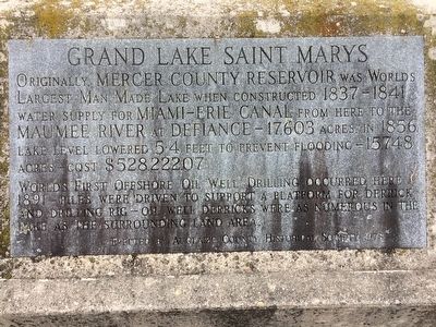
Grand Lake Saint Marys, originally Mercer County reservoir was worlds largest man made lake when constructed in 1837-1841 Water supply for Miami-erie Canal from here to the Maumee River at Defiance - 17603 acres. in 1856 lake level lowered 5.4 feet to prevent flooding - 15,748 acres - cost $528,222.07
Worlds first offshore oil well drilling occurred here 1891 - Piles were driven to support a platform for derrick and drilling rig - Oil well derricks were as numerous in the lake as the surrounding land area. Erected by the Auglaize County Historical Society 1978
Erected 1978 by Auglaize County Historical Society.
Topics. This historical marker is listed in these topic lists: Industry & Commerce • Man-Made Features • Waterways & Vessels. A significant historical year for this entry is 1856.
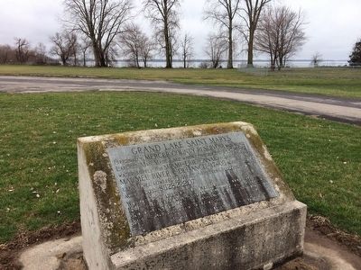
Location. 40° 32.368′ N, 84° 25.037′ W. Marker is in Villa Nova, Ohio, in Auglaize County. Marker can be reached from Ohio Route 364 near Parkway Drive. The marker is located in East Bank park on Grand Lake, off 364. Near the shelter house area, in between two park roads. Touch for map. Marker is in this post office area: Saint Marys OH 45885, United States of America. Touch for directions.
Other nearby markers. At least 8 other markers are within 2 miles of this marker, measured as the crow flies. St. Marys (approx. 0.4 miles away); Veterans Memorial
Additional commentary.
1. Lake lowering mentioned on the marker.
While the marker certainly appears to say the lake was lowered 54 feet, I believe it was meant to say 5.4 feet. There is no way to lower a lake that is about 10 foot deep, 54 feet...........
Credits. This page was last revised on January 28, 2021. It was originally submitted on March 16, 2016, by Michael Baker of Lima, Ohio. This page has been viewed 468 times since then and 18 times this year. Last updated on January 28, 2021, by Craig Doda of Napoleon, Ohio. Photos: 1, 2. submitted on March 16, 2016, by Michael Baker of Lima, Ohio. • Devry Becker Jones was the editor who published this page.

