Pompton Plains in Pequannock Township in Morris County, New Jersey — The American Northeast (Mid-Atlantic)
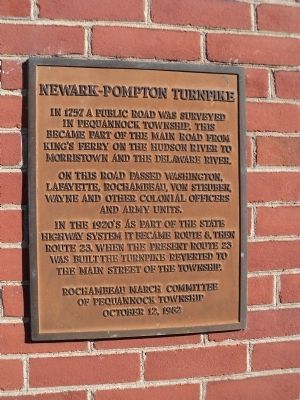
Newark – Pompton Turnpike
On this road passed Washington, Lafayette, Rochambeau, Von Steuben, Wayne and other colonial officers and army units.
In the 1920’s as part of the state highway system it became Route 8, then Route 23. When the present Route 23 was built the Turnpike reverted to the Main Street of the Township.
Rochambeau March Committee
of Pequannock Township
October 12, 1982
Erected 1982 by Rochambeau March Committee of Pequannock Township.
Topics. This historical marker is listed in these topic lists: Colonial Era • Roads & Vehicles • War, US Revolutionary. A significant historical year for this entry is 1757.
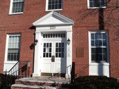
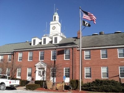
Location. 40° 57.873′ N, 74° 17.661′ W. Marker is in Pequannock Township, New Jersey, in Morris County. It is in Pompton Plains. Marker is on Newark Pompton Turnpike, on the right when traveling north. Marker is located on the Pequannock Township Municipal Building. Touch for map. Marker is at or near this postal address: 530 Newark Pompton Turnpike, Pompton Plains NJ 07444, United States of America. Touch for directions.
Other nearby markers. At least 8 other markers are within 2 miles of this marker, measured as the crow flies. Pompton Plains 9/11 Memorial (a few steps from this marker); First Reformed Church (within shouting distance of this marker); Pompton Plains “Brick Schoolhouse” (about 300 feet away, measured in a direct line); Giles Mandeville House (about 400 feet away); Mandeville Farm Encampment Site (approx. ¼ mile away); Martin Berry House (approx. 0.6 miles away); Jesse Van Ness Farm (approx. 1.2 miles away); Reaction Motors Development and Test Site (approx. 1.3 miles away). Touch for a list and map of all markers in Pequannock Township.
Credits. This page was last revised on February 7, 2023. It was originally submitted on January 27, 2013, by Bill Coughlin of Woodland Park, New Jersey. This page has been viewed 565 times since then and 40 times this year. Last updated on January 31, 2021, by Carl Gordon Moore Jr. of North East, Maryland. Photos: 1, 2, 3. submitted on January 27, 2013, by Bill Coughlin of Woodland Park, New Jersey. • Bill Pfingsten was the editor who published this page.


