St. Paul's Catholic Church Burial Ground

A burial ground for early parishioners and clergy of St. Paul's Catholic Church was located on this site during the nineteenth century. Among those buried here were:
Patrick Robertson, who bequeathed the funds to purchase this property in 1810 and construct the first St. Paul's; Rosalie and Bartholomew Accinelli, founding members of this congregation; Antonio Sylvestre Bilisoli, a founding member of this congregation who fought during the American Revolution; Rev. Francis Devlin, pastor from 1844 to 1855, who died ministering to the citizens of Portsmouth during the Yellow Fever epidemic of 1855; and Rev. Joseph Plunkett, pastor from 1855 to 1870 and during the construction of the fourth St. Paul's.
Erected by St. Paul's Catholic Church.
Topics. This historical marker is listed in these topic lists: Cemeteries & Burial Sites • Religion & Religious Structures • Science & Medicine • War, US Revolutionary. A significant historical year for this entry is 1810.
Location. 36° 50.142′ N, 76° 18.223′ W. Marker is in Portsmouth, Virginia. It is in Olde Towne. It is on Washington Street just north of High Street,
this page online

Regionally, this marker is in Virginia’s Hampton Roads, specifically in Coastal Virginia, and in the Hampton Roads Metropolitan Area. It is also in the American South, specifically in the Upper South, in the Tidewater, and on the Eastern Seaboard. Globally, it is in the North Atlantic Region, North America, the Western Hemisphere, the Western World, and the Anglosphere. Historically, it finds itself in what was once the territory of the Mississippian Culture, one of the original Thirteen Colonies, one of the Confederate States of America, and the Antebellum South.
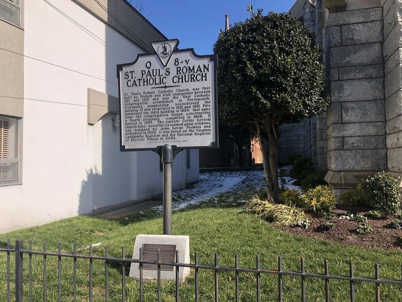
Other nearby markers. At least 8 other markers are within walking distance of this marker: St. Paul’s Roman Catholic Church (here, next to this marker); Priests Who Died In Their Service Memorial (within shouting distance of this marker); Rev. Francis Devlin (about 300 feet away, measured in a direct line); Saint Paul's School (about 300 feet away); George Teamoh (about 300 feet
Credits. This page was last revised on February 1, 2023. It was originally submitted on January 31, 2021, by Devry Becker Jones of Washington, District of Columbia. This page has been viewed 386 times since then and 20 times this year. Photos: 1, 2. submitted on January 31, 2021, by Devry Becker Jones of Washington, District of Columbia.
