Has This Site Ever Been Explored?
Miamisburg Mound State Memorial
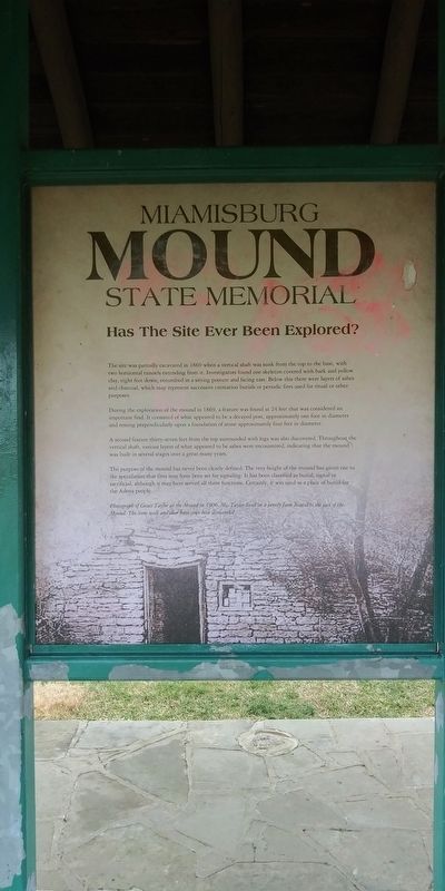
The site was partially excavated in 1869 when a vertical shaft was sunk from the top to the base, with two horizontal tunnels extending from it. Investigators found one skeleton covered with bark and yellow clay, eight feet down, entombed in a sitting posture and facing east. Below this there were layers of ashes and charcoal, which may represent successive cremation burials or periodic fires used for ritual or other purposes.
During the exploration of the mound in 1869, a feature was found at 24 feet that was considered an important find. It consisted of what appeared to be a decayed post, approximately one foot in diameter and resting perpendicularly upon a foundation of stone approximately four feet in diameter.
A second feature thirty-seven feet from the top surrounded with logs was also discovered. Throughout the vertical shaft, various layers of what appeared to be ashes were encountered, indicating that the mound was built in several stages over a great many years.
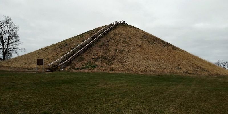
The purpose of the mound has never been clearly defined. The very height of the mound has given rise to the speculation that fires may have been set for signaling. It has been classified as burial, signal or sacrificial, although it may have served all three functions. Certainly, it was used as a place of burial for the Adena people.
Topics. This historical marker is listed in these topic lists: Anthropology & Archaeology • Cemeteries & Burial Sites • Communications • Native Americans. A significant historical year for this entry is 1869.
Location. 39° 37.65′ N, 84° 16.8′ W. Marker is in Miamisburg, Ohio, in Montgomery County. Marker can be reached from Mound Road just north of Enterprise Court, on the right when traveling north. Touch for map. Marker is at or near this postal address: 900 Mound Rd, Miamisburg OH 45342, United States of America. Touch for directions.
Other nearby markers. At least 8 other markers are within walking distance of this marker. Miamisburg Mound State Memorial (here, next to this marker); The Historical Era of Miamisburg Mound (here, next to this marker); Current Restoration Efforts (here, next to this marker); Who built the Mound and why did they build it? (here, next to this marker); Miamisburg Mound (within shouting distance of this marker); a different marker also named The Miamisburg Mound (about 300 feet away, measured in a direct line); Site of Mound Laboratory (1946- 2003) (approx. 0.3 miles away); Mound Laboratory (1946- 2010) (approx. 0.3 miles away). Touch for a list and map of all markers in Miamisburg.
Credits. This page was last revised on February 2, 2021. It was originally submitted on February 1, 2021, by Craig Doda of Napoleon, Ohio. This page has been viewed 277 times since then and 15 times this year. Photos: 1, 2, 3, 4. submitted on February 1, 2021, by Craig Doda of Napoleon, Ohio. • Devry Becker Jones was the editor who published this page.


