Princeton in Mercer County, New Jersey — The American Northeast (Mid-Atlantic)
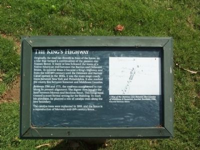
The King’s Highway
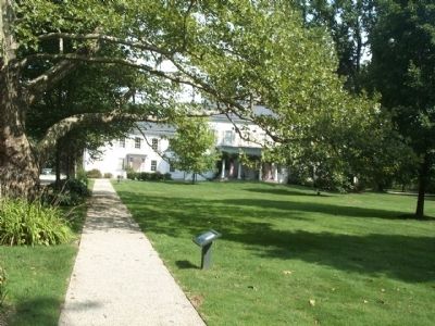
Between 1766 and 1771, the road was straightened to run along its present alignment. The Signer then bought the land between Morven and Stockton Street. This foreground created a more formal setting for the building. To mark his purchase, he planted a row of catalpa trees along the new boundary.
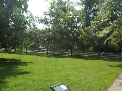
The catalpa trees were replanted in 1999, and the fence is a reproduction of Morven’s mid-19th century fence.
[caption] A Map of the the Division Line Between the Counties of Middlesex & Somerset, Azariah Dunham, 1766, Princeton University Library
Topics. This historical marker is listed in these topic lists: Colonial Era • Roads & Vehicles. A significant historical year for this entry is 1766.
Location. This marker has been replaced by another marker nearby. It was located near 40° 20.843′ N, 74° 40.014′ W. Marker was in Princeton, New Jersey, in Mercer County. Marker could be reached from Stockton Street (U.S. 206). This marker is next to the entrance road of Morven Museum and Garden, close to Stockton Street. Touch for map. Marker was at or near this postal address: 55 Stockton Street, Princeton NJ 08540, United States of America. Touch for directions.
Other nearby markers. At least 8 other markers are within walking distance of this location. The Great Lawn / Morven Museum & Garden (a few steps from this marker); The West Wing (within shouting distance of this marker); W 3 R (within shouting distance of this marker); The Commodore's Greenhouse (within shouting distance of this marker); The Ice House (within shouting distance of this marker); The Colonial Revival Garden (within shouting distance of this marker); Horse Chestnut Walk (within shouting distance of this marker); The Gardens (within shouting distance of this marker). Touch for a list and map of all markers in Princeton.
Also see . . . Morven Museum & Garden. (Submitted on August 20, 2008, by Kevin W. of Stafford, Virginia.)
Credits. This page was last revised on October 17, 2022. It was originally submitted on August 19, 2008, by Gary Nigh of Trenton, New Jersey. This page has been viewed 1,136 times since then and 26 times this year. Last updated on February 3, 2021, by Carl Gordon Moore Jr. of North East, Maryland. Photos: 1, 2, 3. submitted on August 19, 2008, by Gary Nigh of Trenton, New Jersey. • Bill Pfingsten was the editor who published this page.


