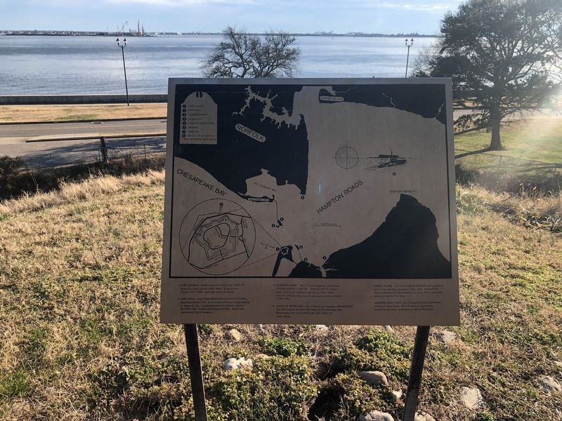
Notable Locations in the Hampton Roads

1. Fort Monroe — largest stone fort built in U.S. (1819-34). Home of Artillery School (1824-1906). Coast Artillery School (1907-1946) and other major commands.
2. Fort Wool — man-made island built on shoals by U.S. Army beginning around 1819. Some construction work supervised by Lt. Robert E. Lee. Presidential retreat for Andrew Jackson and John Tyler. Prison camp during Civil War. Now a park operated by City of Hampton.
3. Engineer Wharf — built to unload supplies, construction material, workers, troops, etc. Starting point for several major Union Army expeditions during Civil War. State prisoner Jefferson Davis was brought ashore at this location in May 1865.
8. Battle of Ironclads — site of famous duel between USS Monitor and CSS Virginia (formerly USS Merrimack) on 9 March 1862. Battle lasted four hours without any clear victory for either vessel.
Craney Island — site of Confederate batteries until successful Union Army and Navy campaign of May 1862. Ironclad CSS Virginia (Merrimack) destroyed here by crew. Now a restricted area controlled by U.S. Navy.
Newport News Point site of large Union Army settlement known as Camp Butler. Starting point of James River Expedition and other campaigns to capture Richmond.
Topics and series.
Location. 37° 0.098′ N, 76° 18.52′ W. Marker is in Hampton, Virginia. It is in Fort Monroe. Marker can be reached from Bernard Road just west of Mathews Lane, on the right when traveling east. Touch for map. Marker is in this post office area: Fort Monroe VA 23651, United States of America. Touch for directions.
Other nearby markers. At least 8 other markers are within walking distance of this marker. Retreat / Courtesies (a few steps from this marker); Lantaka (within shouting distance of this marker); Spanish 1-˝ Pounder (within shouting distance of this marker); 12-Pounder Howitzer (within shouting distance of this marker); 3 – Inch Ordnance Rifle (within shouting distance of this marker); Fort Monroe (within shouting distance of this marker); First Africans in Virginia (within shouting distance of this marker); "Ruth Window" (about 300 feet away, measured in a direct line). Touch for a list and map of all markers in Hampton.
Credits. This page was last revised on February 1, 2023. It was originally submitted on February 8, 2021, by Devry Becker Jones of Washington, District of Columbia. This page has been viewed 142 times since then and 18 times this year. Photo 1. submitted on February 8, 2021, by Devry Becker Jones of Washington, District of Columbia.
Editor’s want-list for this marker. A wide shot of the marker in context. • Can you help?