Lake Improvments
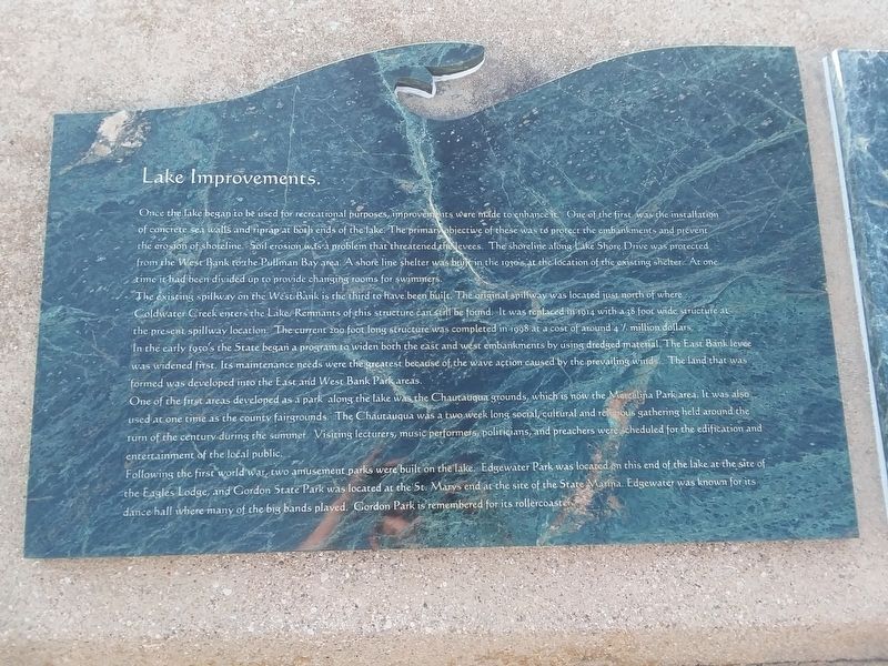
Once the lake began to be used for recreational purposes, improvements were made to enhance it. One of the first was the installation of concrete sea walls and riprap at both ends of the lake. The primary objective of these was to protect the embankments and prevent the erosion of shoreline. Soil erosion was a problem that threatened the levees. The shoreline along Lake Shore Drive was protected from the West Bank to the Pullman Bay area. A shore line shelter was built in the 1930's at the location of the existing shelter. At one time it had been divided up to provide changing rooms for swimmers.
The existing spillway on the West Bank is the third to have been built. The original spillway was located just north of where Coldwater Creek enters the Lake. Remnants of this structure can still be found. It was replaced in 1914 with a 38 foot wide structure at the present spillway location. The current 200 foot long structure was completed in 1998 at a cost of around 4 1/2 million dollars. In the early 1950's the State began a program to widen both the east and west embankments by using dredged material. The East Bank levee was widened first. Its maintenance needs were the greatest because of the wave action caused by the prevailing winds. The land that was formed was developed into the East and West Bank Park areas.
One
of the first areas developed as a park along the lake was the Chautauqua grounds, which is now the Marcelina Park area. It was also Used at one time as the county fairgrounds. The Chautauqua was a two week long social, cultural and religious gathering held around the turn of the century during the summer. Visiting lecturers, music performers, politicians, and preachers were scheduled for the edification and entertainment of the local public.
Following the first world war, two amusement parks were built on the lake. Edgewater Park was located on this end of the lake at the site of
the Eagles Lodge, and Gordon State Park was located at the St. Marys end at the site of the State Marina. Edgewater was known for its
dance hall where many of the big bands played. Gordon Park is remembered for its rollercoaster.
Topics. This historical marker is listed in these topic lists: Parks & Recreational Areas • Waterways & Vessels. A significant historical year for this entry is 1914.
Location. 40° 32.64′ N, 84° 34.261′ W. Marker is in Celina, Ohio, in Mercer County. Marker is on South Main Street (U.S. 127) just south of Lake Shore Drive, on the right when traveling north. Touch for map. Marker is in this post office area: Celina OH 45822, United States of America. Touch for directions.
Other nearby markers. At least 8 other markers are within walking distance of this marker. Geologic History (here, next to this marker); Grand Lake St. Marys (here, next to this
Credits. This page was last revised on February 11, 2021. It was originally submitted on February 9, 2021, by Craig Doda of Napoleon, Ohio. This page has been viewed 92 times since then and 3 times this year. Photos: 1, 2, 3. submitted on February 9, 2021, by Craig Doda of Napoleon, Ohio. • Devry Becker Jones was the editor who published this page.


