
Johnstown in Licking County, Ohio — The American Midwest (Great Lakes)
Johnstown Cemetery
⎯⎯⎯
War Veterans
Photographed by William Fischer, Jr., February 5, 2009
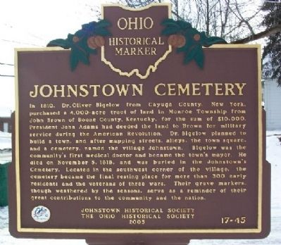
1. Johnstown Cemetery (Side A)
Side A: Johnstown Cemetery
In 1810, Dr. Oliver Bigelow from Cayuga County, New York, purchased a 4,000-acre tract of land in Monroe Township from John Brown of Boone County, Kentucky, for the sum of $10,000. President John Adams had deeded the land to Brown for military service during the American Revolution. Dr. Bigelow planned to build a town, and after mapping streets, alleys, the town square, and a cemetery, named the village Johnstown. Bigelow was the community's first medical doctor and became the town's mayor. He died on November 5, 1818, and was buried in the Johnstown's Cemetery. Located in the southwest corner of the village, the cemetery became the final resting place for more than 300 early residents and the veterans of three wars. Their grave markers, though weathered by the seasons, serve as a reminder of their great contributions to the community and the nation.
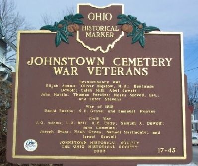
Side B:
Revolutionary War
Elijah Adams; Oliver Bigelow, M.D.; Benjamin DeWolf;
Caleb Hill; Abel Jewett;
John Martin; Thomas Perkins; Moses Scovell, Esq.; and Peter Stevens
War of 1812
David Buxton; S.D. Grove;
this page online
Civil War
J.O. Adams; L.S. Bell; A.E. Cady; Samuel A. DeWolf; John Cummins;
Joseph Evans; Noah Green; Samuel Martindale; and Israel Scovell
Erected 2003 by Johnstown Historical Society and The Ohio Historical Society. (Marker Number 17-45.)
Topics and series. This historical marker is listed in these topic lists: Cemeteries & Burial Sites • Settlements & Settlers • War of 1812 • War, US Civil • War, US Revolutionary. In addition, it is included in the Former U.S. Presidents: #02 John Adams, and the Ohio Historical Society / The Ohio History Connection series lists. A significant historical month for this entry is November 1840.
Location. 40° 9.077′ N, 82° 41.375′ W. Marker is in Johnstown, Ohio, in Licking County. It is at the intersection of Coshocton Street (U.S. 62) and Woodgate Drive, on the right when traveling west on Coshocton Street. Cemetery is about 100 meters north of the marker. Touch for map. Marker is in this post office area: Johnstown OH 43031, United States of America. Touch for directions.

Regionally, this marker is in the Columbus Metropolitan Area. It is also in the American
Photographed by William Fischer, Jr., February 5, 2009
2. Johnstown Cemetery War Veterans Marker (Side B)
Other nearby markers. At least 8 other markers are within 6 miles of this marker, measured as the crow flies: Johnstown Cemetery Revolutionary War Soldiers (about 300 feet away, measured in a direct line); Bigelow Cemetery / Bigelow Cemetery War Veterans (about 500 feet away); American Legion Post 254 Wall of Honor (about 800 feet away); VFW Post 3097 Veterans Memorial (approx. ¼ mile away); Monroe Township Hall (approx. ¼ mile away); Pauline Chambers Yost (approx. 0.3 miles away); Johnstown (approx. 0.6 miles away); Alexandria (approx. 5½ miles away). Touch for a list and map of all markers in Johnstown.
Photographed by William Fischer, Jr., February 5, 2009
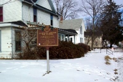
3. Johnstown Cemetery / War Veterans Marker
Photographed by William Fischer, Jr., February 5, 2009
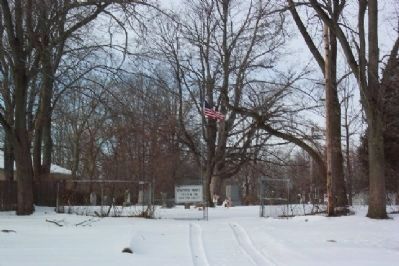
4. Johnstown Cemetery Entrance
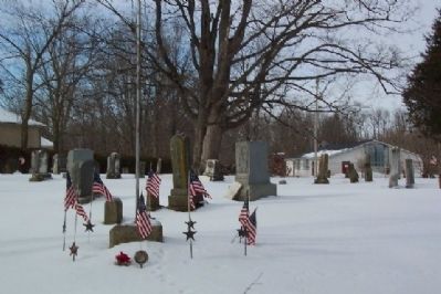
Photographed by William Fischer, Jr., February 5, 2009
5. Johnstown Cemetery
Credits. This page was last revised on June 16, 2016. It was originally submitted on March 4, 2009, by William Fischer, Jr. of Reynoldsburg, Ohio. This page has been viewed 1,728 times since then and 26 times this year. Photos: 1, 2, 3, 4, 5. submitted on March 4, 2009, by William Fischer, Jr. of Reynoldsburg, Ohio. • Craig Swain was the editor who published this page.
