Cumberland in Allegany County, Maryland — The American Northeast (Mid-Atlantic)
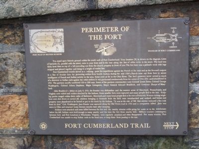
Perimeter of the Fort
Fort Cumberland Trail
Fort Cumberland mainly served as a rallying point for expeditions against the French to the west and as the forward outpost in a line of frontier forts for protecting settlers from hostile Indians during the mid 1700's. Patrols went out from here to secure intelligence of French and Indian activity in the area. Some went as far as the Ohio River. The fort's presence never served as much of a deterrent to Indian raids against the white settlers. It was garrisoned continuously from the winter of 1754-1755 until abandoned in 1765. The garrison usually numbered 150 to 200 men. Some of the garrison commanders were Colonel James Innes, Colonel George Washington, Colonel Adams Stephens, Major Livingston, Major General Edward Braddock, and Governor Sharpe of Maryland.
After Braddock's defeat on July 9, 1755, the frontier was defenseless and the western area of Maryland, Pennsylvania, and Virginia were raided and settlers attacked by the Indians. Some smaller forts were captured and many people fled to the east. Scalping parties ranged within thirty miles of Baltimore, Maryland, and many local people fled as far east as Frederick. Women visiting neighbors were shot down or carried off, children bringing in livestock from the field were tomahawked and scalped, and homes and property were abandoned to be looted or put to the torch by the Indians. "It was at the risk of life that anyone ventured a few rods from his door" - Col. Washington. Jane Frazier was captured along the Old Town road in 1755 and a companion killed. Jane was taken to Ohio and returned home thirteen months later after escaping.
Soldiers were attacked and some killed between the fort and the nearby streams while going for water or to the storehouses below the hill. Indians were bold enough to camp nearby and fire into the fort from nearby hills. Military couriers (messengers) between here and Fort Loudoun at Winchester, Virginia, were regularly attacked and often disappeared. For many reasons, Fort Cumberland was unable to stop Indian raids in the local area or keep them from passing to the east.
Topics. This historical marker is listed in these topic lists: Colonial Era • Forts and Castles • War, French and Indian. A significant historical month for this entry is July 1850.
Location. 39° 39.053′ N, 78° 45.935′ W. Marker is in Cumberland, Maryland, in Allegany County. Marker is on Washington St., on the left when traveling west. Marker in on the stone wall. Touch for map. Marker is in this post office area: Cumberland MD 21502, United States of America. Touch for directions.
Other nearby markers. At least 8 other markers are within walking distance of this marker. Emmanuel Episcopal Church (a few steps from this marker); First Church of Christ, Scientist (Hoyt House) (within shouting distance of this marker); The Fort Bastions (within shouting distance of this marker); Indians and Fort Cumberland (within shouting distance of this marker); Alteration of the Site (within shouting distance of this marker); French and Indian War (within shouting distance of this marker); Gov. Lloyd Lowndes 1845 - 1905 (within shouting distance of this marker); Famous Personalities at Fort Cumberland (within shouting distance of this marker). Touch for a list and map of all markers in Cumberland.
Regarding Perimeter of the Fort. Colonel Adams Stephens is mentioned. Could this be Adam Stephen, eventually helping found what is now Martinsburg, W.Va.?
Credits. This page was last revised on February 20, 2021. It was originally submitted on May 8, 2009, by Bill Pfingsten of Bel Air, Maryland. This page has been viewed 1,647 times since then and 22 times this year. Last updated on February 19, 2021, by Carl Gordon Moore Jr. of North East, Maryland. Photo 1. submitted on May 8, 2009, by Bill Pfingsten of Bel Air, Maryland.
