Near Manassas in Prince William County, Virginia — The American South (Mid-Atlantic)
The Battle Begins
Photographed by Craig Swain, July 19, 2008
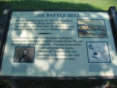
1. The Battle Begins Marker
Late afternoon, orders arrived prompting King to return to the Warrenton Turnpike (modern Route 29), and proceed east toward Centreville. The march resumed to locate and defeat the elusive "Stonewall" Jackson who was operating in the Union rear with half the Confederate army.
After the head of King's column had reached the village of Groveton, Jackson made his presence known by sending out his artillery to fire down upon the moving column. Brigadier General John Gibbon's brigade then turned to fight a fierce twilight battle near the Brawner farm house that began the three-day battle of Second Manassas.
Brigadier General Rufus King
When Jackson's artillery fired on King's column, King and his aides were enjoying a picnic meal beside a pond near the road intersection. During the excitement, King suffered an epileptic seizure, resulting in his four brigades being thrown into battle without an overall commander.
Topics. This historical
this page online
Location. 38° 48.304′ N, 77° 34.276′ W. Marker is near Manassas, Virginia, in Prince William County. It is on Lee Highway (County Route 705) 0.1 miles south of Lee Highway (U.S. 29), on the right when traveling north. Located at the Stuart Hill Center, in the western side of Manassas National Battlefield Park. Touch for map. Marker is at or near this postal address: 12521 Lee Hwy, Manassas VA 20109, United States of America. Touch for directions.

Regionally, this marker is in the Washington Metropolitan Area, in Northern Virginia, and in the Piedmont. It is also in the American South, specifically in the Upper South, in the Mid-Atlantic, and on the Eastern Seaboard. Globally, it is in the North Atlantic Region, North America, the Western Hemisphere, the Western World, and the Anglosphere. Historically, it finds itself in what was once the territory of the Mississippian Culture, one of the original Thirteen Colonies, one of the Confederate States of America, and the Antebellum South.
Other nearby markers. At least 8 other
Photographed by Craig Swain, July 19, 2008
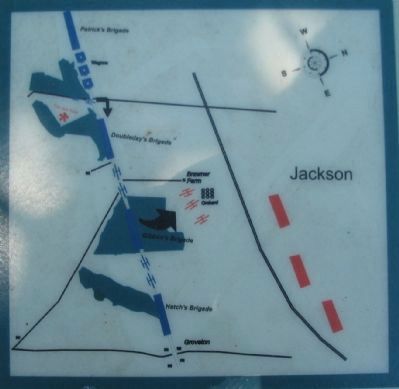
2. Battle Begins Map
Note the north seeking arrow pointing to the right of the map. A red asterisk in the upper left indicates the marker location.
More about this marker. In the upper right is an illustration depicting mounted Federal officers clustered around a pond near the intersection of Warrenton Pike and Pageland Lane. Below it is a map detailing the tactical maneuvers described in the text. On the lower left is a portrait of General King.
Also see . . .
1. Battle of Second Manassas (Second Bull Run). National Park Service website entry (Submitted on July 20, 2025, by Larry Gertner of New York, New York.)
2. Rufus King. Civil War in the East website entry (Submitted on July 20, 2025, by Larry Gertner of New York, New York.)
Photographed by Craig Swain, July 19, 2008
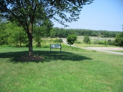
3. The Battle Begins Marker
Overlooking the intersection of Pageland Lane and the old Warrenton Turnpike.
Photographed by Craig Swain, July 19, 2008
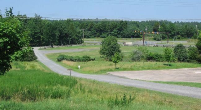
4. Intersection of Pageland Lane and Warrenton Pike
Looking from the marker location towards the intersection. The pond mentioned in the text may have been located near the parking area just down from the marker. Today the area is a "seasonal" pond, and more of a bog during the summer months.
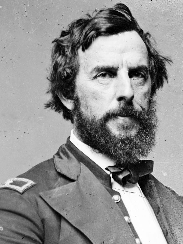
Library of Congress
5. Brigadier General Rufus King
When Jackson's artillery fired on King's column, King and his aides were enjoying a picnic meal beside a pond near the road intersection. During the excitement, King suffered an epileptic seizure, resulting in his four brigades being thrown into battle without an overall commander.
Brady-Handy photograph collection, Library of Congress
Brady-Handy photograph collection, Library of Congress
Credits. This page was last revised on July 20, 2025. It was originally submitted on August 3, 2008, by Craig Swain of Leesburg, Virginia. This page has been viewed 1,441 times since then and 35 times this year. Last updated on February 26, 2021, by Carl Gordon Moore Jr. of North East, Maryland. Photos: 1, 2, 3, 4. submitted on August 3, 2008, by Craig Swain of Leesburg, Virginia. 5. submitted on January 2, 2021, by Allen C. Browne of Silver Spring, Maryland. • Bill Pfingsten was the editor who published this page.
