Woodland Hills near Calabasas in Los Angeles County, California — The American West (Pacific Coastal)
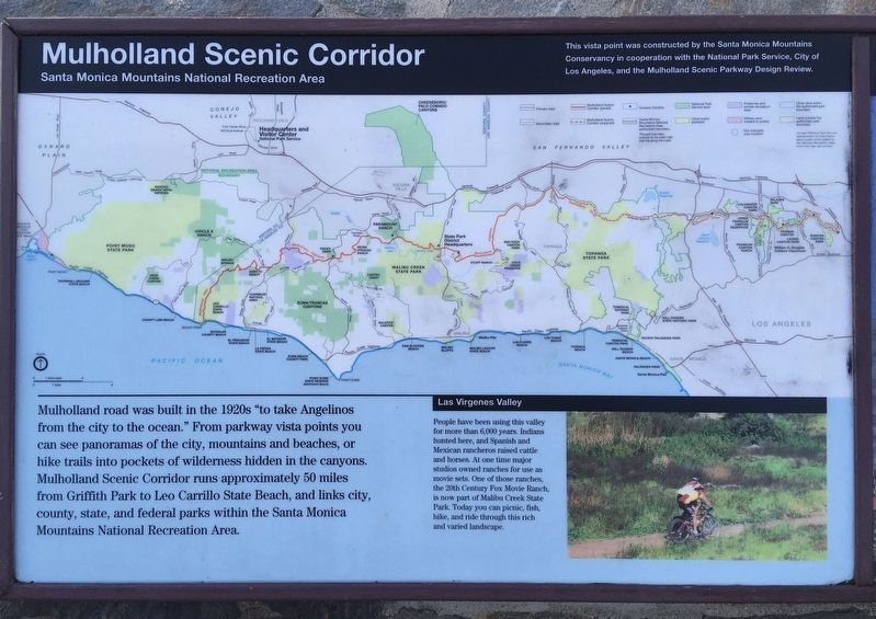
Mulholland Scenic Corridor
Santa Monica Mountains National Recreation Area
Mulholland road was built in the 1920s "to take Angelinos from the city to the ocean.” From parkway vista points you can see panoramas of the city, mountains and beaches, or hike trails into pockets of wilderness hidden in the canyons. Mulholland Scenic Corridor runs approximately 50 miles from Griffith Park to Leo Carrillo State Beach, and links city, county, state, and federal parks within the Santa Monica Mountains National Recreation Area.
Las Virgenes Valley
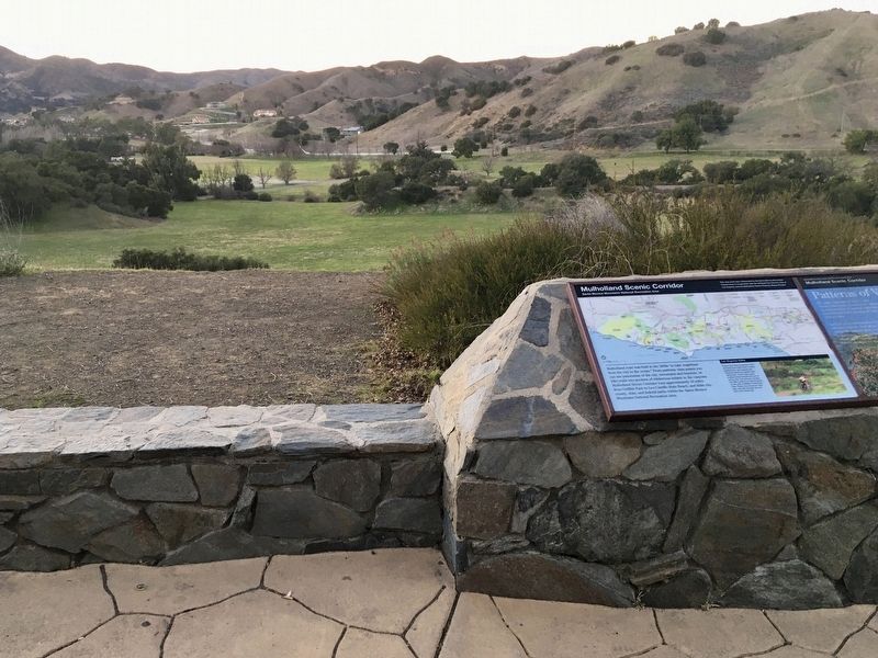
People have been using this valley for more than 6,000 years. Indians hunted here, and Spanish and Mexican rancheros raised cattle and horses. At one time major studios owned ranches for use as movie sets. One of those ranches, the 20th Century Fox Movie Ranch, is now part of Malibu Creek State Park. Today you can picnic, fish, hike, and ride through this rich and varied landscape.
Erected by National Park Service.
Topics. This historical marker is listed in these topic lists: Entertainment • Native Americans • Parks & Recreational Areas • Roads & Vehicles.
Location. 34° 5.901′ N, 118° 41.689′ W. Marker is near Calabasas, California, in Los Angeles County . It is in Woodland Hills. Marker is on Mulholland Highway, 1.4 miles east of Las Virgenes Road, on the right when traveling east. Located at the Alisa B. Katz Overlook. Touch for map. Marker is in this post office area: Calabasas CA 91302, United States of America. Touch for directions.
Other nearby markers. At least 8 other markers are within 5 miles of this marker, measured as the crow flies. King Gillette Ranch (approx. 0.8 miles away); Century Ranch (approx. 1.9 miles away); Calabasas Schoolhouse Bell (approx. 2˝ miles away); M*A*S*H (approx. 2.9 miles away); Reagan Ranch (approx. 3.1 miles away); Paramount Ranch (approx. 3.7 miles away); The Rouse Residence (approx. 4.1 miles away); Morrison Ranch House (approx. 4.3 miles away). Touch for a list and map of all markers in Calabasas.
Credits. This page was last revised on January 30, 2023. It was originally submitted on February 27, 2021, by Craig Baker of Sylmar, California. This page has been viewed 229 times since then and 22 times this year. Photos: 1, 2. submitted on February 27, 2021, by Craig Baker of Sylmar, California. • J. Makali Bruton was the editor who published this page.

