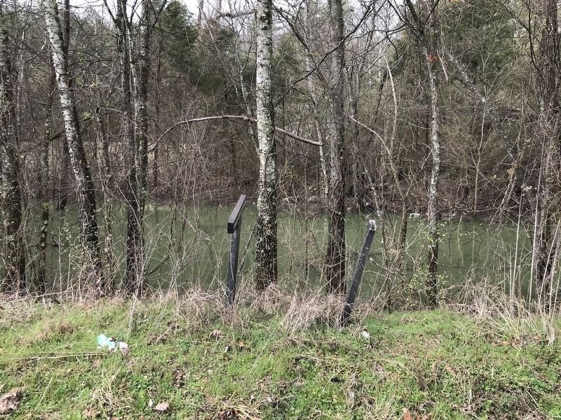
Near Trenton in Dade County, Georgia — The American South (South Atlantic)
Brown's Spring
Chickamauga Campaign Heritage Trail
Inscription.
Brown's Spring, located at the base of Sand Mountain, was a major landmark used by the Federal Army in the occupation of Dade County in September, 1863. One of the logistical problems of the campaign was to make sure that all camp sites had an adequate source of water, both for the men and for the large number of draft animals connected with the supply trains. Brown's Spring was shown on existing maps and it was believed to be sufficient in flow to meet the needs of a large group.
Two of General George Thomas' 14th Army Corps divisions crossed over the rugged slopes of Sand Mountain and came down to Brown's Spring. "General Negley (Second Division) was unable to get his trains all up to-day, but will do do tomorrow, and make Brown's Spring tomorrow night," Thomas reported to General James Garfield, the Chief of Staff, on September 3, 1863. On the same day, the general discussed the situation in his correspondence with General Negley: "This route will take you by Brown's Spring, where you had better encamp until I can overtake you."
The following day, September 4, Thomas informed General Garfield: "The First Division (Baird) is in camp this side of the river opposite Bridgeport, to-night. It will follow Negley's division, and will reach the foot of the mountain at Brown's Spring Sunday night. Negley's division will be at Brown's Spring tonight."
General James S. Negley, commander of the second division in the 14th Army Corps, reported his position on September 4th: "Marched the command forward 3 p.m. arrived at Brown's Spring at the foot of the mountain. Found a small spring at this point, which after being excavated and dammed up, afforded sufficient water for my command. By 8 p.m. my entire train was parked at foot of the mountain except 8 wagons of supplies, which were left [on the other side of the mountain] at Moore's Spring."
General George Thomas reported "Headquarters of the corps still at Brown's Spring on September 7th." While the army was camped around Brown's Spring they captured a number of Confederate soldiers who had been attempting to visit their families in the area. These were men who had been paroled after they were captured at Vicksburg. They had thought it possible to make a visit home before rejoining their commands, not knowing that Dade County had also been occupied. Several of them spent the rest of the war in prison, and a few died there.
General Philip Sheridan also led his division from the 20th Army Corps over Sand Mountain by this same route. For a few days all the available space around Brown's Spring was taken up by camp sites. General Negley sent out reconnaissance patrols to explore the area. They found that adequate water could be found at Cureton's Mill and on Hurricane Creek near the foot of Lookout Mountain. The men eventually moved on down the valley to Johnson's Crook for the crossing of Lookout Mountain.
Captions (left to right):
• General Philip Sheridan and staff
• From the map of Col. William E. Merrill, Chief Engineer, Army of the Cumberland
• Soldiers in camp
Topics. This historical marker is listed in these topic lists: War, US Civil • Waterways & Vessels. A significant historical month for this entry is September 1863.
Location. Marker has been reported missing. It was located near 34° 50.799′ N, 85° 32.812′ W. Marker was near Trenton, Georgia, in Dade County. Marker was on Back Valley Road (County Route 52) ¼ mile north of Castle Drive, on the right when traveling north. Touch for map. Marker was in this post office area: Trenton GA 30752, United States of America. Touch for directions.
Other nearby markers. At least 8 other markers are within 4 miles of this location, measured as the crow flies. White Oak Gap (approx. 2.2 miles away); Union School (approx. 2½ miles away); Payne's (Sitton's) Mill (approx. 2.8 miles away); Trenton (approx. 2.8 miles away); Dade County (approx. 2.8 miles away); Cureton Plantation (approx. 3.3 miles away); Macon Iron Works (approx. 3.7 miles away); The O'Neal House (approx. 3.8 miles away). Touch for a list and map of all markers in Trenton.
Also see . . . Brown's Spring. PDF of the missing marker face by the Georgia Civil War Commission. (Submitted on March 4, 2021, by Duane and Tracy Marsteller of Murfreesboro, Tennessee.)
Credits. This page was last revised on March 4, 2021. It was originally submitted on March 4, 2021, by Duane and Tracy Marsteller of Murfreesboro, Tennessee. This page has been viewed 323 times since then and 34 times this year. Photo 1. submitted on March 4, 2021, by Duane and Tracy Marsteller of Murfreesboro, Tennessee.
Editor’s want-list for this marker. Closeup photo of the marker. • Can you help?
