Point of Rocks
A "Landmark" Community
— Canal Towns • Point of Rocks —
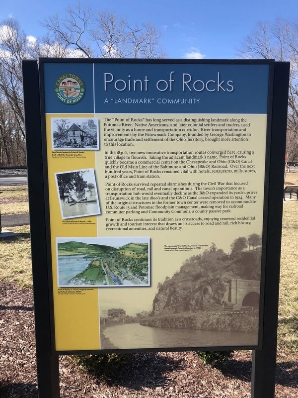
The "Point of Rocks" has long served as a distinguishing landmark along the Potomac River. Native Americans, and later colonial settlers and traders, used the vicinity as a home and transportation corridor. River transportation and improvements by the Patowmack Company, founded by George Washington to encourage trade and settlement of the Ohio Territory, brought more attention to this location.
In the 1830's, two new innovative transportation routes converged here, causing a true village to flourish. Taking the adjacent landmark's name, Point of Rocks quickly became a commercial center on the Chesapeake and Ohio (C&O) Canal and the Old Main Line of the Baltimore and Ohio (B&O) Railroad. Over the next hundred years, Point of Rocks remained vital with hotels, restaurants, mills, stores, and a post office and train station.
Point of Rocks survived repeated skirmishes during the Civil War that focused on disruption of road, rail and canal operations. The town's importance as a transportation hub would eventually decline as the B&O expanded its yards upriver at Brunswick in the late 1800's and the C&O Canal ceased operation in 1924. Many of the original structures in the former town center were removed to accommodate U.S. Route 15 and Potomac floodplain management, making way for railroad commuter parking and Community Commons,
a county passive park.
Point of Rocks continues its tradition as a crossroads, enjoying renewed residential growth and tourism interest that draws on its access to road and rail, rich history, recreational amenities, and natural beauty.
Topics and series. This historical marker is listed in these topic lists: Railroads & Streetcars • Settlements & Settlers • War, US Civil • Waterways & Vessels. In addition, it is included in the Baltimore and Ohio Railroad (B&O), the Chesapeake and Ohio (C&O) Canal, and the Former U.S. Presidents: #01 George Washington series lists. A significant historical year for this entry is 1924.
Location. 39° 16.455′ N, 77° 32.329′ W. Marker is in Point of Rocks, Maryland, in Frederick County. Marker is at the intersection of Monroe Street and Clay Street (Maryland Route 28), on the right when traveling south on Monroe Street. Touch for map. Marker is at or near this postal address: 3725B Clay St, Point of Rocks MD 21777, United States of America. Touch for directions.
Other nearby markers. At least 8 other markers are within walking distance of this marker. A different marker also named Point of Rocks (a few steps from this marker); a different marker also named Point of Rocks (within shouting distance of this marker); a different marker also named Point of Rocks (about 300 feet away, measured in a direct line); a different marker also named Point of Rocks

Credits. This page was last revised on March 6, 2021. It was originally submitted on March 6, 2021, by Devry Becker Jones of Washington, District of Columbia. This page has been viewed 247 times since then and 34 times this year. Photos: 1, 2, 3. submitted on March 6, 2021, by Devry Becker Jones of Washington, District of Columbia.

