Ebensburg in Cambria County, Pennsylvania — The American Northeast (Mid-Atlantic)
This Tablet Marks the Site
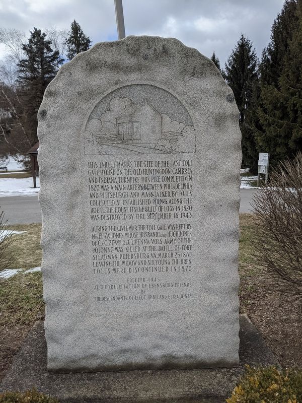
Photographed by Mike Wintermantel, March 6, 2021
1. This Tablet Marks the Site Marker
During the Civil War the toll gate was kept by Mrs. Eliza Jones whose husband, Lieut. Hugh Jones of Co. C. 209th Regt. Penna. Vols. Army of the Potomac was killed at the battle of Fort Steadman, Petersburg, VA., March 25, 1865, leaving the widow and six young children. Tolls were discontinued in 1870.
Erected 1945 by The Descendants of Lieut. Hugh and Eliza Jones.
Topics. This historical marker is listed in these topic lists: Roads & Vehicles • War, US Civil. A significant historical date for this entry is March 25, 1865.
Location. 40° 28.931′ N, 78° 42.804′ W. Marker is in Ebensburg, Pennsylvania, in Cambria County. It is on Rowena Drive 0.1 miles east of Manor Drive, on the right when traveling east. Touch for map. Marker is in this post office area: Ebensburg PA 15931, United
this page online

Regionally, this marker is in Pennsylvania’s Laurel Highlands. It is also in the American Northeast, in the Mid-Atlantic, in Appalachia, and specifically in Northern Appalachia. Globally, it is in North America, the Western Hemisphere, the Western World, and the Anglosphere. Historically, it finds itself in what was once the Haudenosaunee (Iroquois) Confederacy and also one of the original Thirteen Colonies.
Other nearby markers. At least 8 other markers are within 4 miles of this marker, measured as the crow flies: The Noon-Collins House and the YMCA Building of Ebensburg (approx. 0.6 miles away); Cambria County (approx. 0.6 miles away); Ebensburg Historic District (approx. 0.6 miles away); Kimball Park (approx. 0.6 miles away); Veterans Park of Cambria County (approx. 0.7 miles away); Penn-Eben Hotel (approx. ¾ mile away); Ebensburg (approx. 0.8 miles away); Loretto (approx. 4.1 miles away). Touch for a list and map of all markers in Ebensburg.

Photographed by Mike Wintermantel, March 6, 2021
2. This Tablet Marks the Site Marker
Credits. This page was last revised on March 6, 2021. It was originally submitted on March 6, 2021, by Mike Wintermantel of Pittsburgh, Pennsylvania. This page has been viewed 676 times since then and 32 times this year. Photos: 1, 2. submitted on March 6, 2021, by Mike Wintermantel of Pittsburgh, Pennsylvania.
