Battle of Ball's Bluff - October 21, 1861
Mid-Afternoon Union and Confederate Deployments and Engagements

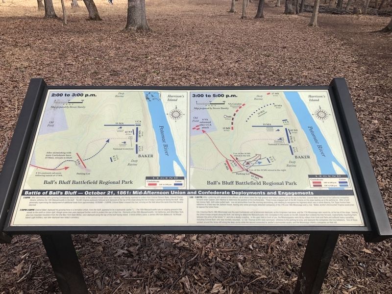
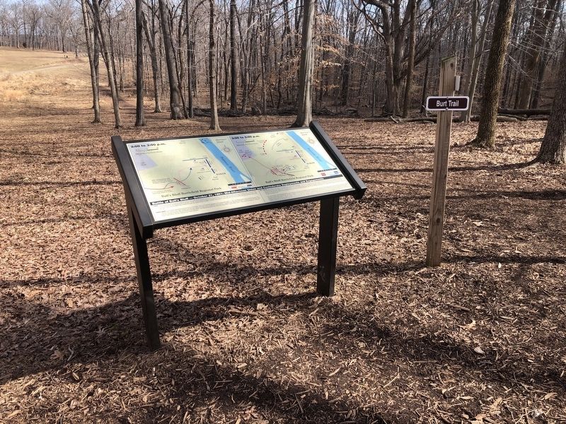
2:00PM: After skirmishing with a growing Confederate force in the vicinity of the Jackson House since early morning, and having received no orders from Colonel Edward Baker, Colonel Charles Devens withdrew the 15th Massachusetts to the bluff. The 8th Virginia cautiously followed and deployed at the top of the slope along the line of today's parking lot facing the bluff. After personally supervising the deployment of additional boats from approximately 10:00AM - 2:00PM, Colonel Baker crossed the river, arriving on the field about the same time that Devens returned.
2:00PM-3:00PM: Colonel Baker deployed his growing force in a formation which, from the bluff, appeared to be a backwards capital "L." The 15th Massachusetts was on sloping ground in the woods to the north or Union right, though some men were deployed further north to protect the rear of that line. Elements of the 20th Massachusetts, 1st California, and 42nd New York plus two mountain howitzers from the 2nd New York State Militia, were deployed along the top of the bluff facing inland. A third artillery piece, a James rifle from Battery B, 1st Rhode Island Light Artillery, was later deployed near today's cemetery.
3:00-5:00 PM: After conferring with several of his officers, all of whom noted the high ground near today's parking lot as the
key to the field, Colonel Baker sent two of his California companies forward under Captain John Markoe to determine the position of the Confederates. These troops engaged part of the 8th Virginia on the slope leading up to the parking lot. After a brief but vicious fight, both sides pulled back. Low on ammunition from the morning skirmishing, and needing to reorganize his regiment which was in some disarray, Col. Eppa Hunton then withdrew to a field near the Jackson house, leaving only some previously detached companies of the 17th and 18th Mississippi and Lt. Col. Walter Jenifer's dismounted Virginia cavalrymen to oppose the Union force.Col. Erasmus Burt's 18th Mississippi was the next Confederate unit to arrive and deployed, as the Virginians had done, and the 17th Mississippi later would do, at the top of the slope. Seeing the Union troops arrayed along the bluff, but failing to detect the Massachusetts men concealed in the woods on his left, Colonel Burt ordered his men forward, inadvertently marching them between the arms of the Union "L" and into a deadly crossfire. In the open field in front of you, the Mississippians were hit by volleys from front and flank and suffered heavy casualties, including Colonel Burt, who was mortally wounded. Lt. Col. Thomas Griffin took command, withdrew to the parking lot area, and deployed the companies into two battalions. One of these

Topics. This historical marker is listed in these topic lists: War, US Civil • Waterways & Vessels. A significant historical date for this entry is October 21, 1861.
Location. 39° 7.861′ N, 77° 31.804′ W. Marker is in Leesburg, Virginia, in Loudoun County. Marker can be reached from Balls Bluff Park, 0.2 miles east of Balls Bluff Road, on the right when traveling west. Touch for map. Marker is in this post office area: Leesburg VA 20176, United States of America. Touch for directions.
Other nearby markers. At least 8 other markers are within walking distance of this marker. The Battle of Ball's Bluff (here, next to this marker); 8th Virginia Infantry (within shouting distance of this marker); 8th Virginia Volunteer Infantry Regiment (within shouting distance of this marker); The Battle at Ball’s Bluff (within shouting distance of this marker); Additional Area Civil War Sites (about 300 feet away, measured in a direct line); a different marker also named Battle of Balls Bluff (about 300 feet away); A Divided America, A Divided Loudoun County (about 300 feet away); Aftermath of Ball’s Bluff (about 300 feet away). Touch for a list and map of all markers in Leesburg.
Credits. This page was last revised on March 9, 2021. It was originally submitted on March 6, 2021, by Devry Becker Jones of Washington, District of Columbia. This page has been viewed 174 times since then and 27 times this year. Photos: 1, 2. submitted on March 6, 2021, by Devry Becker Jones of Washington, District of Columbia. 3. submitted on March 7, 2021, by Bradley Owen of Morgantown, West Virginia.
