Near Chickamauga in Walker County, Georgia — The American South (South Atlantic)
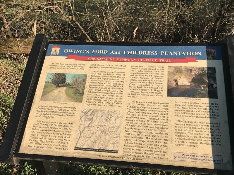
Owing's Ford and Childress Plantation
Chickamauga Campaign Heritage Trail
Inscription.
In 1863 there was a thriving farming
community along West Chickamauga
Creek in the vicinity of Birds Mill. One of the most important plantations was the
Childress Plantation. Significance of this
family was such that the road now known
as Old Bethel Road was called Childress
Road during the war.
John Owings came to the area from North Carolina with his wife Elizabeth. They had seven children. In 1860, the Federal Census showed John as a farmer who owned six slaves. Richard Childress came to Walker County from South Carolina and his wife was from North Carolina. They had five children. In 1860, Richard was a 72 year-old farmer who owned nine slaves. Owing's Ford (called Owen's Ford in the official records) was an important crossing point.
By the second week of September, 1863, the Confederate Army of Tennessee, under General Braxton Bragg, was largely consolidated on the east side of the Creek, while the Federal Army of the Cumberland, commanded by General William S. Rosecrans, was still widely scattered. West Chickamauga Creek lay between the two forces. To protect his men while marching north, Rosecrans sought to cover all the likely crossings south of Lee and Gordon's Mills. One of these important crossing places was Owen's Ford. Wartime records indicate a major skirmish at this site. John Lindsey dates the skirmish at Owen's Ford as the 18th and involving the 8th Tennessee Cavalry Regiment of Dibrell's Brigade in Armstrong's Division of General Nathan Bedford Forrest's Corps. "Skirmished all day at Owen's Ford," he wrote, and with the aid of Captain A. L. Huggin's [Tennessee] battery were enabled to hold the position taken during the day."
"Just before sundown [on September 18]," General Daniel H. Hill, Confederate Corps Commander, wrote, "our cavalry pickets were driven away at Owen's Ford, some miles above the mill, and the Yankees crossed over a considerable force. I hastened there in person with Daniel W. Adams' brigade, but the Yankees did not advance beyond Childress'. The next morning Adams' brigade was withdrawn to Glass' Mill." When the Federal Army invaded the local area, all livestock and provisions were confiscated. The residents were told to seek refuge, many of the local civilians left the area for safer places. Susannah Childress Jones, wife of Dr. George W. Jones, wanted to go to Pigeon Mountain because that area was still in Confederate hands. She was, however faced with a problem because all the horses and mules had been taken by the army. Nevertheless, her difficulty was overcome and she and her baby, Kirby, were pulled to the mountain in a buggy drawn by one of the enslaved Africans.
The
Childress site today consists of a
two-story frame structure with columns
in front that is believed to be the main
house of the wartime Childress
plantation. The residents of the area
remember it as the Henderson House,
and say that the last Childress widow had
a brother named Henderson who
acquired the property.
Captions (left to right):
• The Childress House
• From the map of Col. William E. Merrill, Chief Engineer, Army of the Cumberland
• Owens (Owing's) Spring
Erected by Chickamauga Campaign Heritage Trail; Sponsored by Capital Bank.
Topics and series. This historical marker is listed in these topic lists: African Americans • War, US Civil • Waterways & Vessels. In addition, it is included in the Chickamauga Campaign Heritage Trail series list. A significant historical month for this entry is September 1863.
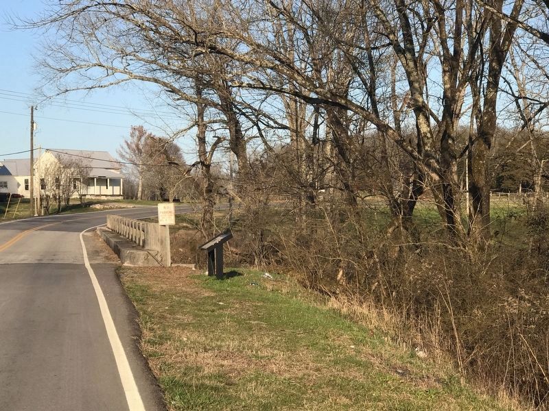
Location. 34° 49.974′ N, 85° 19.002′ W. Marker is near Chickamauga, Georgia, in Walker County. Marker is on Old Bethel Road, 0.2 miles east of Cove Road (Georgia Route 341), on the right when traveling east. Touch for map. Marker is in this post office area: Chickamauga GA 30707, United States of America. Touch for directions.
Other nearby markers. At least 8 other markers are within 3 miles of this marker, measured as the crow flies. Bethel Church (approx. ¾ mile away); Veterans Memorial (approx. ¾ mile away); Bird's Mill and Worthens' Gap (approx. ¾ mile away); Gowan’s (Gower’s) Ford And Widow Glenn’s Grave (approx. 1.2 miles away); Chickamauga Prince Hall Lodge No. 221 (approx. 1.8 miles away); Glass's Mill Battle Site (approx. 2.8 miles away); a different marker also named Glass's Mill Battle Site (approx. 2.8 miles away); Cavalry Corps. (approx. 2.9 miles away). Touch for a list and map of all markers in Chickamauga.
Credits. This page was last revised on April 4, 2021. It was originally submitted on March 9, 2021, by Duane and Tracy Marsteller of Murfreesboro, Tennessee. This page has been viewed 398 times since then and 37 times this year. Photos: 1, 2. submitted on March 9, 2021, by Duane and Tracy Marsteller of Murfreesboro, Tennessee.

