
Yorktown in York County, Virginia — The American South (Mid-Atlantic)
Yorktown Waterfront
Union Port and Supply Depot
| — | 1862 Peninsula Campaign | — |
Photographed by Bill Coughlin, August 12, 2008
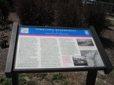
1. Yorktown Waterfront Civil War Trails Marker
In spring 1862, the Confederate heavy artillery batteries on the bluffs at Yorktown, as well as those positioned along the waterfront on both sides of the York River, effectively blocked the U.S. Navy’s attempts to bypass Magruder’s 2nd Peninsula Defensive Line. The waterfront fortifications were built by Maj. Gen. John Bankhead Magruder’s Army of the Peninsula and Confederate naval personnel. The earthworks on Yorktown’s inland perimeter were mostly constructed atop the British defenses from the 1781 siege.
On the night of May 3-4, 1862, the Confederate army abandoned the 2nd Defensive Line. Gen. Joseph E. Johnston, CSA, believed that the Confederate positions could not withstand Maj. Gen. George B. McClellan’s, USA, elaborately prepared bombardment with heavy siege guns. The Confederate army was prevented from evacuating its heavy equipment and artillery via the York River because McClellan’s Siege Battery Number 1, comprised of 100- and 200-pound Parrott siege cannon, had already bombarded the waterfront.
The Confederate evacuation suddenly changed Yorktown into a busy port supporting the Union advance on Richmond. Members
this page online
Following the 1862 Peninsula Campaign, Yorktown became a Union garrison and headquarters for a federally held district which also included Williamsburg and Gloucester Point. Its waterfront area was an active port for Union forces until the summer of 1864, when the Union army established a supply base at City Point on the James River during the Petersburg Campaign.
Erected by Virginia Civil War Trails.
Topics and series. This historical marker is listed in these topic lists: Notable Places • War, US Civil. In addition, it is included in the Virginia Civil War Trails series list. A significant historical year for this entry is 1862.
Location. 37° 14.169′ N, 76° 30.361′ W. Marker is in Yorktown, Virginia, in York County. It is at the intersection
Photographed by Bill Coughlin, August 12, 2008
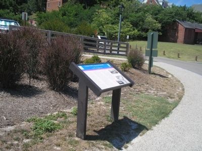
2. Marker at the Yorktown Waterfront

Regionally, this marker is on Virginia’s Peninsula, in Coastal Virginia, and in the Hampton Roads Metropolitan Area. It is also in the American South, specifically in the Upper South, in the Tidewater, and on the Eastern Seaboard. Globally, it is in the North Atlantic Region, North America, the Western Hemisphere, the Western World, and the Anglosphere. Historically, it finds itself in what was once the territory of the Mississippian Culture, one of the original Thirteen Colonies, one of the Confederate States of America, and the Antebellum South.
Other nearby markers. At least 8 other markers are within walking distance of this marker: Great Fire of 1814 (here, next to this marker); Tobacco Inspection (here, next to this marker); Yorktown's Stormy Past (within shouting distance of this marker); TransAmerica Bike Trail (within shouting distance of this marker); Yorktown’s Waterfront (within shouting distance of this
Photographed by Bill Coughlin, August 12, 2008
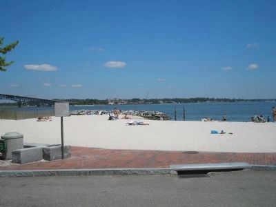
3. York River Waterfront
This photo of the Yorktown Waterfront was taken from in front of the marker. The Gloucester Point batteries were located to the right of the bridge on the opposite side of the York River.
Other markers no longer nearby. Pirates in Yorktown? (was about 300 feet away, measured in a direct line but has been confirmed missing); Chesapeake Bay Impact Crater (was about 300 feet away but has been confirmed missing).
More about this marker. The right of the marker contains a map of fortified Yorktown, courtesy of the National Archives, and two war-time photographs, courtesy of the U.S. Army Military History Institute. One photo is of “Troops, along with siege guns, mortars and gun platforms assembled at Yorktown’s lower wharf awaiting shipment up river. In the distance is the upper wharf and on the bluffs to the left are abandoned Confederate cannon.” The other is of “A view of the lower wharf looking toward the York River. The ordinance to the left is the same as that seen in the lower part of the other waterfront view.”
Regarding Yorktown Waterfront. "ordinance" should have been "ordnance" (no
Photographed by Brady's National Photographic Portrait Galleries, 1862
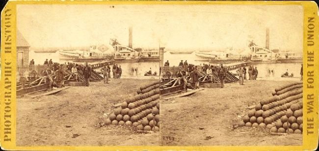
4. Embarkation for White House, from Yorktown, Va.
Stereograph showing Union soldiers and supplies including stacks of cannon balls at the dock in Yorktown, Virginia. Steamships in the distance will transport the supplies to White House Landing Virginia. - Library of Congress Prints and Photographs Division
Also see . . . Yorktown in the Civil War. Yorktown Battlefield, National Park Service. (Submitted on August 18, 2008, by Bill Coughlin of Woodland Park, New Jersey.)
Credits. This page was last revised on November 15, 2024. It was originally submitted on August 18, 2008, by Bill Coughlin of Woodland Park, New Jersey. This page has been viewed 1,696 times since then and 38 times this year. Last updated on March 9, 2021, by Carl Gordon Moore Jr. of North East, Maryland. Photos: 1, 2, 3. submitted on August 18, 2008, by Bill Coughlin of Woodland Park, New Jersey. 4. submitted on December 27, 2014. • Bernard Fisher was the editor who published this page.
