Batestown in Prince William County, Virginia — The American South (Mid-Atlantic)
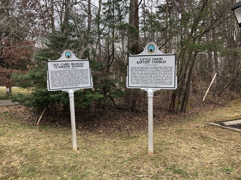
Little Union Baptist Church
Photographed by Devry Becker Jones (CC0), March 12, 2021
1. Little Union Baptist Church Marker
Inscription.
Little Union Baptist Church. . The Little Union Baptist Church was originally built in 1903 on land deeded by Mary Bates Thomas and her husband, John Thomas. Mary Bates Thomas (1838-1922) was a truly remarkable and accomplished woman of color. Born into a free African American family that had established the small community of Batestown, Mary learned to read and write. She would put these skills to good use for the benefit of the illiterate. She was also a healer and midwife. Mary and John were pillars of Batestown where they operated a store. Recognizing their community's need for a church, they donated the land for it in 1901. A growing congregation brought about construction of a new church building a short distance from the original church site in 1977 and this structure was expanded into a larger church building in 1996.
The Little Union Baptist Church was originally built in 1903 on land deeded by Mary Bates Thomas and her husband, John Thomas. Mary Bates Thomas (1838-1922) was a truly remarkable and accomplished woman of color. Born into a free African American family that had established the small community of Batestown, Mary learned to read and write. She would put these skills to good use for the benefit of the illiterate. She was also a healer and midwife. Mary and John were pillars of Batestown where they operated a store. Recognizing their community's need for a church, they donated the land for it in 1901. A growing congregation brought about construction of a new church building a short distance from the original church site in 1977 and this structure was expanded into a larger church building in 1996.
Erected 2018 by Prince William County Historical Commission.
series list. A significant historical year for this entry is 1903.
Location. 38° 34.766′ N, 77° 20.822′ W. Marker is in Batestown, Virginia, in Prince William County. It is on Mine Road 0.9 miles north of Victoria Falls Drive, on the left when traveling north. Touch for map. Marker is at or near this postal address: 17150 Mine Rd, Dumfries VA 22025, United States of America. Touch for directions.
Regionally, this marker is in the Washington Metropolitan Area, in Northern Virginia, and in the Piedmont. It is also in the American South, specifically in the Upper South, in the Mid-Atlantic, and on the Eastern Seaboard. Globally, it is in the North Atlantic Region, North America, the Western Hemisphere, the Western World, and the Anglosphere. Historically, it finds itself in what was once the territory of the Mississippian Culture, one of the original Thirteen Colonies, one of the Confederate States of America, and the Antebellum South.
Other nearby markers. At least 8 other markers are within one mile of this marker, measured as the crow flies: Old Cabin Branch / Clarkson School (here, next to this marker); a different marker
Photographed by Devry Becker Jones (CC0), March 12, 2021
Credits. This page was last revised on March 12, 2021. It was originally submitted on March 12, 2021, by Devry Becker Jones of Washington, District of Columbia. This page has been viewed 581 times since then and 39 times this year. Photos:1, 2. submitted on March 12, 2021, by Devry Becker Jones of Washington, District of Columbia.
Editor’s want-list for this marker. A photo of the church building. • Can you help?