Mt. Carmel in McCormick County, South Carolina — The American South (South Atlantic)
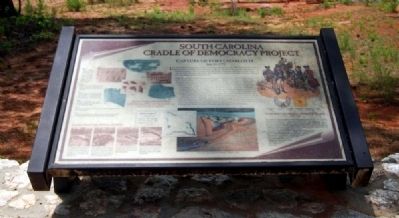
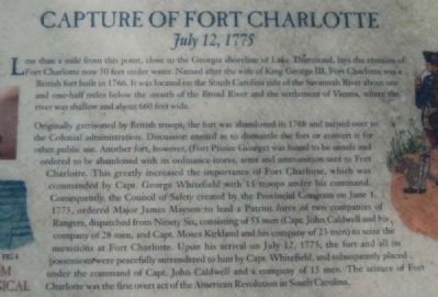
Capture of Fort Charlotte
July 12, 1775
— South Carolina Cradle of Democracy Project —
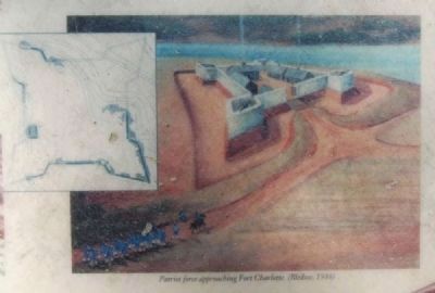
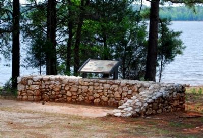
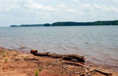
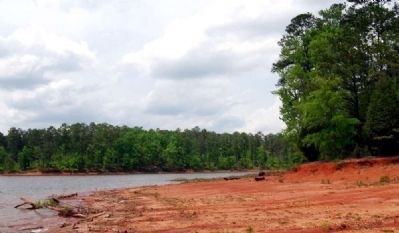
Less than a mile from this point, close to the Georgia shoreline of Lake Thurmond, lays the remains of Fort Charlotte now 50 feet under water. Named after the wife of King George III, Fort Charlotte was a British fort built in 1766. It was located on the South Carolina side of the Savannah River about one and one-half miles below the mount of the Broad River and the settlement of Vienna, where the river was shallow and about 660 feet wide.
Originally garrisoned by British troops, the fort was abandoned in 1768 and turned over to the Colonial administration. Discussion ensured as to dismantle the fort or convert it for other public use. Another fort, however, (Fort Prince George) was found to be unsafe and ordered to be abandoned with its ordinance stores, arms and ammunition sent to Fort Charlotte. This greatly increased the importance of Fort Charlotte, which was commanded by Capt. George Whitefield with 15 troops under his command. Consequently, the Council of Safety created by the Provincial Congress on June 1, ordered Major James Mayson to lead a Patriot force of two companies of Rangers, dispatched from Ninety Six, consisting of 53 men (Capt. John Caldwell and his company of 28 men, and Capt. Moses Kirkland and his company of 23 men) to seize the munitions at Fort Charlotte. Upon his arrival on July 12, 1775, the fort and all its possessions were peacefully surrendered to him by Capt. Whitefield, and subsequently placed under the command of Capt. John Caldwell and a company of 15 men. The seizure of Charlotte was the first overt act of the American Revolution in South Carolina.
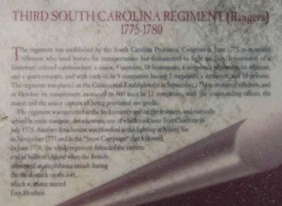
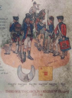
Third South Carolina Regiment (Rangers) 1775-1780
The regiment was established by the South Carolina Provincial Congress in June 1775, as mounted riflemen who used horses for transportation but dismounted to fight on foot. It consisted of a lieutenant colonel commandant, a major, 9 captains, 18 lieutenants, a surgeon, a paymaster, an adjutant and a quartermaster, and with each of its 9 companies having 2 sergeants, a drummer, and 50 privates. The regiment was placed on the Continental Establishment in September 1776 as mounted riflemen, and in October its complement increased to 600 men in 12 companies, with the commanding officer, the major, and the senior captain all being promoted one grade.
The regiment was recruited in the backcountry and on the frontiers, and normally served in multi-company detachments, one of which took over Fort Charlotte in July 1775. Another detachment was bloodied in the fighting at Ninety Six in November 1775 and in the "Snow Campaign" that followed. In June 1776 the whole regiment defended the eastern end of Sullivan's Island when the British attempted an amphibious assault during the naval attack on the fort, which was later named Fort Moultrie.
Topics. This historical marker is listed in these topic lists: Colonial Era • Forts and Castles • War, US Revolutionary • Waterways & Vessels. A significant historical date for this entry is July 12, 1775.
Location. 33° 57.15′ N, 82° 32.383′ W. Marker is in Mt. Carmel, South Carolina, in McCormick County. Marker is on State Highway 33-91. Marker is located at the end of State Road 33-91, on the shore of Lake Thurmond. Access to the marker is limited to the months of April to August, when the Mt. Carmel Campground is open. Touch for map. Marker is in this post office area: Mount Carmel SC 29840, United States of America. Touch for directions.
Other nearby markers. At least 8 other markers are within 5 miles of this marker, measured as the crow flies. Hester's Ferry (approx. 1.3 miles away in Georgia); Bobby Brown State Park Monument (approx. 2.8 miles away in Georgia); USS Scorpion (SS-278) (approx. 2.9 miles away in Georgia); Site of Willington Academy (approx. 3.6 miles away); Site of Willington Presbyterian Church (approx. 3.6 miles away); Fort Charlotte (approx. 4.1 miles away); Mt. Carmel Historical District (approx. 4.2 miles away); Willington Academy (approx. 4.4 miles away). Touch for a list and map of all markers in Mt. Carmel.
Regarding Capture of Fort Charlotte. Lake Thurmond or Clark's
Hill Lake? The name depends on the side of the lake upon which you stand. Georgians prefer Clark's Hill, while in South Carolina, the name of the state's beloved senator is most often used.
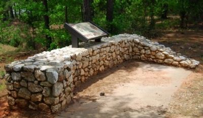
"ordinance" should be "ordnance" (no "i"); necessary to use photos 2 and 3 to view legible text
Notice "53 men (Capt. John Caldwell and his company of 28 men, and Capt. Moses Kirkland and his company of 23 men)"; the numbers do not add up.
Also see . . .
1. 3rd South Carolina Regiment. The 3rd South Carolina Regiment was raised on June 6, 1775, at Ninety-Six Court House, South Carolina, for service with the Continental Army. (Submitted on May 9, 2009, by Brian Scott of Anderson, South Carolina.)
2. Fort Charlotte (South Carolina). Fort Charlotte was a colonial era fort located in McCormick County, South Carolina, near present day Mount Carmel. (Submitted on May 9, 2009, by Brian Scott of Anderson, South Carolina.)
3. Fort Charlotte SC. 12 July 1775. *Major James Mason vs. Capt. George Whitfield. Fort Charlotte captured. (Submitted on May 9, 2009, by Brian Scott of Anderson, South Carolina.)
4. Lake Strom Thurmond. Lake Strom Thurmond, known in Georgia as Clarks Hill Lake, is a reservoir at the border between Georgia and South Carolina in the Savannah River Basin. (Submitted on May 9, 2009, by Brian Scott of Anderson, South Carolina.)
Additional commentary.
1. About Fort Charlotte
The last fort erected during the colonial period was built, 1765-66, on the Savannah river about forty-five miles above Augusta, opposite the rnouth of the Broad river, in the lower part of what is now Abbeville county. It was constructed of stone at a cost of £1,000 sterling and was called Fort Charlotte in honor of Her Majesty, the queen. (Source: South Carolina as a Royal Province, 1719-1776 by William Roy Smith, pg 212.)
— Submitted May 9, 2009, by Brian Scott of Anderson, South Carolina.
2. Summary of the Battle
July 12, 1775 at Fort Charlotte, South Carolina - In June, the Council of Safety in Charlestown ordered Maj. James Mayson, commander of Fort Ninety-Six, to capture Fort Charlotte. Fort Charlotte was located just west of Ninety-Six and was on the Savannah River. On July 12, the American force of Ranger companies captured the fort without any bloodshed or opposition. The only occupants of the fort were Capt. George Whitefield, his family, and a few men of the garrison. The Rangers also managed to capture 1,050 lbs. of gunpowder, 18 cannon, 15 muskets, 83 casks of musket cartridges, 2,521 musket balls, and 343 iron cannonballs. Mayson and the 3rd South Carolina Regiment would be stationed at Fort
Charlotte to command the interior. (Source: http://www.myrevolutionarywar.com/battles/1775s.htm.)
— Submitted May 9, 2009, by Brian Scott of Anderson, South Carolina.
3. Seizure of Fort Charlotte, July 12, 1775
Fort Charlotte, a frontier outpost left over from the last round of Indian troubles, contained a ton or more of gunpowder, plus artillery pieces and ammunition. Its other appeal was that it was guarded only by a single captain of the province's handful of full-time military personnel and his family -- more caretakers than garrison.
The fort itself was situated on the upper Savannah River and located so as to guard a ford (now under the waters of Clark's Hill Reservoir) frequently crossed by Creek warriors given to crossing from Georgia and raiding into frontier settlements just beyond. The principle one of these, the village of Ninety Six, was distant some thirty miles to the north and east. Constructed of stone, the fort was initially occupied by British regulars, now long since withdrawn.
Late in June the Council of safety ordered Major James Mayson, a resident of the Ninety Six area, to seize the fort and its munitions. Mayson was given two companies of mounted rangers recently raised. The colony had a long history of using troops of this sort, and

Photographed By Brian Scott, May 2, 2009
6. Scenes of the 1952 Excavation
From left to right:
1) In foreground is lower portion of outer northwest wall with the foundation stones immediately to the right of it. The point of the eastern bastion is to the rear, in the upper left corner.
2) Fallen masonry outside the east bastion showing how rocks tumbled down sides of elevation on which the fort was built. Section of standing wall can be seen in center of picture toward top of the stones.
3) View inside the east bastion showing standing walls. These have been exposed to the level of the original surface of the ground.
4) The "Magazine" after removal of fallen rocks form the earthen floor. Doorway at lower right corner. Rocks falling outside of the building are still in place.
Kirkland's supposed grudge did not, however, prevent the column's marching, with Mayson in the lead, unhindered into the fort. Mayson seized it in the name of the Provincial Congress and, leaving Caldwell and his rangers in charge, decided to proceed for Ninety Six with some of the gunpowder. Mayson was accompanied by Kirkland and his company as escort. By then, news of the fort's seizure had had time to reach those elements in the backcountry inclined towards loyalty to the British Crown -- or outright animosity towards the lowcountry Whigs controlling the Council of Safety. This sudden move -- taking the fort and its powder -- was in their eyes provocative to the point of outrage.
It was at this juncture that Kirkland formally decided to change sides. He took the step of urging his neighbors who were loyalists to seize the gunpowder taken by Mayson and now stored in the courthouse at Ninety Six. When the loyalists arrived there,
Photographed By Brian Scott, May 2, 2009
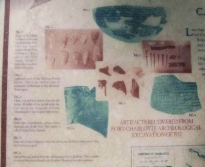
7. Artifacts Recovered from Fort Charlotte Archaeological Excavation of 1952
1) Some of the oldest artifacts of human workmanship from the aplands overlooking Fort Charlotte. They are of the "Old Quartz Culture", believed to be older than 5,000 years.
2) Restored vessel of the Slattings Pottery period. This is the earliest type of prehistoric earthenware in the Savannah River region.
3) China, iron and lead artifacts from the old humus. Probably of the period when the Fort was in use. Fragment of a clay "churchwarden" pipe in offer right corner.
4) Older type of prehistoric pottery from a disturbed area at the Fort. This variety is called Dunlap Fabric Method.
5) Glass and crockery fragments from the old humus. Probably of the period when the Fort was occupied.
6) Later prehistoric pottery from the old humus at Fort Charlotte. This is similar to some of the pottery found at the Rembert Mounds a few miles upstream.
Meanwhile, representatives of South Carolina's political elite -- and indeed, precisely those most inclined to oppose the new British policies -- were taken steps in concert with those of the other colonies to help shape both a system of government and an overall military response. In the wake of Lexington and Concord, and as New England militia gathered against the British in Boston, the Second Continental Congress met in Philadelphia. It assumed general direction of what was becoming a war effort and would be the means of government until adoption of the Articles
of Confederation some five and a half years later.
South Carolina's representatives were Christopher Gadsden, Thomas Lynch, Arthur Middleton, and Edward and Josn Rutledge. Few among this or any other colony's delegation were ready as yet to take the plung of declaring independence from Britain. For the moment, their cause remained that of restoration of historic rights within the imperial context. They made it clear that even though all the colonies, including South Carolina, stood to forfeit lucrative economic benefits as a result of trouble with Britain, they would stand by New England. Their support took specific military form. They voted to support the militia units investing Boston and to create a force of regular troops eventually to be termed the Continental Army, whose "Continental Line" would be made up of regiments provided from each colony. As important as these measures were, however, they were not more important than the naming of George Washington to be commander in chief of the army. Washington was a Virginia planter schooled by service in the House of Burgesses, his colony's lower house and the oldest such body in North America, and by active campaigning in the war just past. Finally, he represented the South. He thus helped tie that region's fortunes irrevocably to those of Massachusetts and New England. The South Carolina representatives played a crucial role in his appointment and they could not have been, in the words of historian John Richard Alden, displeased to see a man of "their kind and country" appointed to command a military effort to be made by all the colonies.
In South Carolina, though, only gradually did the war turn form arms and ammunition seizures into a shootig one. Rather, a sort of slow dance prevailed as the two groups -- those acting in the name of colonial rights on the one hand, Britain's loyal adherents on the other -- maneuvered for position. The loyalists were called by their opponents Tories because that name denoed in their minds the party of support for the king and the policies of control from Whitehall. The other side called themselves the Whigs after the king's opposition in Parliament. A particular favorite of the Americans was William Pitt, the "Great Commoner" now raised to the peerage as the Earl of Chatham. The British already spoke of the Whig group as rebels but the rebels saw themselves as patriots, a term thereafter to be enshrined in triumphalist, nationalistic accounts of the struggle. (Source South Carolina and the American Revolution by John W. Gordon, pgs 22-25.)
— Submitted May 10, 2009, by Brian Scott of Anderson, South Carolina.
Credits. This page was last revised on March 14, 2021. It was originally submitted on May 9, 2009, by Brian Scott of Anderson, South Carolina. This page has been viewed 2,033 times since then and 70 times this year. Last updated on March 14, 2021, by Carl Gordon Moore Jr. of North East, Maryland. Photos: 1, 2, 3, 4, 5, 6, 7, 8, 9, 10, 11. submitted on May 9, 2009, by Brian Scott of Anderson, South Carolina. • Bill Pfingsten was the editor who published this page.
