Near Lovell in Big Horn County, Wyoming — The American West (Mountains)
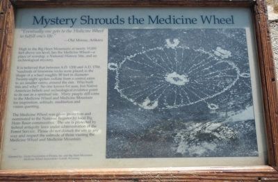
Mystery Shrouds the Medicine Wheel
High in the Big Horn Mountains at nearly 10,000 feet above sea level, lies the Medicine Wheel - a place of worship, a National Historic Site, and an archeological mystery.
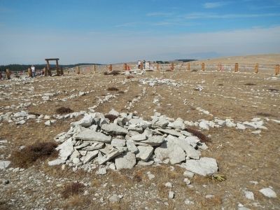
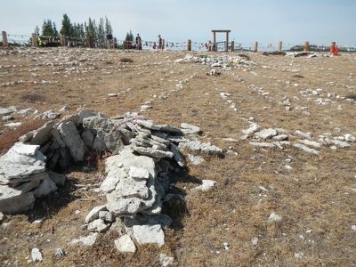
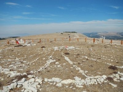
It is believed that between A.D. 1200 and A.D. 1700, hundreds of limestone rocks were placed in the shape of a wheel roughly 80 feet in diameter. Twenty-eight spokes radiate from a central cairn to six smaller cairns around the rim. Who built this and why? No one knowns for sure, but Native Americans beliefs and archeological evidence point to its use as a spiritual site. Many people still come to the Medicine Wheel and Medicine Mountain for inspiration, solitude, meditation and vision questing.
The Medicine Wheel was given protection and nominated to the National Register by local Big Horn communities. The site is protected by federal antiquity laws under administration of the Forest Service. Please do not disturb the site in any way and respect the solitude of those visiting the Medicine Wheel and Medicine Mountain.
Erected by Mary Alice Fortin Foundation of Florida and Big Horn Mountain Medicine Wheel Association.
Topics and series. This historical marker is listed in these topic lists: Anthropology & Archaeology • Native Americans. In addition, it is included in the National Historic Landmarks series list.
Location. Marker has been reported permanently removed. It was located near 44° 49.579′ N, 107° 55.311′ W. Marker was near Lovell, Wyoming, in Big Horn County. Marker could be reached from 12 near U.S. 14A. The Medicine Wheel parking lot is at the end of Forest Service Road 12, about 22 miles east of Lovell via U.S. Highway 14A. A trail about a mile and one-half long takes you to the Medicine Wheel site. Touch for map. Marker was in this post office area: Lovell WY 82431, United States of America.
We have been informed that this sign or monument is no longer there and will not be replaced. This page is an archival view of what was.
Other nearby markers. At least 8 other markers are within 4 miles of this location, measured as the crow flies. Welcome to the Medicine Wheel (here, next to this marker); Five Springs (approx. 0.4 miles away); Medicine Wheel (approx. 1.2 miles away); a different marker also named Medicine Wheel (approx. 1.2 miles away); Bighorn Basin
(approx. 2.6 miles away); Big Horn Basin (approx. 2.6 miles away); Reconstruction - Finally! (approx. 3˝ miles away); The Original Dayton-Kane Highway (approx. 3.8 miles away). Touch for a list and map of all markers in Lovell.
More about this marker. This marker was removed and replaced with a new marker - Welcome to the Medicine Wheel.
Also see . . . Bighorn Medicine Wheel - Stanford Solar Center. The wheel was constructed by Plains Indians between 300-800 years ago, and has been used and maintained by various groups since then. The central cairn is the oldest part, with excavations showing it extends below the wheel and has been buried by wind-blown dust. It may have supported a central pole. The star alignments are most accurate for around 1200 AD, since slight changes in the Earth's orbit have caused perturbations since. The solstice alignments remain accurate today. (Submitted on December 6, 2015, by Barry Swackhamer of Brentwood, California.)
Photographed By Barry Swackhamer, September 14, 2015
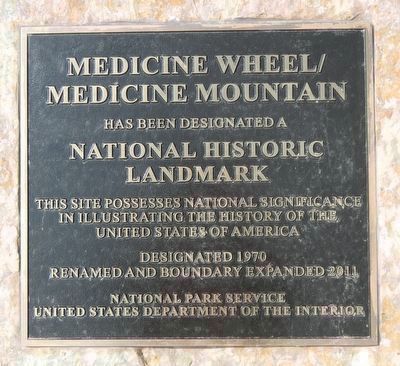
5. Medicine Wheel/ Medicine Mountain
National Historic
Landmark
This site possesses national significance in illustrating the history of the United States of America
Designated 1970
Renamed and Boundary Expanded 2011
National Park Service
United States Department of the Interior
Credits. This page was last revised on March 20, 2021. It was originally submitted on December 6, 2015, by Barry Swackhamer of Brentwood, California. This page has been viewed 627 times since then and 26 times this year. Last updated on March 20, 2021, by Craig Baker of Sylmar, California. Photos: 1, 2, 3, 4. submitted on December 6, 2015, by Barry Swackhamer of Brentwood, California. 5. submitted on December 7, 2015, by Barry Swackhamer of Brentwood, California. • J. Makali Bruton was the editor who published this page.
