Near Franklin in Macon County, North Carolina — The American South (South Atlantic)
The Appalachian & Bartram Trails

Photographed by Cosmos Mariner, July 19, 2009
1. The Appalachian & Bartram Trails Marker
Appalachian Trail
The Appalachian Trail's original concept proposed in 1921 was to preserve the Appalachian crests by developing a great trail traversing its length so as to allow city workers to revitalize themselves and escape the mechanization of modern society. The dream was to create a footpath of wonder and tranquility.
The Appalachian National Scenic Trail traverses 14 states and stretches 2100 miles along Appalachian Mountain ridgelines from Georgia to Maine. Three to four million people, from all over the world, hike some portion of the Appalachian Trail each year. It was constructed in the 1920s and 1930s by volunteer hiking clubs. Today, the Nantahala Hiking Club and the U.S. Forest Service work together to maintain 53 miles of "The A.T." that cross the Wayah Ranger District. The trail is marked with white blazes.
Bartram Trail
"...I beheld with rapture and astonishment a sublimely awful scene of power and magnificence, a world of mountains piled upon mountains."
—William Bartram, 1775
William
this page online
The name “Wayah” comes from the Cherokee Indian word “wa’ya” meaning “wolf.”
Erected by Forest Service, United States Department of Agriculture.
Topics. This historical marker is listed in these topic lists: Charity & Public Work • Indigenous Peoples and Communities • Parks & Recreational Areas.
Location. 35° 10.732′ N, 83° 33.738′ W. Marker is near Franklin, North Carolina, in Macon County. It can be reached from Wayah Bald Road (Forest Road 69) 4½ miles north of Wayah Road (State Road 1310). Marker is located near the Wayah Bald Observation Tower parking lot. Touch for map.

2. Marker detail: Early Appalachian Trail Sign

Regionally, this marker is in andspecifically he Mountains in the Golden Corner. It is also in the American South, specifically in the Upper South, in Appalachia, and specifically in Southern Appalachia. Globally, it is in North America, the Western Hemisphere, the Western World, and the Anglosphere. Historically, it finds itself in what was once the original Cherokee Nation, the territory of the Mississippian Culture, one of the original Thirteen Colonies, one of the Confederate States of America, and the Antebellum South.
Other nearby markers. At least 8 other markers are within 10 miles of this marker, measured as the crow flies: Wayah Bald (here, next to this marker); The John B. Byrne Memorial Tower (here, next to this marker); Wilson Lick Ranger Station (approx. 1.7 miles away); Nantahala Community and Lake (approx. 4½ miles away); The Turbine Inlet Valve (approx. 9.2 miles away); A Glimpse Into Nantahala's Past (approx. 9.4 miles away); William Bartram (approx. 9.6 miles away); Coweeta Hydrologic Laboratory (approx.
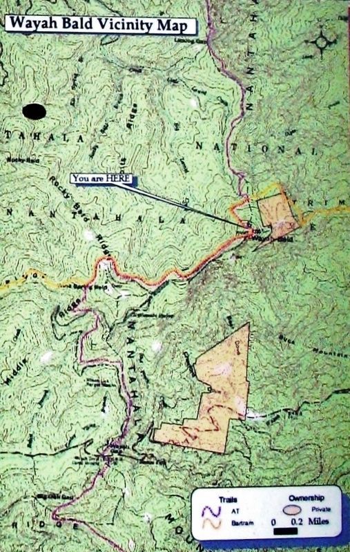
3. Wayah Bald Vicinity Map
Another marker is no longer nearby. Cherokee Defeat (was approx. 9½ miles away but has been permanently removed).
Also see . . .
1. Appalachian Trail History. In October 1921, regional planner Benton MacKaye went public with his proposal for “An Appalachian Trail: A Project in Regional Planning.” (Submitted on March 22, 2021, by Cosmos Mariner of Cape Canaveral, Florida.)
2. North Carolina Bartram Trail. Philadelphia-born naturalist William Bartram was among the most well-known of the early naturalists, botanists and explorers of his day. In 1791, he published his journals under the title Bartram’s Travels, which has been published continuously and remains in print today in a number of world languages. In 1977, The North Carolina Bartram Trail Society was organized to establish and maintain the North Carolina section of the memorial trail that honors Bartram and his work. (Submitted on March 22, 2021, by Cosmos Mariner of Cape Canaveral, Florida.)
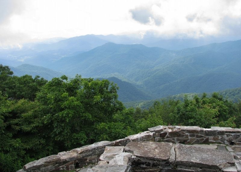
Photographed by Cosmos Mariner, July 19, 2009
4. Appalachian Mountains
Credits. This page was last revised on March 22, 2021. It was originally submitted on March 22, 2021, by Cosmos Mariner of Cape Canaveral, Florida. This page has been viewed 599 times since then and 53 times this year. Photos: 1, 2, 3, 4. submitted on March 22, 2021, by Cosmos Mariner of Cape Canaveral, Florida.
