Toluca, Mexico State, Mexico — The Central Highlands (North America)
Toluca
Photographed by J. Makali Bruton, March 15, 2021
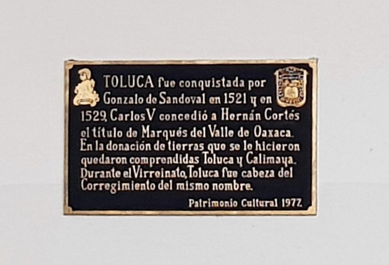
1. Toluca Marker
Restrictions in place at the time of this photo did not permit a clearer image.

Patrimonio Cultural 1972.
Toluca was conquered by Gonzalo de Sandoval in 1521 and in 1529, Charles V granted Hernán Cortés the title of Marquis of the Oaxaca Valley. In this donation of lands were included Toluca and Calimaya. During the Viceroyalty, Toluca was head of the Corregimiento of the same name.
Cultural Heritage 1972.
Erected 1972 by Patrimonio Cultural.
Topics. This historical marker is listed in these topic lists: Colonial Era • Wars, Non-US. A significant historical year for this entry is 1521.
Location. 19° 17.513′ N, 99° 39.393′ W. Marker is in Toluca, Estado de Mexico (Mexico State). It is on Avenida Independencia just east of Calle Nicolás Bravo Norte, on the right when traveling east. Touch for map. Marker is in this post office area: Toluca MEX 50000, Mexico. Touch for directions.

Regionally,
this page online
Other nearby markers. At least 8 other markers are within walking distance of this marker: Toluca as the Capital of the State of Mexico (here, next to this marker); a different marker also named Toluca (a few steps from this marker); a different marker also named Toluca (a few steps from this marker); Church of la Santa Veracruz (within shouting distance of this marker); Francisco Modesto de Olaguibel (within shouting distance of this marker); Manuel de Olaguibel (within shouting distance of this marker); Temple of the Santa Veracruz (within shouting distance of this marker); a different marker also named Temple of the Santa Veracruz (about 90 meters away, measured in a direct line). Touch for a list and map of all markers in Toluca.

Photographed by J. Makali Bruton, March 15, 2021
2. Toluca Marker
The marker is above this additional tablet which celebrates the 1976 renovation of this Palacio Municipal of Toluca.
Photographed by J. Makali Bruton, March 15, 2021
3. Toluca Marker
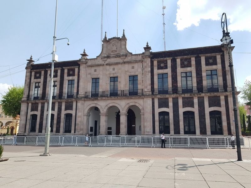
The marker is one of many in the entryway of the Toluca City Hall (Ayuntamiento de Toluca).
Credits. This page was last revised on March 22, 2021. It was originally submitted on March 22, 2021, by J. Makali Bruton of Washington, District of Columbia. This page has been viewed 161 times since then and 11 times this year. Photos: 1, 2, 3. submitted on March 22, 2021, by J. Makali Bruton of Washington, District of Columbia.
