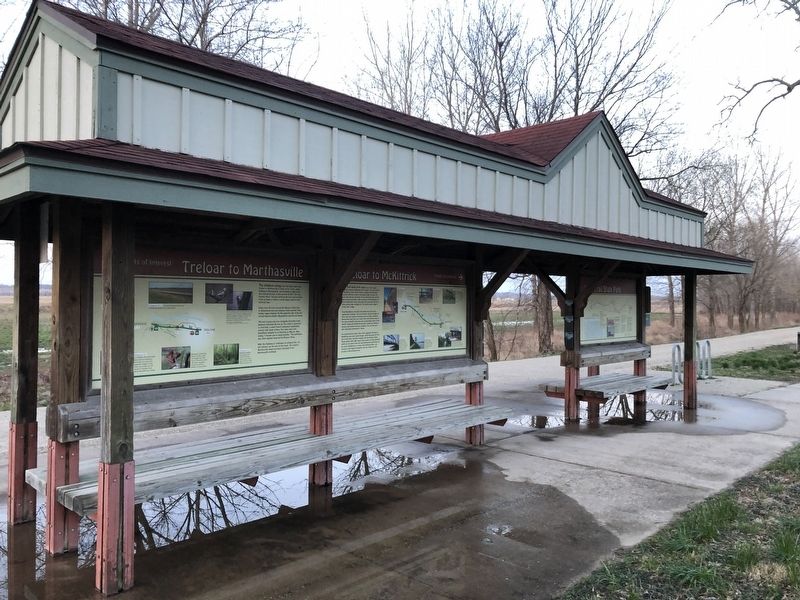
Treloar to Marthasville
Points of Interest

The distance along Katy Trail State Park from Treloar to Marthasville is seven miles. Peers, about halfway to Marthasville, was founded in 1893 when the railroad arrived. It was named for MKT attorney Charles Peers. The gap between the trail and building fronts at Peers is where a small depot stood in Katy Railroad days.
Views from the trail toward the Missouri River take in bottomland corn and soybean fields and the Ozark border region beyond. On the opposite side of the trail are tall dolomite bluffs, hilly pastures and fine old homes.
The trail crosses and runs alongside Charrette Creek between mileposts 80 and 79. The creek is named for La Charrette, a small French settlement established around 1796 south of here. The Lewis and Clark Expedition stopped at La Charrette on May 25, 1804, noting "7 houses and as many families." The settlement was later washed away by the Missouri River.
After the Highway 47 underpass at milepost 78.1, an old caboose can be seen to the north. The original Marthasville depot has been relocated to the Marthasville trailhead.
Erected by Missouri State Parks.
Topics and series.
this page online
Location. 38° 38.6′ N, 91° 11.265′ W. Marker is in Treloar, Missouri, in Warren County. It is at the intersection of Market Street and Texas, on the left when traveling west on Market Street. Touch for map. Marker is at or near this postal address: 16698 Texas, Marthasville MO 63357, United States of America. Touch for directions.

Regionally, this marker is in the Missouri River Corridor and in Greater St. Louis. It is also in the American Midwest, in the Lewis & Clark Corridor, and in the Corn Belt. Globally, it is in North America, the Western Hemisphere, the Western World, and the Anglosphere. Historically, it finds itself in what was once the territory of the Mississippian Culture, the Louisiana Purchase, and the Antebellum South.
Other nearby markers. At least 8 other markers are within 3 miles of this marker,
Credits. This page was last revised on March 24, 2021. It was originally submitted on March 24, 2021, by Devry Becker Jones of Washington, District of Columbia. This page has been viewed 313 times since then and 41 times this year. Photos: 1, 2. submitted on March 24, 2021, by Devry Becker Jones of Washington, District of Columbia.
