O'Fallon in St. Charles County, Missouri — The American Midwest (Upper Plains)
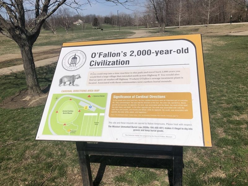
O'Fallon's 2,000-year-old Civilization
City of O'Fallon, Missouri, founded in 1856

Photographed By Devry Becker Jones (CC0), March 22, 2021
1. O'Fallon's 2,000-year-old Civilization Marker
If you could step into a time machine in this park and travel back 2,000 years you would find a large village that extended north across Highway P. You would also find an open-air market off Highway 79 where O'Fallon's sewage treatment plant is located. Associated with these communities were earthen burial mounds.
Significance of Cardinal Directions
To the people who once lived here, the four cardinal directions were an important part of everyday life. They acknowledge "the east was the direction of the Sun, the color red, sacred fire, blood, and life and success; its opposite, the west, was associated with the Moon, the souls of the dead, the color black, and death. In the other opposite pair, the north was associated with cold, the color blue (and purple), and trouble and defeat; while its opposite, the south, was associated with warmth, the color white, peace, and happiness."
Source: "The Southeastern Indians," Charles Hudson, 1976, The University of Tennessee Press, Knoxville, Tennessee, page 132
This site and these mounds are sacred to Native Americans. Please treat with respect.
The Missouri Unmarked Burial Law (RSMo 194.400-401) makes it illegal to dig into graves and keep burial goods.)
Erected by the City of O'Fallon, Missouri.
Topics. This historical marker is listed in these topic lists: Anthropology & Archaeology • Cemeteries & Burial Sites • Industry & Commerce • Native Americans • Settlements & Settlers. A significant historical year for this entry is 1976.
Location. 38° 49.573′ N, 90° 42.55′ W. Marker is in O'Fallon, Missouri, in St. Charles County. Marker is on Dames Park Drive, 0.8 miles south of State Highway P, on the left when traveling west. Touch for map. Marker is at or near this postal address: 387 Dames Park Dr, O Fallon MO 63366, United States of America. Touch for directions.
Other nearby markers. At least 8 other markers are within 2 miles of this marker, measured as the crow flies. The Ancient Cities and Earthen Mounds of O'Fallon (a few steps from this marker); The Ancient Earthen Burial Mounds of O'Fallon (about 300 feet away, measured in a direct line); O'Fallon During Ancient Times (about 300 feet away); Alien Designs or Native Handiwork? (about 400 feet away); Early O'Fallon (approx. 0.2 miles away); Omer J. Dames War Memorial (approx. 0.2 miles away); Veterans Memorial (approx. 0.2 miles away); Fort Zumwalt (approx. 1.9 miles away). Touch for a list and map of all markers in O'Fallon.

Photographed By Devry Becker Jones (CC0), March 22, 2021
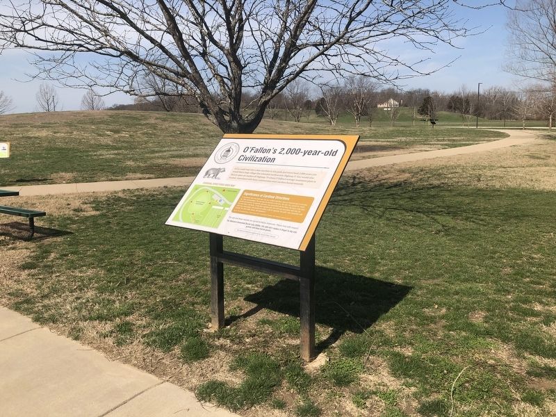
2. O'Fallon's 2,000-year-old Civilization Marker
Credits. This page was last revised on July 14, 2022. It was originally submitted on March 27, 2021, by Devry Becker Jones of Washington, District of Columbia. This page has been viewed 295 times since then and 42 times this year. Photos: 1, 2. submitted on March 27, 2021, by Devry Becker Jones of Washington, District of Columbia.