Near Gering in Scotts Bluff County, Nebraska — The American Midwest (Upper Plains)
A Landmark for the Ages
From prehistoric times to the present, people have used this geologic edifice as a waypoint.
— Scotts Bluff National Monument —
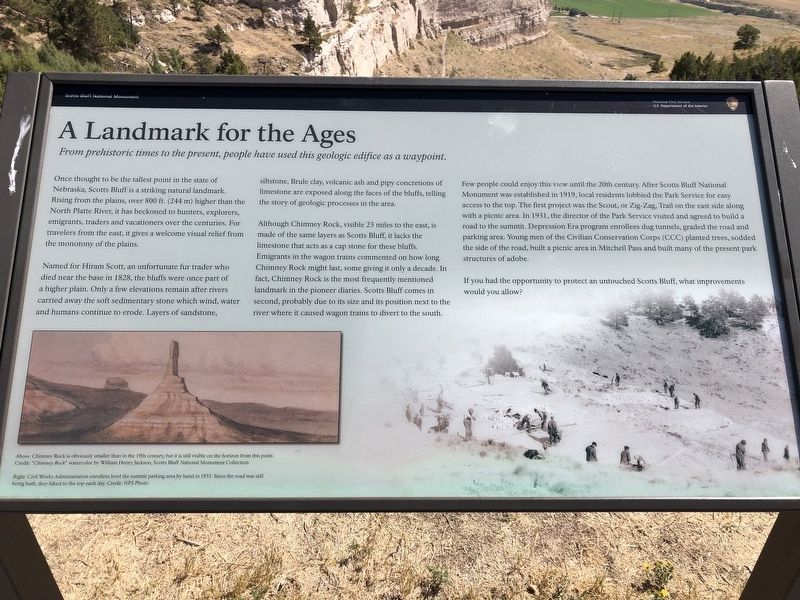
Once thought to the tallest point in the state of Nebraska, Scots Bluff is a striking natural landmark.
Rising from the plains, over 800 ft. (244 m) higher than the North Platte River, it has beckoned to hunters, explorers, emigrants, traders and vacationers over the centuries. For travelers from the east, it gives a welcome visual relief from the monotony of the plains.
Named for Hiram Scott, an unfortunate fur trader who died near the base in 1828, the bluffs were once part of a higher plain. Only a few elevations remain after rivers carried away the soft sedimentary stone which wind, water and humans continue to erode. Layers of sandstone, siltstone, Brule clay, volcanic ash and pipy concretions of limestone are exposed along the faces of the bluffs, telling the story of geologic processes in the area.
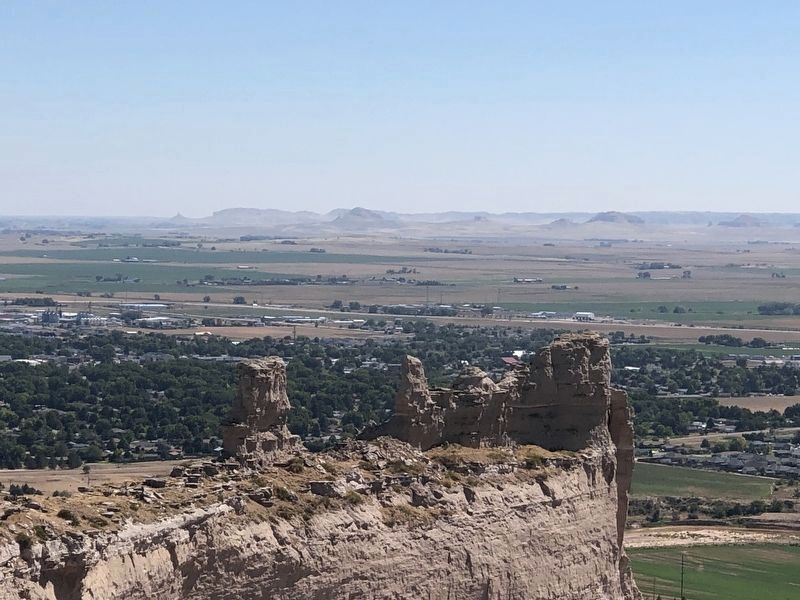
Although Chimney Rock, visible 23 miles to the east, is made of the same layers as Scotts Bluff, it lacks the limestone that acts as a cap stone for these bluffs. Emigrants in the wagon trains commented on how long Chimney Rick might last, some giving it only a decade. In fact, Chimney Rock is the most frequently mentioned landmark in the pioneer diaries. Scotts Bluff comes in second, probably due to its size and its position next to the river where it caused wagon trains to divert to the south.
Few people could enjoy this view until the 20th century. After Scott's Bluff National Monument was established in 1919, local residents lobbied the Park Service for easy access to the top. The first project was the Scout, or Zig-Zag, Trail on the east side along with a picnic area. In 1931, the director of the Park Service visited and agreed to build a road to the summit. Depression Era program enrollees dug tunnels, graded the road and parking area. Young men of the Civilian Conservation Corps (CCC) planted trees, sodded the side of the road, built a picnic area in Mitchell Pass and built many of the present park structures of adobe.
If you had the opportunity to protect an untouched Scotts Bluff, what improvements would you allow?
Erected by National Park Service, U.S. Department of the Interior.
Topics and series. This historical marker is listed in these topic lists: Natural Features • Parks & Recreational Areas • Settlements & Settlers. In addition, it is included in the Civilian Conservation Corps (CCC) series list. A significant historical year for this entry is 1828.
Location. 41° 50.223′ N, 103° 42.004′ W. Marker is near Gering, Nebraska, in Scotts Bluff County. Marker is on Old Oregon Trail, 2 miles west of Five Rocks Road. The marker is at the top of Scotts Bluff, 1.5 miles from the visitor's center. Touch for map. Marker is at or near this postal address: 190276 Old Oregon Trail, Gering NE 69341, United States of America. Touch for directions.
Other nearby markers. At least 8 other markers are within walking distance of this marker. Saddle Rock Trail (about 500 feet away, measured in a direct line); Eroding Landmark (about 500 feet away); Scott Memorial (about 500 feet away); Remnant Highlands (about 600 feet away); A Landscape Changed Forever (approx. 0.2 miles away); Before the Wagons (approx. 0.2 miles away); The Many Faces of the Trail (approx. 0.2 miles away); The Way West (approx. 0.2 miles away). Touch for a list and map of all markers in Gering.
Credits. This page was last revised on March 31, 2021. It was originally submitted on March 31, 2021, by Ruth VanSteenwyk of Aberdeen, South Dakota. This page has been viewed 142 times since then and 10 times this year. Photos: 1, 2, 3. submitted on March 31, 2021, by Ruth VanSteenwyk of Aberdeen, South Dakota. • Devry Becker Jones was the editor who published this page.


