The Origins of Ivy Creek Natural Area
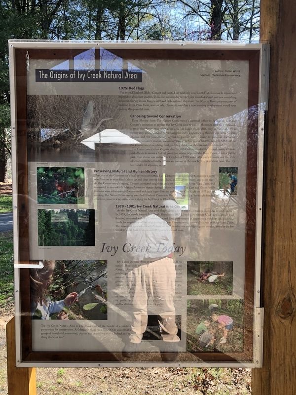
1975: Red Flags
For years, Elizabeth (Babs) Conant had canoed the relatively new South Fork Rivanna Reservoir and enjoyed its abundant wildlife. Then one autumn day in 1975, she rounded a bend and saw something ominous. Survey stakes flagged with red ribbons lined the shore. The 80-acre Greer property, part of historic River View Farm, was for sale. Conant feared that a new housing development would soon destroy this peaceful oasis.
Canoeing toward Conservation
Dave Morine from The Nature Conservancy's national office in Arlington accepted Conant's invitation to explore the Ivy Creek area by canoe. Moments after they launched, a great blue heron took wing from a beaver lodge. Impressed by the richness of the habitat, Morine and the Conservancy agreed to partner with Conant to purchase the Greer property. Conant's mother, known as "Ranny" to her grandchildren, donated $150,000 to the Conservancy's revolving fund, enabling the Rann Preserve to be established.
The Conservancy's first Virginia director, Bill Cole, worked with city and county citizens and officials to secure a federal grant that would help turn the
this page online
Preserving Natural and Human History
As chair of the Conservancy's local project committee, Babs Conant worked tirelessly to manage a corps of volunteers to raise funds; clean up and clear out the house, barn and other structures; and plant trees. At the Conservancy's urging, Constant contacted neighbors to learn more about River View Farm and uncovered its remarkable African American history dating back to the 1870s. The Carr and Greer family histories were subsequently documented and their legacy lives on today at Ivy Creek. At its 1977 annual meeting, The Nature Conservancy awarded Elizabeth Conant an Oak Leaf Award for "her single-handed efforts to preserve a key natural area along the Ivy Creek in Charlottesville, Virginia."
1978 - 1981: Ivy Creek Natural Area Grows
As the Ivy Creek Natural Area took shape, development threats remained along the western border. In 1979, the newly formed Ivy
Ivy Creek Today
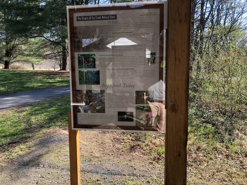
Ivy Creek Natural Area is open daily from 7 AM to sunset. Thousands of annual visitors enjoy walking the Natural Area's miles of trails, as well as attending public programs on Central Virginia's spectacular natural history. Each spring and fall, local school groups explore Ivy Creek, led by trained volunteer guides. The Education Building was erected in the late-1990s, and in 2011-2012 the historic barn was restored. The nonprofit Ivy Creek Foundation continues to manage the property, preserving and maintaining its public spaces and providing quality environmental and local historical education to the public.
The Ivy Creek Natural Area is a textbook case of the benefit of a public-private
partnership for conservation. As Margaret Mead once said, "Never doubt that a small group of thoughtful, committed, citizens can change the world. Indeed, it is the only thing that ever has."Erected by Ivy Creek Foundation.
Topics. This historical marker is listed in these topic lists: African Americans • Agriculture • Parks & Recreational Areas • Settlements & Settlers. A significant historical month for this entry is October 1978.
Location. 38° 5.467′ N, 78° 29.589′ W. Marker is near Charlottesville, Virginia, in Albemarle County. It is in Roslyn Ridge. It can be reached from Earlysville Road 0.3 miles south of Woodlands Road, on the right when traveling south. Touch for map. Marker is at or near this postal address: 1780 Earlysville Rd, Charlottesville VA 22901, United States of America. Touch for directions.

Regionally, this marker is in the Piedmont and in Central Virginia. It is also in the American South and specifically in the Upper South. Globally, it is in North America, the Western Hemisphere, the Western World, and the Anglosphere. Historically, it finds itself in what was once the territory of the Mississippian Culture, one of the original Thirteen Colonies, one of the Confederate States of America, and the Antebellum South.
Other nearby markers. At least 8 other markers are within 2 miles of this marker, measured as the crow flies: Legacy of Hugh Carr / The Village of Hydraulic Mills (here, next to this marker); Six Miles of Trails (a few steps from this marker); Old Springs (approx. 0.2 miles away); Rio Hill 1864 Skirmish (approx. 1.2 miles away); Rio Hill (approx. 1.2 miles away); Skirmish at Rio Hill (approx. 1.2 miles away); “The Albemarle 26” (approx. 1.2 miles away); Convention Army The Barracks (approx. 1.8 miles away). Touch for a list and map of all markers in Charlottesville.
Another marker is no longer nearby. Albemarle Barracks Burial Site (was approx. 1.7 miles away but has been confirmed missing).
Credits. This page was last revised on February 2, 2023. It was originally submitted on April 4, 2021, by Devry Becker Jones of Washington, District of Columbia. This page has been viewed 701 times since then and 46 times this year. Photos: 1, 2. submitted on April 4, 2021, by Devry Becker Jones of Washington, District of Columbia.
