Near Williamsburg in James City County, Virginia — The American South (Mid-Atlantic)
Governor Yeardley’s Lot 1620’s
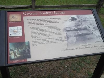
In 1620, Yeardley acquired a seven-and-a-quarter-acre lot extending east from this location. A 1625 muster roll listed the members of Yeardley’s large household: Yeardley; his wife Lady Temperance Yeardley; their three children; and 24 servants, including three African men and five African women (eight of the first nine Africans documented at Jamestown). The muster also lists 50 cattle, 40 swine, and 11 goats and kids on Yeardley’s lot. In addition to three dwellings, Yeardley owned three boats – a barque, four-ton shallop, and skiff.
At this location, archaeologists excavated the brick foundations of a structure that may have been Yeardley’s. Scattered building materials along Black River suggest that two additional dwellings, perhaps for servants, may have been located at the eastern end of his lot.
” . . . for his conveniency and the more Commodity of his houses & dwellings”
- Yeardley’s Land Patent
Erected by Colonial National Historic Park.
Topics. This historical marker is listed in this topic list: Colonial Era. A significant historical year for this entry is 1610.
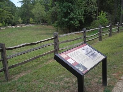
Location. 37° 12.621′ N, 76° 46.572′ W. Marker is near Williamsburg, Virginia, in James City County. Marker can be reached from Colonial Parkway, on the right when traveling west. Marker is located behind the Visitor Center, in the "New Towne" section of the Historic Jamestown unit of Colonial National Historic Park. Touch for map. Marker is in this post office area: Williamsburg VA 23185, United States of America. Touch for directions.
Other nearby markers. At least 8 other markers are within walking distance of this marker. A Place of Work (about 400 feet away, measured in a direct line); Colonial Parkway (about 400 feet away); Iron and Industry (about 400 feet away); Pitch and Tar Swamp (about 400 feet away); Tradesmen on Governor Harvey’s Lot 1630s (about 500 feet away); Governor Harvey’s House 1630s (about 500 feet away); Swann’s Tavern 1670s (about 600 feet away); Foundations at Jamestown (about 600 feet away). Touch for a list and map of all markers in Williamsburg.
More about this marker. The right side of the marker contains a photograph of a “House where Yeardley possibly lived with his family, excavated ca. 1930’s.” The left side of the marker features a sketch of an “English servant feeding pigs,” a map showing “Governor Yeardley’s 7½ acre lot extending east from this location,” and a painting of “The First Assembly meeting at Jamestown in 1619 with Governor Yeardley presiding.”
Also see . . .
1. George Yeardley. Biography of Gov. Yeardley from Wikipedia. (Submitted on March 14, 2009, by Bill Coughlin of Woodland Park, New Jersey.)
2. Historic Jamestowne. Colonial National Historic Park from National Park Service website. (Submitted on March 14, 2009, by Bill Coughlin of Woodland Park, New Jersey.)
3. Historic Jamestowne. Historic Jamestowne is the site of the first permanent English settlement in America. The site is jointly administered by APVA Preservation Virginia and the National Park Service. (Submitted on March 14, 2009, by Bill Coughlin of Woodland Park, New Jersey.)
Credits. This page was last revised on June 16, 2016. It was originally submitted on March 14, 2009, by Bill Coughlin of Woodland Park, New Jersey. This page has been viewed 945 times since then and 20 times this year. Photos: 1, 2. submitted on March 14, 2009, by Bill Coughlin of Woodland Park, New Jersey.

