Pocahontas in Randolph County, Arkansas — The American South (West South Central)
The River Basin
Photographed by Thomas Smith
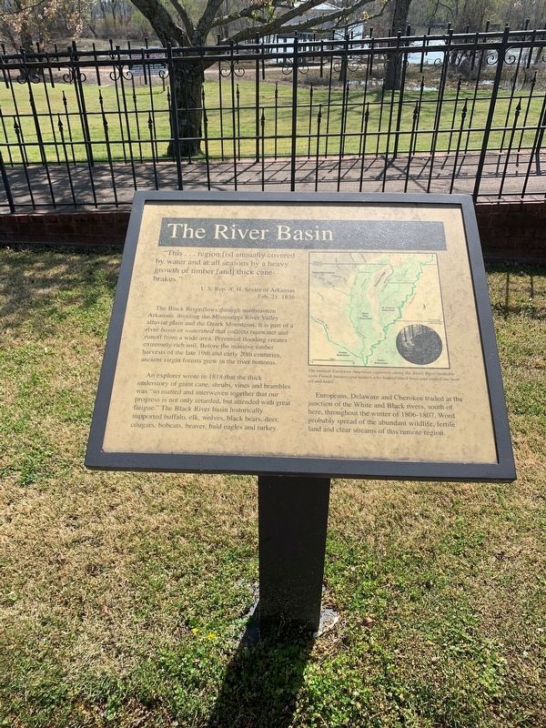
1. The River Basin Marker
"This … region [is] annually covered by water and at all seasons by a heavy growth of timber [and] thick can-brakes."
U.S. Rep. A. H. Sevier of Arkansas
Feb. 21. 1838
The Black River flows through northeastern Arkansas, dividing the Mississippi River Valley alluvial plain and Ozark Mountains. It is part of a river basin or watershed that collects rainwater and runoff from a wide area. Perennial flooding creates extremely rich soil. Before the massive timber harvest of the late 19th and early 20th centuries, ancient virgin forest grew in the river bottoms.
An explorer wrote in 1818 that the thick understory of giant cane, shrubs, vines and brambles was 'so matted and interwoven together that our progress is not only retarded, but attended with great fatigue.' The Black River basin historically supported buffalo, elk, wolves, black bear, deer, cougars, bobcats beaver, bald eagles and turkey. Europeans, Delaware and Cherokee traded at the junction of the White and Black rivers, south of here, throughout the winter of 1806-1807. Word probably spread of the abundant wildlife, fertile land and clear streams of this
this page online
Topics. This historical marker is listed in these topic lists: Agriculture • Animals • Exploration • Indigenous Peoples and Communities. A significant historical year for this entry is 1806.
Location. 36° 15.595′ N, 90° 58.156′ W. Marker is in Pocahontas, Arkansas, in Randolph County. It is on U.S. 62/67 north of South Bettis Street, on the right when traveling north. Touch for map. Marker is in this post office area: Pocahontas AR 72455, United States of America. Touch for directions.

Regionally, this marker is in the American South, specifically in the Upper South, and in the Ozarks. Globally, it is in North America, the Western Hemisphere, the Western World, and the Anglosphere. Historically, it finds itself in what was once the territory of the Mississippian Culture, the Louisiana Purchase, one of the Confederate States of America, and the Antebellum South.
Other nearby markers. At least 8 other markers are within walking distance of this marker: Native American Culture (a few steps from this marker); Settlement (a few steps from this marker); The Black River (a few steps from this marker);

Photographed by Mark Hilton, April 3, 2021
2. The River Basin Marker with rain swollen Black River in background.
Regarding The River Basin. The earliest European-American explorers along the Black River probably were French hunters and traders who hunted black bear and traded the bear oil and hides.
Credits. This page was last revised on April 10, 2021. It was originally submitted on April 7, 2021, by Thomas Smith of Waterloo, Ill. This page has been viewed 302 times since then and 21 times this year. Photos: 1. submitted on April 7, 2021, by Thomas Smith of Waterloo, Ill. 2. submitted on April 8, 2021, by Mark Hilton of Montgomery, Alabama. • Devry Becker Jones was the editor who published this page.
