Manhattan Beach in Los Angeles County, California — The American West (Pacific Coastal)
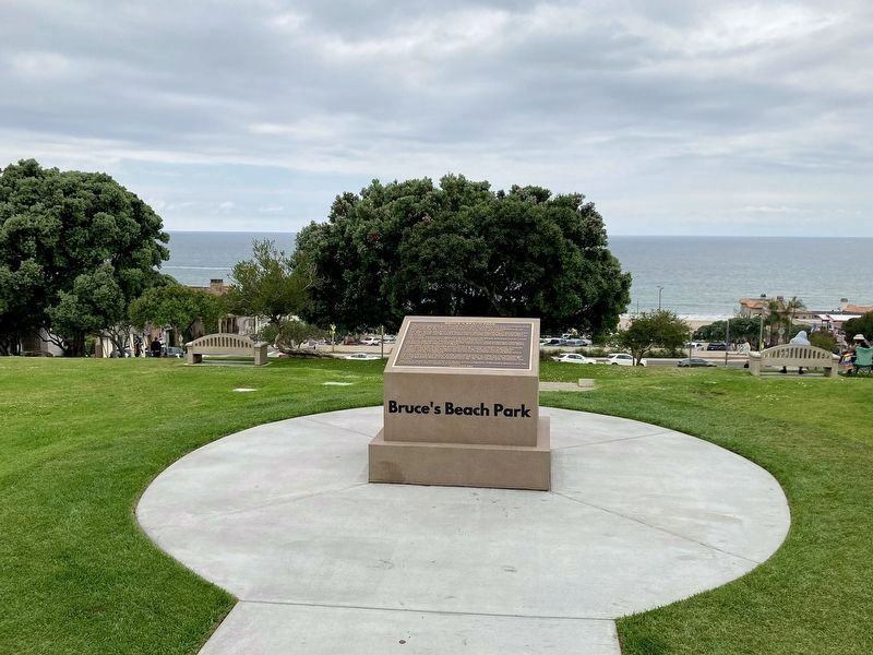
Bruce’s Beach Park
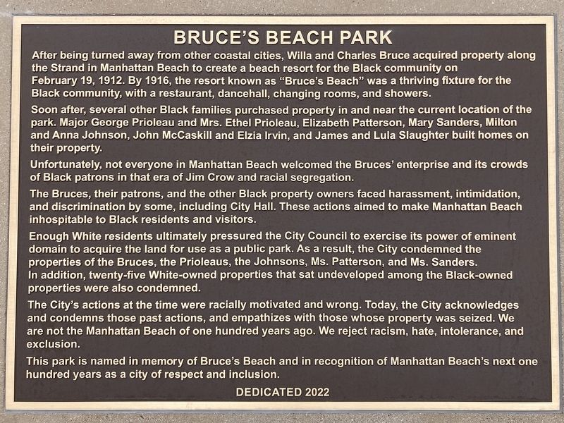
After being turned away from other coastal cities, Willa and Charles Bruce purchased property along the Strand in Manhattan Beach to create a beach resort for the area’s Black community on February 19, 1912. By 1916, the resort known as “Bruce’s Beach” was a thriving fixture for visiting Blacks, with a restaurant, dancehall, changing rooms, and showers.
Soon after, several other Black families purchased property and built homes in the area where this park is now, including Major George Prioleau and Mrs. Ethel Prioleau, Elizabeth Patterson, Mary R. Sanders, Milton and Anna Johnson, John McCaskill and Elzia L. Irvin, and James and Lulu Slaughter.
Unfortunately, not everyone in Manhattan Beach welcomed the Bruces’ enterprise and its crowds of Black patrons in that era of Jim Crow and racial segregation.
The Bruces, their patrons, and the other Black property owners in the area faced harassment, intimidation, and discrimination by some, including City Hall. The purpose of these actions was to make Manhattan Beach inhospitable to Black residents and visitors.
Enough White residents ultimately pressured the City Council to exercise its power of eminent domain to acquire the land for use as a public park. The City condemned the properties of the Bruces, Prioleaus, Johnsons, Patterson, and Sanders. Twenty-five White-owned properties that sat undeveloped among the Black-owned properties were condemned as well.
The City’s action at the time was racially motivated and wrong. Today, the City acknowledges, empathizes, and condemns those past actions. We are not the Manhattan Beach of one hundred years ago. We reject racism, hate, intolerance, and exclusion.
This park is named in memory of Bruce’s Beach and in recognition of Manhattan Beach’s next one hundred years as a city of respect and inclusion.
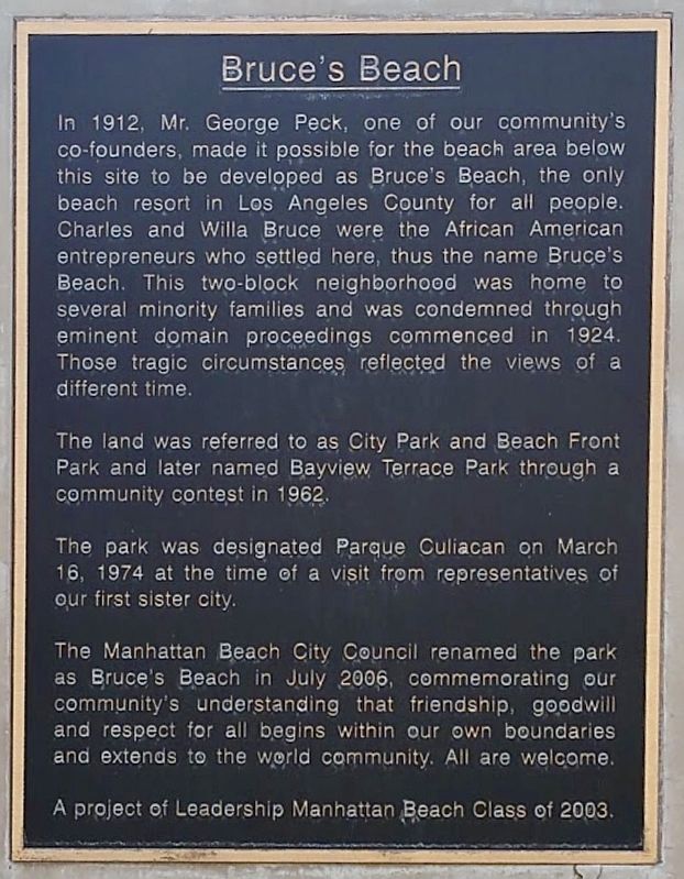
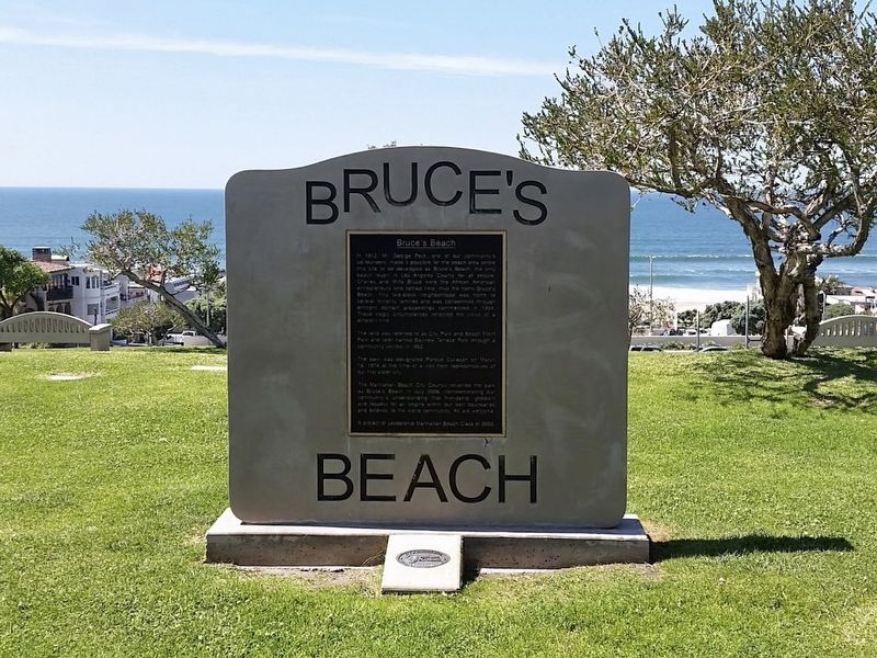
old marker text:
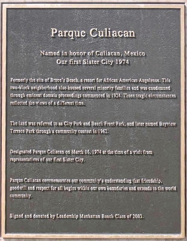
In 1912, Mr. George Peck, one of our community's co-founders, made it possible for the beach area below this site to be developed as Bruce's Beach, the only beach resort in Los Angeles County for all people. Charles and Willa Bruce were the African American entrepreneurs who settled here, thus the name Bruce's Beach. This two-block neighborhood was home to several minority families and was condemned through eminent domain proceedings commenced in 1924. Those tragic circumstances reflected the views of a different time.
The land was referred to as City Park and Beach Front Park and later named Bayview Terrace Park through a community contest in 1962.
The park was designated Parque Culiacan on March 16, 1974 at the time of a visit from representatives of our first sister city.
The Manhattan Beach City Council renamed the park as Bruce's Beach in July 2006, commemorating our community's understanding that friendship, goodwill and respect for all begins within our own boundaries and extends to the world community. All are welcome.
Erected 2023 by City of Manhattan Beach.
Topics. This historical marker is listed in these topic lists: African Americans • Civil Rights • Parks & Recreational Areas.
Location. Marker is missing. It was located near 33° 53.672′ N, 118° 24.909′ W. Marker was in Manhattan Beach, California, in Los Angeles County. Marker was at the intersection of Highland Avenue and 27th Street, on the right when traveling east on Highland Avenue. Touch for map. Marker was at or near this postal address: 2600 Highland Ave, Manhattan Beach CA 90266, United States of America. Touch for directions.
Other nearby markers. At least 8 other markers are within 3 miles of this location, measured as the crow flies. The History of Bruce’s Beach (about 600 feet away, measured in a direct line); Manhattan Beach Pier (approx. 0.7 miles away); Former Site Of The La Mar Theatre (approx. ľ mile away); Beach Cottage (approx. 1.8 miles away); Dockweiler Hang Gliding Center (approx. 2 miles away); The Metropolitan Theater (approx. 2.4 miles away); Site of The Courthouse, City Jail, Police and Fire Station (approx. 2.4 miles away); Space Park (approx. 2.4 miles away). Touch for a list and map of all markers in Manhattan Beach.
Regarding Bruce’s Beach Park. On April 9, 2021, the County of Los Angeles announced plans to return Bruce's Beach to the descendants of Charles and Willa Bruce. On June 28, 2022, this action was approved. The County began leasing the property for $413K/year, and reached an agreement to purchase it for $20 million in 2023.
In 2022 the County installed a new interpretive sign at their lifeguard headquarters next to the park. See: Other Nearby Marker - The History of Bruce’s Beach.
In March 2022 the city approved new language for a replacement plaque in Bruce’s Beach Park. The plaque was installed in 2023, and stolen in 2024.
Also see . . . Marker stolen from historic Bruce’s Beach. KTLA News website entry:
The bronze marker was stolen January 29th by thieves in a string of crimes targeting valuable metals in public spaces. (Submitted on January 31, 2024, by Mark Hilton of Montgomery, Alabama.)
Credits. This page was last revised on April 19, 2024. It was originally submitted on April 9, 2021, by Craig Baker of Sylmar, California. This page has been viewed 473 times since then and 54 times this year. Photos: 1. submitted on January 4, 2023, by Craig Baker of Sylmar, California. 2. submitted on May 28, 2023, by Craig Baker of Sylmar, California. 3, 4. submitted on April 9, 2021, by Craig Baker of Sylmar, California. 5. submitted on January 4, 2023, by Craig Baker of Sylmar, California. • J. Makali Bruton was the editor who published this page.
