West Central in Springfield in Greene County, Missouri — The American Midwest (Upper Plains)
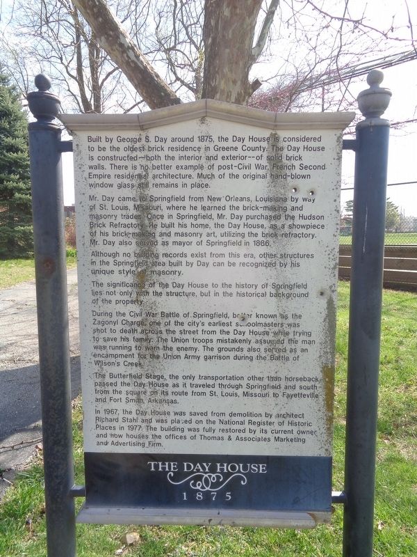
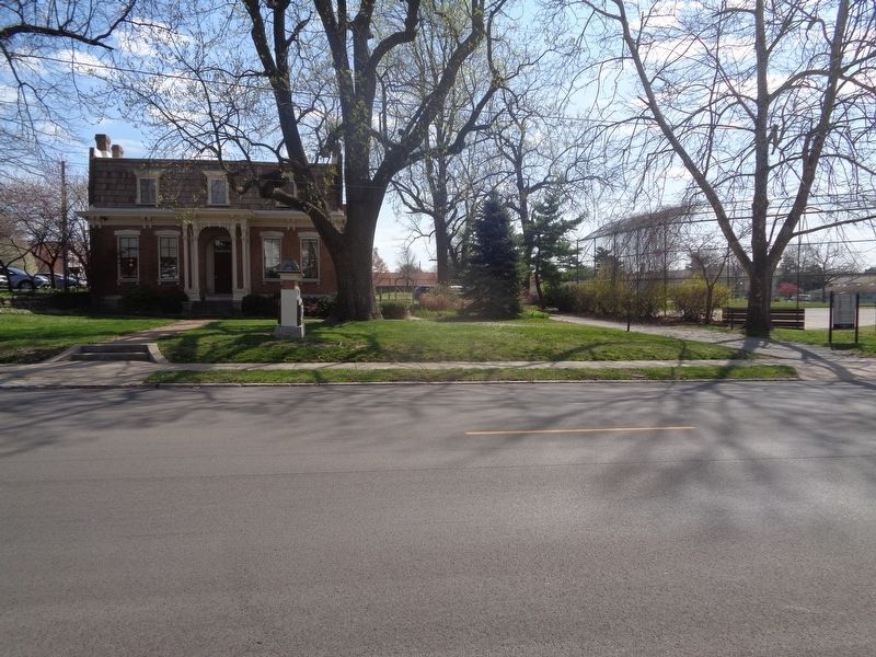
The Day House
1875
Mr. Day came to Springfield from New Orleans, Louisiana by way of St. Louis, Missouri, where he learned the brick-making and masonry trades. Once in Springfield, Mr. Day purchased the Hudson Brick Refractory. He built his home, the Day House, as a showpiece of his brick-making and masonry art, utilizing the brick refractory. Mr. Day also served as mayor of Springfield in 1886.
Although no building records exist from this era, other structures in the Springfield area built by Day can be recognized by this unique style of masonry.
The significance of the Day House to the history of Springfield lies not only with the structure, but in the historical background of the property.
During the Civil War Battle of Springfield, better known as the Zagonyl Charge, one of the city's earliest schoolmasters was shot to death across the street from the Day House while trying to save his family. The Union troops mistakenly assumed the man was running to warn the enemy. The grounds also served as an encampment for the Union Army garrison during the Battle of Wilson's Creek.
The Butterfield Stage, the only transportation other than horseback passed the Day House as it traveled through Springfield and south from the square on its route from St. Louis, Missouri to Fayetteville and Fort Smith, Arkansas.
In 1967, the Day House was saved from demolition by architect Richard Stahl and was placed on the National Register of Historic Places in 1977. The building was fully restored by its current owner and now houses the offices of Thomas & Associates Marketing and Advertising Firm.
Topics. This historical marker is listed in these topic lists: Architecture • Industry & Commerce • Roads & Vehicles • War, US Civil. A significant historical year for this entry is 1875.
Location. 37° 12.206′ N, 93° 17.539′ W. Marker is in Springfield, Missouri, in Greene County. It is in West Central. Marker is at the intersection of South Avenue and West Mt Vernon Street, on the right when traveling north on South Avenue. Touch for map. Marker is at or near this postal address: 614 South Ave, Springfield MO 65806, United States of America. Touch for directions.
Other nearby markers. At least 8 other markers are within walking distance of this marker. Battle of Springfield (within shouting distance of this marker); a different marker also named Battle of Springfield (about 500 feet away, measured in a direct line); a different marker also named Battle of Springfield (about 600 feet away); a different marker also named Battle of Springfield (approx. 0.2 miles away); Wilshire Apartments (approx. 0.2 miles away); Kickapoo Indian Village (approx. 0.2 miles away); a different marker also named Battle of Springfield (approx. ¼ mile away); a different marker also named Battle of Springfield (approx. ¼ mile away). Touch for a list and map of all markers in Springfield.
Also see . . . Day House on Wikipedia. The historic house is currently the Betty and Bobby Allison Ozarks Counseling Center (as of April 2021). Marker may have listed the incorrect year for its NRHP designation year, as it was listed in 1976 (#76001110). (Submitted on April 12, 2021, by Jason Voigt of Glen Carbon, Illinois.)
Credits. This page was last revised on February 16, 2023. It was originally submitted on April 12, 2021, by Jason Voigt of Glen Carbon, Illinois. This page has been viewed 182 times since then and 20 times this year. Photos: 1, 2. submitted on April 12, 2021, by Jason Voigt of Glen Carbon, Illinois.

