Stockton Springs in Waldo County, Maine — The American Northeast (New England)
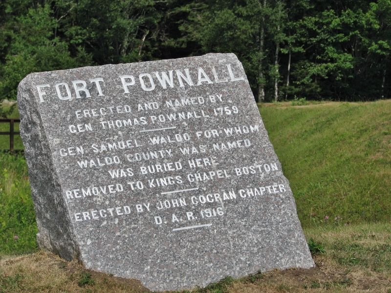
Fort Pownall
Gen Thomas Pownall 1759
• • •
Gen Samuel Waldo for whom
Waldo County was named
was buried here
Removed to Kings Chapel Boston
• • •
Erected by John Cocran Chapter
D.A.R. 1916
Erected 1916 by John Cocran Chapter, Daughters of the American Revolution.
Topics and series. This historical marker is listed in these topic lists: Cemeteries & Burial Sites • Forts and Castles • War, French and Indian • War, US Revolutionary. In addition, it is included in the Daughters of the American Revolution series list. A significant historical year for this entry is 1759.
Location. 44° 28.067′ N, 68° 48.69′ W. Marker is in Stockton Springs, Maine, in Waldo County. Marker can be reached from Lighthouse Road, one mile east of Cape Jellison Road. Marker is located at the Fort Pownall site, just north of the Fort Point Lighthouse. Touch for map. Marker is at or near this postal address: 207 Lighthouse Road, Stockton Springs ME 04981, United States of America. Touch for directions.
Other nearby markers. At least 8 other markers are within 6 miles of this marker, measured as the crow flies. Fort Pownall, 1759-1775 (within shouting distance of this marker); Fort Point State Park (about 300 feet away, measured in a direct line); The Home of a Hero / La maison d'un héros (approx. 5.1 miles away); Fort George & the Penobscot Expedition (approx. 5.4 miles away); Burial Place of British officers, (approx. 5.4 miles away); Fort George (approx. 5.4 miles away); The Growth of Ship Building: Isaac Carver / Le développement des chantiers navals : Isaac Carver (approx. 5½ miles away); Line of Argyle Street (approx. 5½ miles away). Touch for a list and map of all markers in Stockton Springs.
Regarding Fort Pownall. National Register of Historic Places #69000028.
Also see . . . Fort Pownall (Wikipedia). Fort Pownall was a British fortification built during the French and Indian War, whose remains are located at Fort Point State Park in Stockton Springs, Maine. The fort was named for Governor Thomas Pownall, who oversaw its construction. It never saw action, and was destroyed during the American Revolutionary War by the actions of both colonists and the British military to prevent its further use. (Submitted on April 12, 2021, by Cosmos Mariner of Cape Canaveral, Florida.)
Credits. This page was last revised on April 12, 2021. It was originally submitted on April 12, 2021, by Cosmos Mariner of Cape Canaveral, Florida. This page has been viewed 205 times since then and 13 times this year. Photo 1. submitted on April 12, 2021, by Cosmos Mariner of Cape Canaveral, Florida.
