Transportation
— Davidsonville Historic State Park —
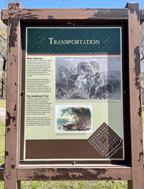
River Highway
Davidsonville was located on a wedge- shaped piece of land formed by the confluence of the Black, Spring, and Eleven Point rivers, placing it in the midst of the transportation and trade superhighways of the era. Boats traveled up and down the Black River enroute to the Mississippi River, and from there had access to world markets.
Goods were shipped on flatboats, keelboats, and open cargo rowboats. As a river port, the town provided landing areas for freight and passengers, as well as a variety of support services. Near the water were warehouses to store and ship goods, and boat storage and repair facilities.
The Southwest Trail
Travelers by land used the matrix
of primitive roads that made up the
Southwest Trail, a passage that
began in St. Louis, crossed diagonally
through the state to Little Rock, and
continued on to Washington and the
Red River in the southwest. A spur trail
led to Davidsonville, where travelers
could find blacksmiths, stables, inns,
taverns, and the postal stop.
Travelers came on horseback or in wagons pulled by horses, mules, and oxen. Ferries, such as Hix's Ferry at the Arkansas-Missouri border, aided road travelers in crossing the rivers.
[Photo captions]:
Settlers arrived in Arkansas along the Southwest
Trail. (Emigrants Crossing the Plains, Felix Octavius Carr Darley, c.1869,
Robert B. Honeyman, Jr. Collection of Early Californian and Western Pictorial Material, The Bancroft Library, University of California, Berkeley.)
Small boats shipped goods to and from the port at Davidsonville.
(Encampment of the Travellers on the Missouri, Karl Bodmer, 1834.)
Erected by the State of Texas.
Topics. This historical marker is listed in these topic lists: Roads & Vehicles • Waterways & Vessels. A significant historical year for this entry is 1869.
Location. 36° 9.232′ N, 91° 3.397′ W. Marker is near Black Rock, Arkansas, in Randolph County. Marker can be reached from Arkansas Route 166, 0.6 miles south of Arkansas Route 361 when traveling south. Located 11 miles south of Pocahontas and within the Davidsonville Historic State Park. Touch for map. Marker is at or near this postal address: 8047 Hwy 166 S, Pocahontas AR 72455, United States of America. Touch for directions.
Other nearby markers. At least 8 other markers are within walking distance of this marker. Commerce and Business (within shouting distance of this marker); Davidsonville's Courthouse (within shouting distance of this marker); County Seat Town (within shouting distance of this marker); Oldest Town Site in Arkansas (within shouting distance of this marker); Courthouse Square
Credits. This page was last revised on April 13, 2021. It was originally submitted on April 13, 2021, by Mark Hilton of Montgomery, Alabama. This page has been viewed 80 times since then and 5 times this year. Photos: 1, 2, 3. submitted on April 13, 2021, by Mark Hilton of Montgomery, Alabama.


