Hominy in Buncombe County, North Carolina — The American South (South Atlantic)
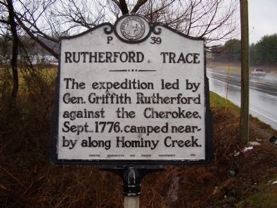
Rutherford Trace
Erected 1954 by Archives Conservation and Highway Departments. (Marker Number P-39.)
Topics and series. This historical marker is listed in these topic lists: Native Americans • Notable Events. In addition, it is included in the North Carolina Division of Archives and History series list. A significant historical year for this entry is 1776.
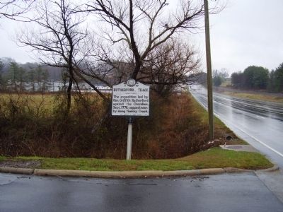
Location. 35° 32.719′ N, 82° 40.11′ W. Marker is in Hominy, North Carolina, in Buncombe County. Marker is on Smokey Park Highway (U.S. 19/23). Touch for map. Marker is at or near this postal address: 1189 Smokey Park Hwy, Candler NC 28715, United States of America. Touch for directions.
Other nearby markers. At least 8 other markers are within 5 miles of this marker, measured as the crow flies. William Moore (approx. 2 miles away); Home Place of Capt. Wm. Moore (approx. 2 miles away); Sulphur Springs (approx. 3.3 miles away); a different marker also named Rutherford Trace (approx. 3.9 miles away); Olive Tilford Dargan (approx. 4˝ miles away); The Quilt Garden (approx. 4.7 miles away); Dr. L.B. McBrayer (approx. 4.7 miles away); "End of Car Line" (approx. 4.8 miles away).
Credits. This page was last revised on June 16, 2016. It was originally submitted on March 16, 2009, by Stanley and Terrie Howard of Greer, South Carolina. This page has been viewed 2,380 times since then and 144 times this year. Photos: 1, 2. submitted on March 16, 2009, by Stanley and Terrie Howard of Greer, South Carolina. • Kevin W. was the editor who published this page.

