Resaca in Gordon County, Georgia — The American South (South Atlantic)
Crossing the Oostanaula at Lay's Ferry
Inscription.
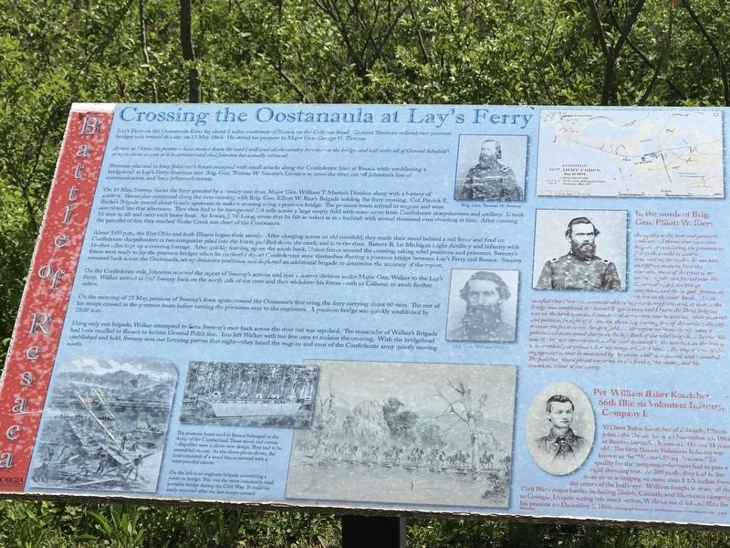
Lay's Ferry on the Oostanaula River lay about 5 miles southwest of Resaca on the Calhoun Road. General Sherman ordered two pontoon bridges sent toward this site on 13 May 1864. He stated his purpose to Major Gen. George H. Thomas:
As soon as I know the pontoons have started down the road I will send all the cavalry here to cross the bridge, and will order all of General Schofield's army to move as soon as it is demonstrated that Johnston bas actually retreated.
Sherman planned to keep Johnston's forces occupied with small attacks along the Confederate lines at Resaca while establishing a bridgehead at Lay's Ferry. Sherman sent Brig. Gen. Thomas W. Sweeny's Division to cross the river, cut off Johnston's line of communication, and force Johnston's retreat.
On 14 May, Sweeny found the ferry guarded by a cavalry unit from Major Gen. William T. Martin's Division along with a battery of artillery. Skirmishes continued along the river crossing with Brig. Gen. Elliott W. Rice's Brigade holding the ferry crossing. Col. Patrick E. Burke's Brigade moved about ½ mile upstream to make a crossing using a pontoon bridge. The pontoon boats arrived in wagons and were assembled late that afternoon. They then had to be transported ¾ mile across a large empty field with scant cover from Confederate sharpshooters and artillery. It took 16 men to lift and carry each heavy boat. An Iowan, J. W. Long, wrote that he felt as naked as in a bathtub with several thousand men shooting at him. After running the gauntlet of fire, they reached Snake Creek just short of the Oostanaula.
About 5:00 p.m., the 81st Ohio and 66th Illinois began their assault. After charging across an old cornfield, they made their stand behind a rail fence and fired on Confederate sharpshooters as two companies piled into the boats, paddled down the creek, and into the river. Battery B, 1st Michigan Light Artillery and infantry with 16-shot rifles kept up a covering barrage. After quickly forming up on the south bank, Union forces secured the crossing, taking rebel positions and prisoners. Sweeny's forces were ready to lay the pontoon bridges when he received a report Confederates were themselves floating a pontoon bridge between Lay's Ferry and Resaca. Sweeny retreated back across the Oostanaula, set up defensive positions, and deployed an additional brigade to determine the accuracy of the report.
On the Confederate side, Johnston received the report of Sweeny's actions and sent a reserve division under Major Gen. Walker to the Lay's Ferry. Walker arrived to find Sweeny back on the north side of the river and then withdrew his forces south to Calhoun to await further orders.
On the morning of 15
May, portions of Sweeny's force again crossed the Oostanaula first using the ferry carrying about 60 men. The rest of his troops crossed in the pontoon boats before turning the pontoons over to the engineers. A pontoon bridge was quickly established by 10:00 a.m.
Using only one brigade, Walker attempted to force Sweeny's men back across the river but was repulsed. The remainder of Walker's Brigade had been recalled to Resaca to bolster General Polk's line. This left Walker with too few men to reclaim the crossing. With the bridgehead established and held, Sweeny sent out listening parties that night — they heard the wagons and men of the Confederate army quietly moving south.
In the words of Brig. Gen. Elliott W. Rice:
As rapidly as the boat and pontoons could cross, I threw over my entire brigade, surrendering the pontoons as fast as they could be used in constructing the bridge. In one hour and fifteen minutes from the commencement of the crossing my entire brigade was ferried over the Oostenaula [sp.], the bridge completed, the brigade formed in echelon on the south bank....I was satisfied that there was a considerable rebel force in my front, and, as soon as the bridge was completed, the Second Brigade over, and I knew the Third Brigade was on the bank opposite, I commenced demonstrations to ascertain their strength and position, in sight of the enemy, throwing a strong line of skirmishers directly to cover the front across the open field …The regiment immediately made a gallant and determined charge on the left flank of the rebel brigade … So speedily was the brigade thrown over, and so well concealed in the woods, that the enemy was completely surprised when my troops attacked him. … The importance of this engagement cannot be measured by the enemy's killed, captured, and wounded. The position gained placed our army on the flank of the enemy, and his communications at our mercy.
Pvt. William Baker Kaericher, 66th Illinois Volunteer Infantry, Company I:
William Baker Kaericher of Edwards, Illinois joined the Union Array on November 25, 1861 at Benton Barracks, Missouri. He was 18 years old. The 66th Illinois Volunteer Infantry was known as the “Western Sharpshooters.” To qualify for the company, volunteers had to pass a rigid shooting test. At 200 yards, they had to fire three shots averaging no more than 3⅓ inches from the center of the bull's-eye. William fought in many of the Civil War's major battles including Shiloh, Corinth, and Sherman's campaign in Georgia. Despite seeing this much action, William survived and filed for his pension on December 5, 1866. Photograph courtesy of the Abraham Lincoln Presidential Library and Museum
Captions (Clockwise from top):
• Brig. Gen. Thomas W. Sweeny
• [Brig. Gen. Elliott W. Rice]
• Maj. Gen, William Walker
• [Pvt. William Baker Kaericher]
• The pontoon boats used at Resaca belonged to the Army of the Cumberland. These wood and canvas collapsibles were a clever new design. They had to be assembled on site. As the above photo shows, the boat consisted of a wood frame covered with a waterproofed canvas.
• On the left is an engineer brigade assembling a pontoon bridge. This was the most commonly used portable bridge during the Civil War. It could be easily removed after the last troops crossed.
Erected by Georgia Department of Natural Resources - State Parks and Historic Sites.
Topics. This historical marker is listed in these topic lists: Bridges & Viaducts • War, US Civil • Waterways & Vessels. A significant historical year for this entry is 1864.
Location. 34° 34.641′ N, 84° 57.156′ W. Marker is in Resaca, Georgia, in Gordon County. Marker can be reached from Resaca Lafayette Road Northwest (Georgia Route 136). Marker is on entrance road to Resaca Battlefield State Historic Site. Touch for map. Marker is at or near this postal address: 6 GA-136, Resaca GA 30735, United States of America. Touch for directions.
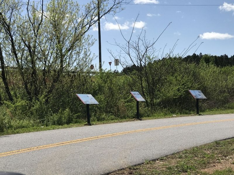
Other nearby markers. At least 8 other markers are within walking distance of this marker. Resaca — A Defensible Position (here, next to this marker); The Road to Resaca (here, next to this marker); Battle of Resaca (a few steps from this marker); Logan's XV Corps to the South (approx. ¼ mile away); Dancers in the Red Clay Minuet (approx. 0.3 miles away); South Toward Atlanta (approx. 0.3 miles away); a different marker also named Battle of Resaca (approx. 0.6 miles away); a different marker also named Battle of Resaca (approx. 0.6 miles away). Touch for a list and map of all markers in Resaca.
Credits. This page was last revised on April 14, 2021. It was originally submitted on April 13, 2021, by Duane and Tracy Marsteller of Murfreesboro, Tennessee. This page has been viewed 333 times since then and 37 times this year. Photos: 1, 2. submitted on April 13, 2021, by Duane and Tracy Marsteller of Murfreesboro, Tennessee.

