Near Baxter Springs in Cherokee County, Kansas — The American Midwest (Upper Plains)
Baxter Springs Soldiers' Lot
Photographed by Jason Voigt, April 6, 2021
1. Baxter Springs Soldiers' Lot Marker
Civil War Dead
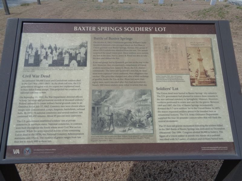
An estimated 700,000 Union and Confederate soldiers died in the Civil War (1861-1865). As the death toll rose, the U.S. government struggled with the urgent but unplanned need to bury fallen Union troops. This propelled the creation of a national cemetery system.
On September 11, 1861, the War Department directed officers to keep "accurate and permanent records of deceased soldiers." Federal authority to create military burial grounds came in an Omnibus Act of July 17, 1862. Cemetery sites were chosen where troops were concentrated: camps, hospitals, battlefields, railroad hubs. By 1872, 74 national cemeteries and several soldiers' lots contained 305,492 remains. About 45 percent were unknown.
The U.S. government established soldiers' lots at private cemeteries in northern states. National cemeteries, in contrast, were built throughout the South were most Civil War action occurred. While the army reported dozens of lots containing Union dead in the 1870s, the National Cemetery Administration maintains only fifteen. The number of graves ranges from less than ten to nearly 400 in these lots.
Battle of Baxter Springs
On
this page online
A second group, led by Quantrill, got lost on the way to the fort. However, they encountered a detachment of Union soldiers escorting Gen. James G. Blunt, the U.S. district commander. The latter saw Quantrill's men but, because most wore captured Union uniforms, their allegiance was unclear. The guerrillas charged and, after a brief exchange of gunfire, broke the Union line. Blunt lost more than eighty men, many executed after they had surrendered. Nearly 100 Union soldiers were killed in action that day.
Soldiers' Lot
The Union dead were buried in Baxter Springs' city cemetery. The U.S. government had planned to remove these remains to the new national cemetery in Springfield, Missouri. However, residents petitioned to retain and care for the graves. Between
Photographed by Jason Voigt, April 6, 2021
2. Baxter Springs Soldiers' Lot Marker
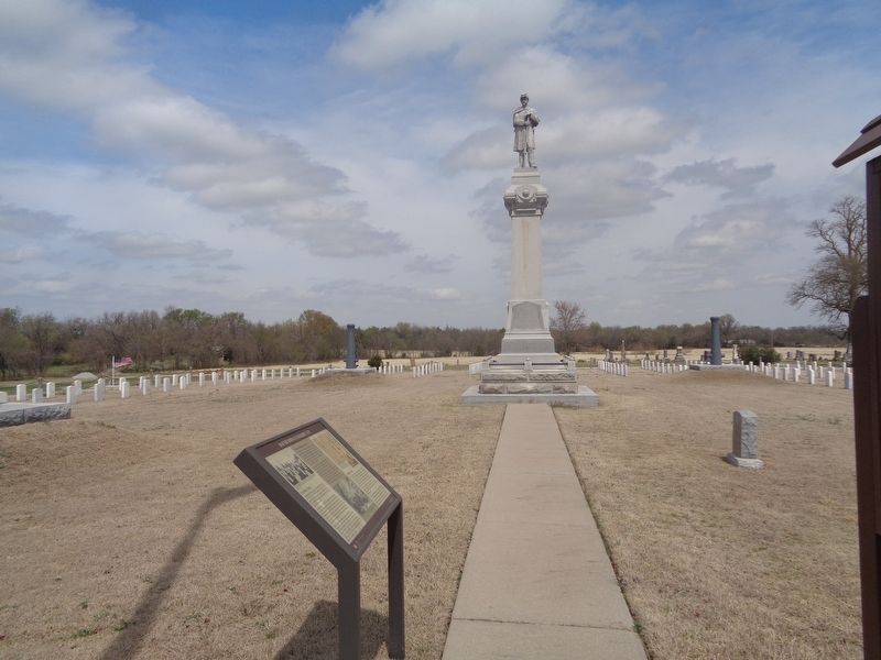
Civil War monument is in the background.
The 27-foot-tall granite monument honoring the soldiers killed in the 1863 Battle of Baxter Springs was dedicated on Decoration (Memorial) Day 1886. Congress allotted $4,000 to build it. The figure of a Union soldier at parade rest stands on a pedestal inscribed with 163 names of soldiers and civilians buried here.
Erected by U.S. Department of Veterans Affairs.
Topics and series. This historical marker is listed in these topic lists: Cemeteries & Burial Sites • War, US Civil. In addition, it is included in the National Cemeteries series list. A significant historical date for this entry is July 17, 1862.
Location. 37° 1.927′ N, 94° 46.241′ W. Marker is near Baxter Springs, Kansas, in Cherokee County. It can be reached from West Avenue (U.S. 166) west of West 5th Street. Marker is located in the Soldiers' Lot at Baxter Springs Cemetery. Touch for map. Marker is at or near this postal address: 166 West Ave, Baxter Springs KS 66713, United States of America. Touch for directions.

Regionally, this marker is in Eastern Kansas and specifically in Bleeding Kansas Border War Country. It is also in the American Midwest, in the Corn Belt, on the prairies, and on the Southern Plains. Globally, it is in North America, the Western Hemisphere, the Western World, and the Anglosphere. Historically, it finds itself in what was once New Spain and also the Louisiana Purchase.
Other nearby markers. At least 8 other markers are within 2 miles of this marker, measured as the crow flies: Civil War Tour (here, next to this marker); Baxter Springs Civil War Memorial (a few steps from this marker); Tbe Economic Engines (approx. 1.7 miles away); Baxter Springs: from Fort to Town (approx. 1.7 miles away); The Earliest Residents (approx. 1.7 miles away); a different marker also named Civil War Tour (approx. 1.7 miles away); Johnston Public Library (approx. 1.9 miles away); Baxter Springs Massacre (approx. 1.9 miles away). Touch for a list and map of all markers in Baxter Springs.
Also see . . .
1. Baxter Springs City Cemetery Soldiers' Lot. From the U.S. Department of Veterans Affairs, this lot is located in the central part of Baxter Springs Cemetery. Contains history and some useful information, regarding access and burials. (Submitted on April 14, 2021, by Jason Voigt of Glen Carbon, Illinois.)
2. Baxter Springs City Cemetery Soldiers' Lot. Find A Grave website entry:
Contains a list of interments and photos from the user-generated website. This is only for the Soldiers' Lot, not the cemetery surrounding it. (Submitted on April 14, 2021, by Jason Voigt of Glen Carbon, Illinois.)
Credits. This page was last revised on June 21, 2022. It was originally submitted on April 14, 2021, by Jason Voigt of Glen Carbon, Illinois. This page has been viewed 489 times since then and 51 times this year. Photos: 1, 2. submitted on April 14, 2021, by Jason Voigt of Glen Carbon, Illinois.
