Near Chester in Chesterfield County, Virginia — The American South (Mid-Atlantic)
Bermuda Hundred Landing
Butler’s Campaign Begins
— Bermuda Hundred Campaign —
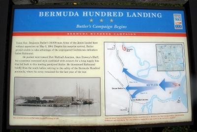
He pushed west toward Port Walthall Junction, then Drewry’s Bluff, but a cautious command style combined with concern for a long supply line that led back to this landing paralyzed Butler. He threatened Richmond briefly from the south before retiring to the safety of the Bermuda Hundred peninsula, where his army remained for the last year of the war.
Erected by Virginia Civil War Trails.
Topics and series. This historical marker is listed in this topic list: War, US Civil. In addition, it is included in the Virginia Civil War Trails series list. A significant historical month for this entry is May 1796.
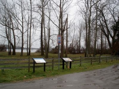
Location. 37° 20.489′ N, 77° 16.26′ W. Marker is near Chester, Virginia, in Chesterfield County. Marker is on Bermuda Hundred Road, 1.4 miles east of Allied Road, on the right when traveling east. Touch for map. Marker is in this post office area: Chester VA 23836, United States of America. Touch for directions.
Other nearby markers. At least 8 other markers are within 2 miles of this marker, measured as the crow flies. Bermuda Hundred (within shouting distance of this marker); a different marker also named Bermuda Hundred (within shouting distance of this marker); Beyond the Big House (approx. 1.7 miles away); Resistance and Punishments (approx. 1.7 miles away); A Busy Port (approx. 1.7 miles away); Grant's Cabin (approx. 1.7 miles away); City Point (approx. 1.7 miles away); a different marker also named City Point (approx. 1.7 miles away). Touch for a list and map of all markers in Chester.
More about this marker. On the lower left is a photo of “The crowded wharves at Bermuda Hundred Landing in 1864.”
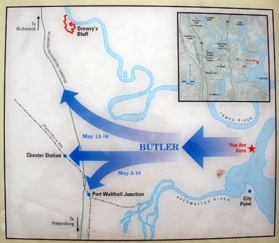
On the right is a map of the Bermuda Hundred Peninsula showing the potential targets of Butler’s Army of the James. The map carries the caption, “Once his army was established here, Butler would be free to threaten the vital transportation links between Richmond and Petersburg. The river offered a sheltered escape route in the event of a disaster.”
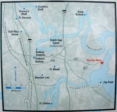
The map inset shows Civil War sites on the Bermuda Hundred Peninsula.
Also see . . .
1. Chesterfield Heritage Alliance. Bermuda Hundred Campaign. (Submitted on March 16, 2009, by Bernard Fisher of Richmond, Virginia.)
2. Civil War Traveler. Chesterfield County. (Submitted on March 16, 2009, by Bernard Fisher of Richmond, Virginia.)
3. Wikipedia. Bermuda Hundred, Virginia. (Submitted on March 16, 2009, by Bernard Fisher of Richmond, Virginia.)
Credits. This page was last revised on June 16, 2016. It was originally submitted on March 16, 2009, by Bernard Fisher of Richmond, Virginia. This page has been viewed 2,332 times since then and 62 times this year. Photos: 1, 2, 3, 4. submitted on March 16, 2009, by Bernard Fisher of Richmond, Virginia.


